Drive from airport
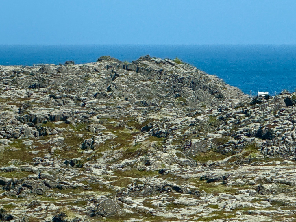
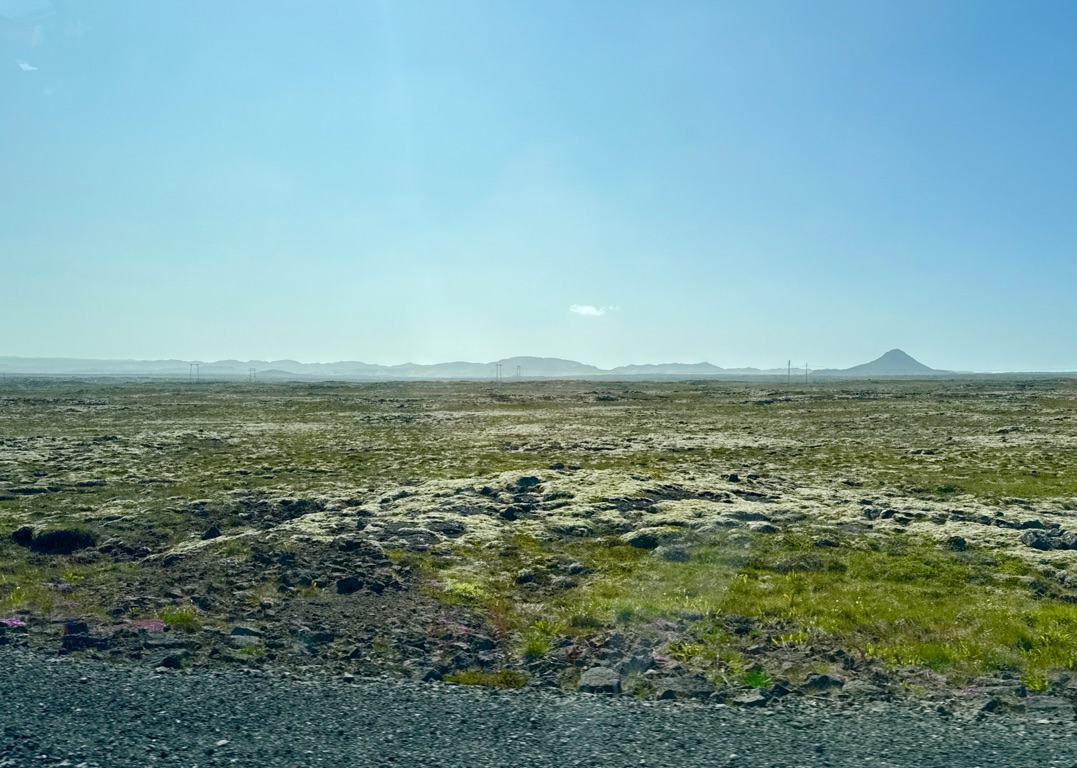
Landed around 930AM. 45 minute taxi ride to the city. Road empty, driving through vast lava fields. No trees for miles. Actually reminds me of the west coast of the Big Island. But that lava is newer. This landscape here has eroded enough to have grass.
Drive from airport
![]()
![]()
![]()
![]()
![]()
![]()
OR
Copy the link to @rickkossik Journo below
![]()
![]()
![]()
![]()
![]()
![]()
OR
Copy the link to @rickkossik Journo below
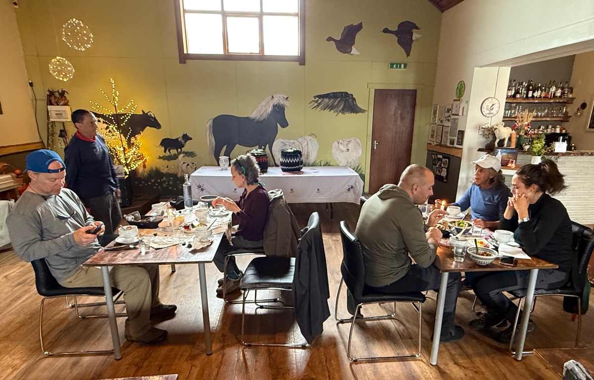
After dropping off luggage, made a beeline to this place.
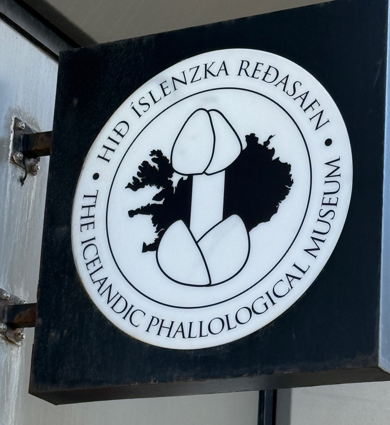
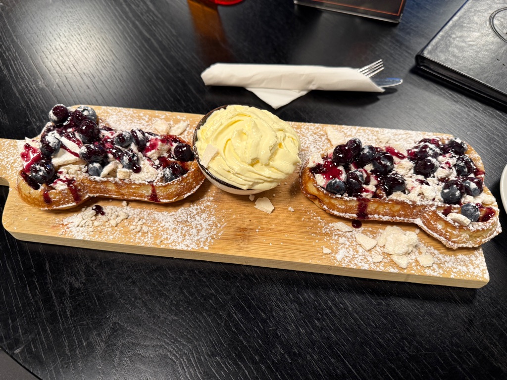
My lunch. Blueberry penis waffles
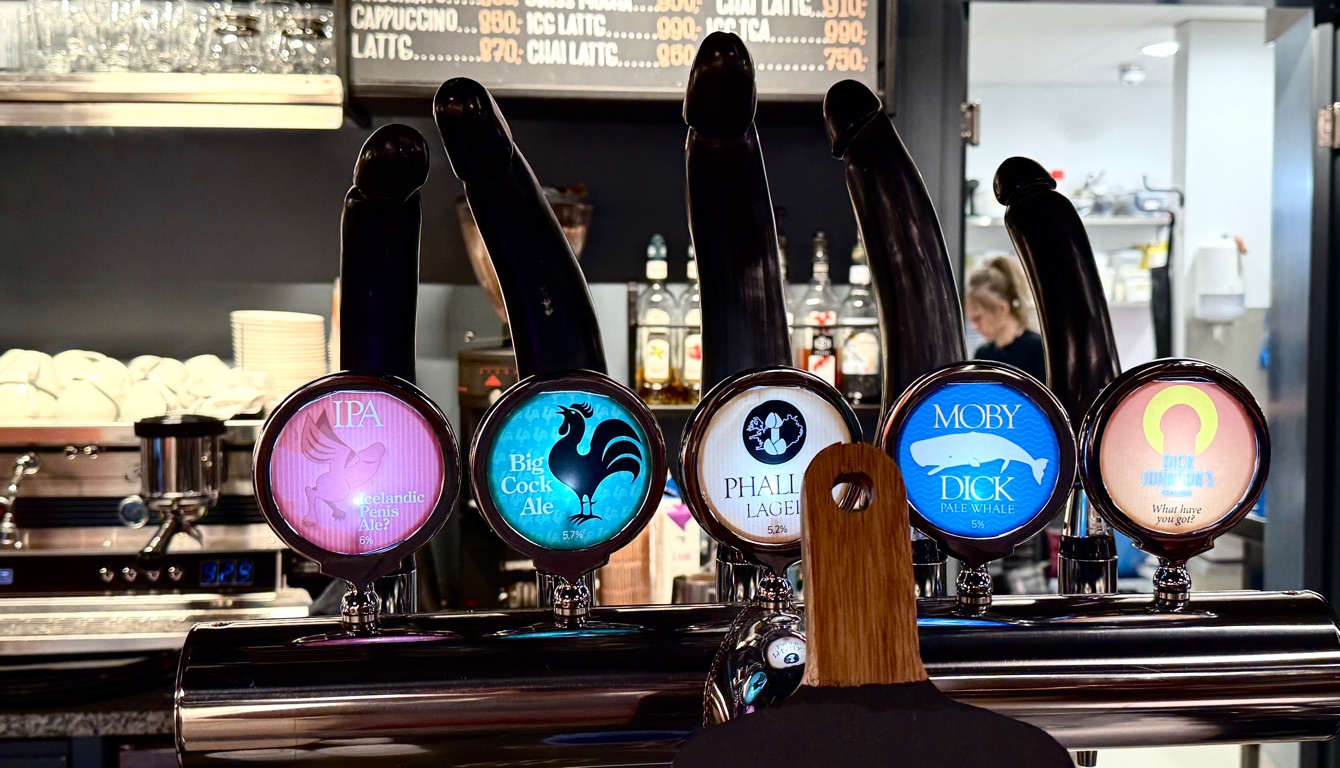
Too early to drink
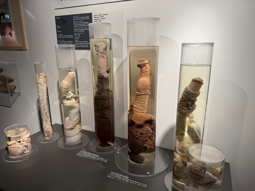
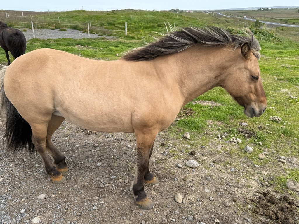
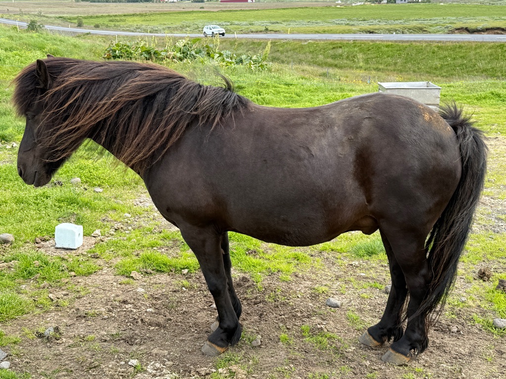
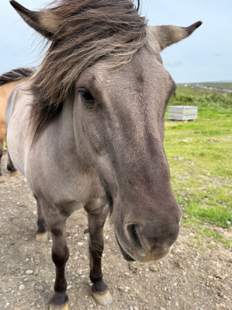
Horses
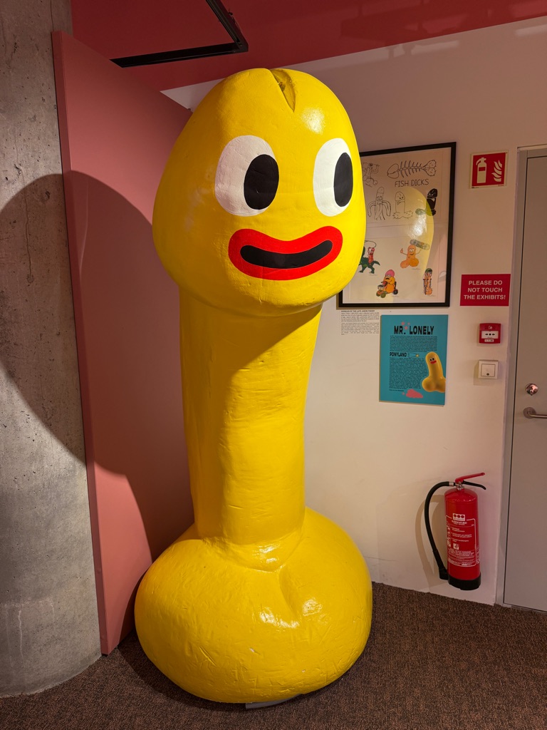
No idea what this was about. Its 7 feet tall
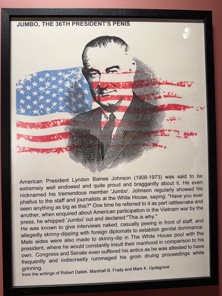
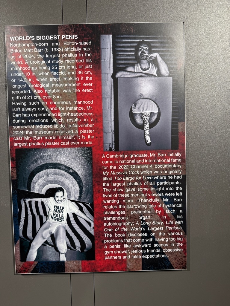
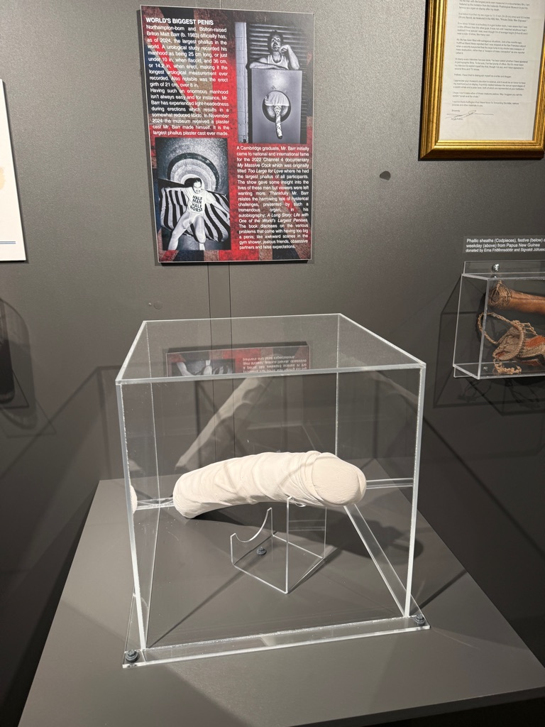
This is disturbing
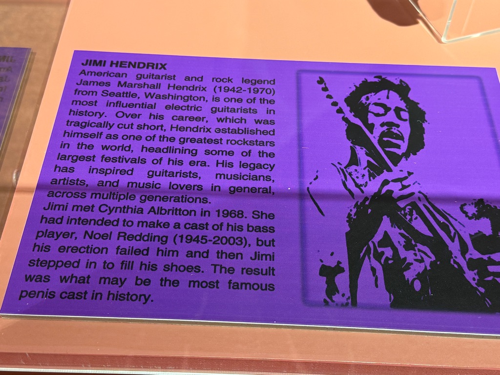
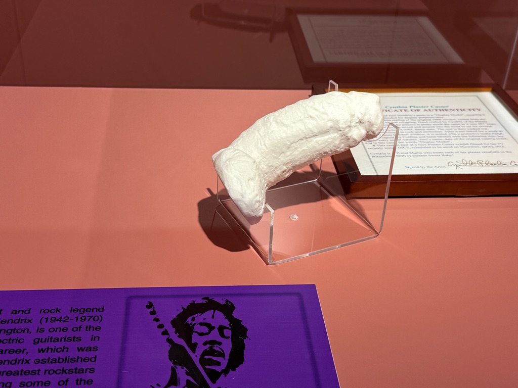
Jimmy Hendrix made a donation
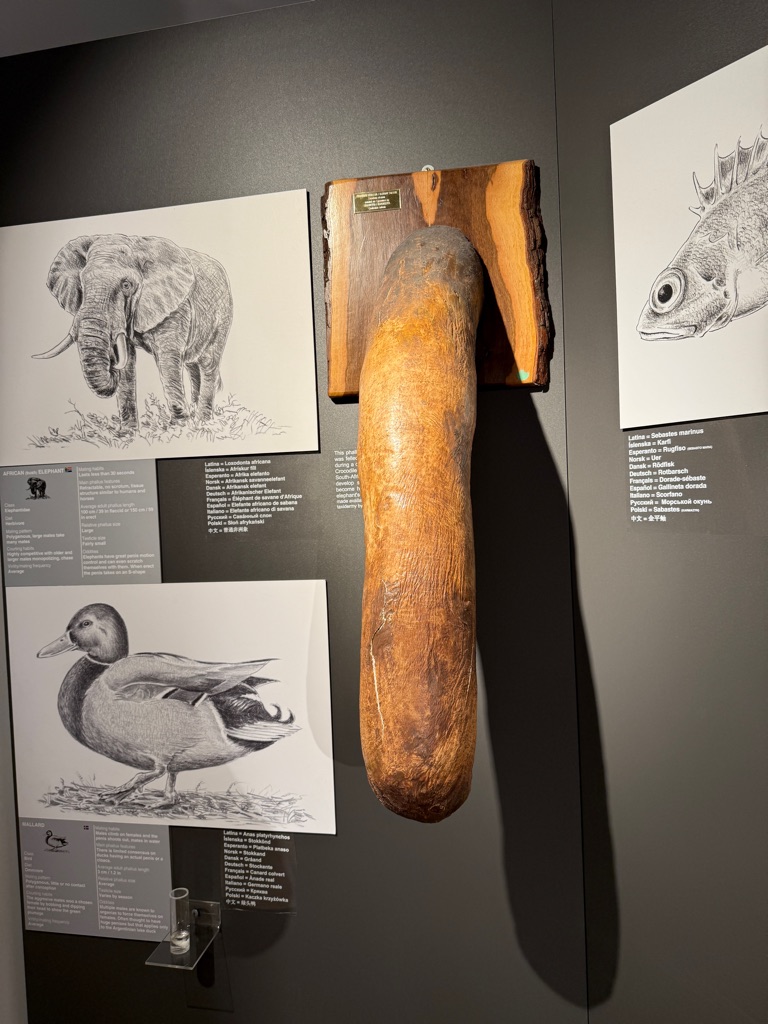
Elephant
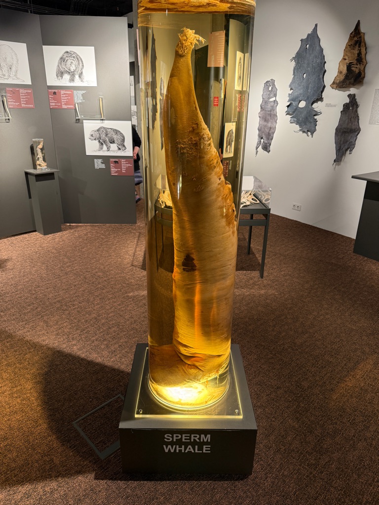
Sperm whale
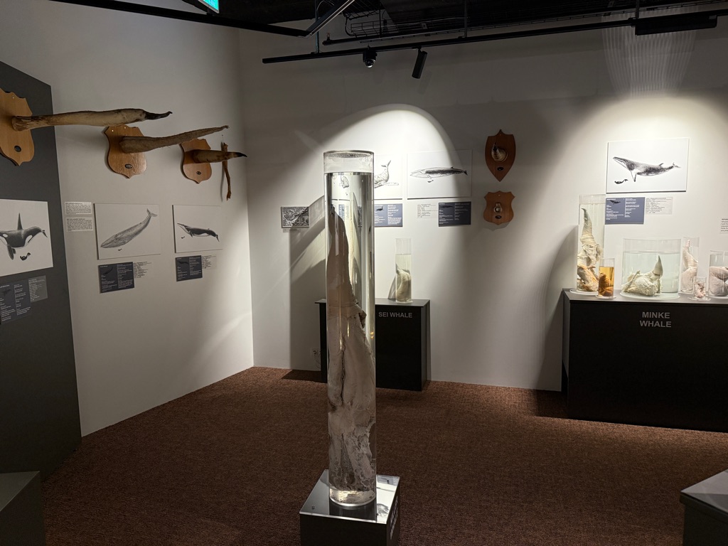
Assorted whales
Holy shit
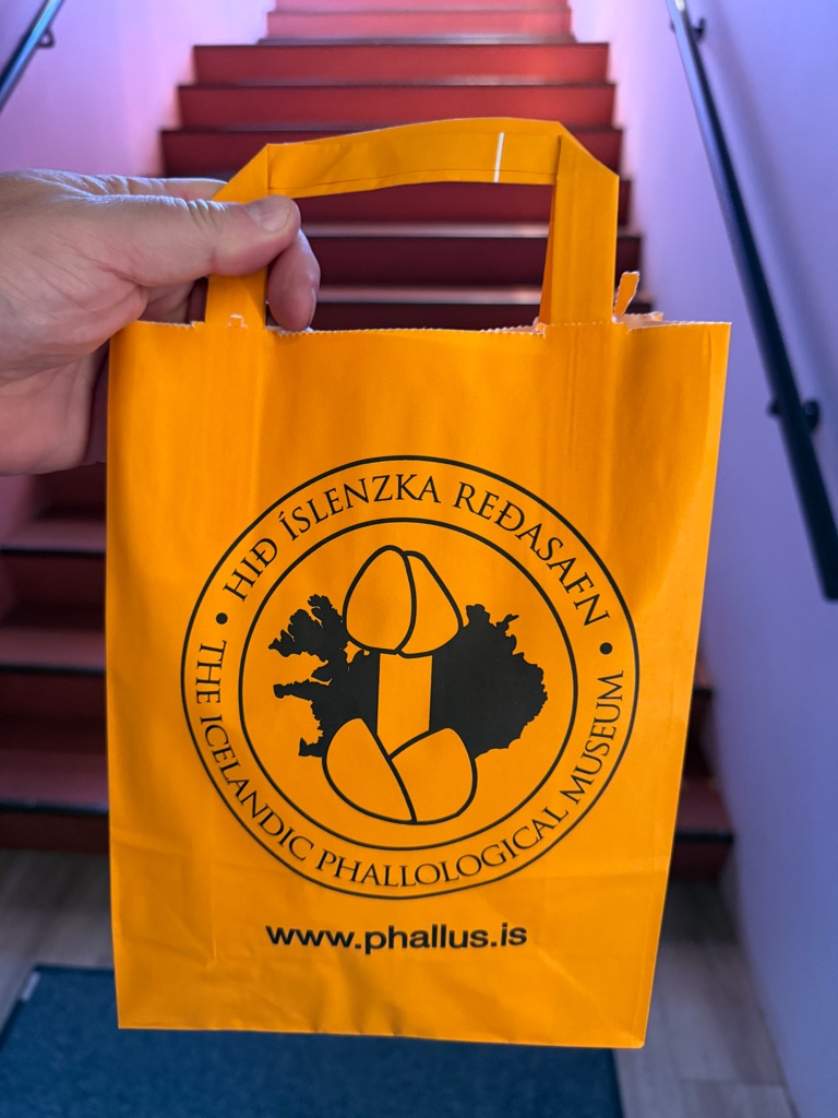
Christmas shopping for kids is complete
![]()
![]()
![]()
![]()
![]()
![]()
OR
Copy the link to @rickkossik Journo below
![]()
![]()
![]()
![]()
![]()
![]()
OR
Copy the link to @rickkossik Journo below
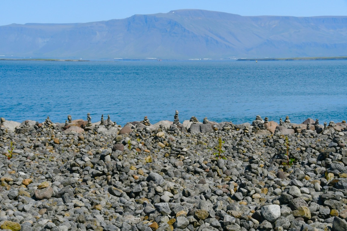
Waterfront. As I said, reminds me of Hawaii
![]()
![]()
![]()
![]()
![]()
![]()
OR
Copy the link to @rickkossik Journo below
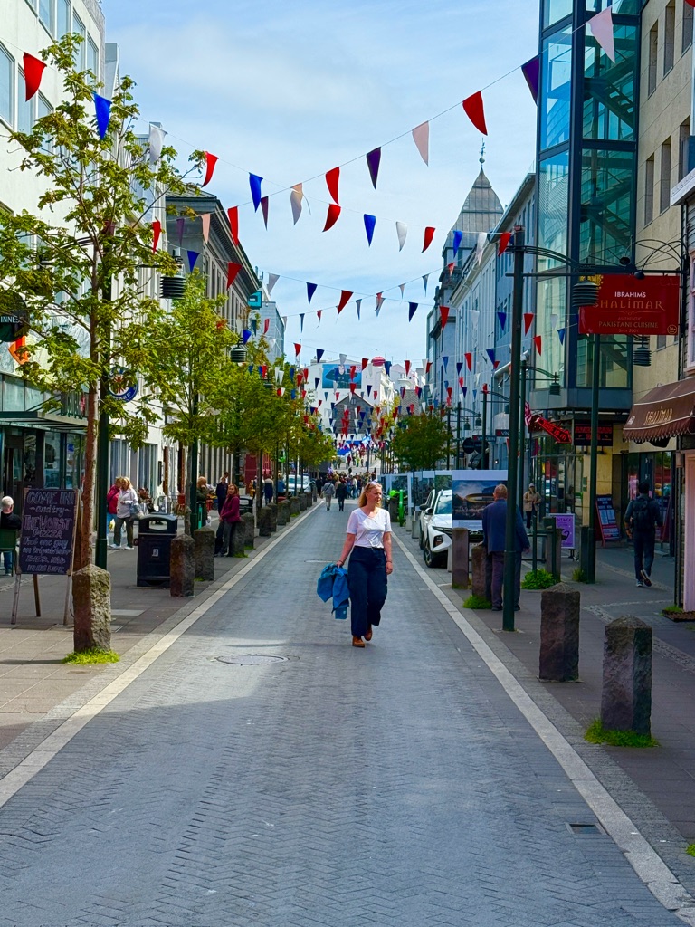
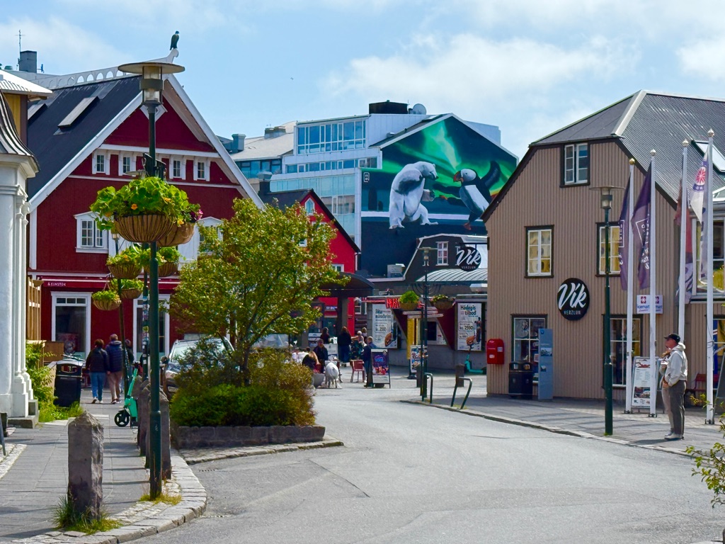
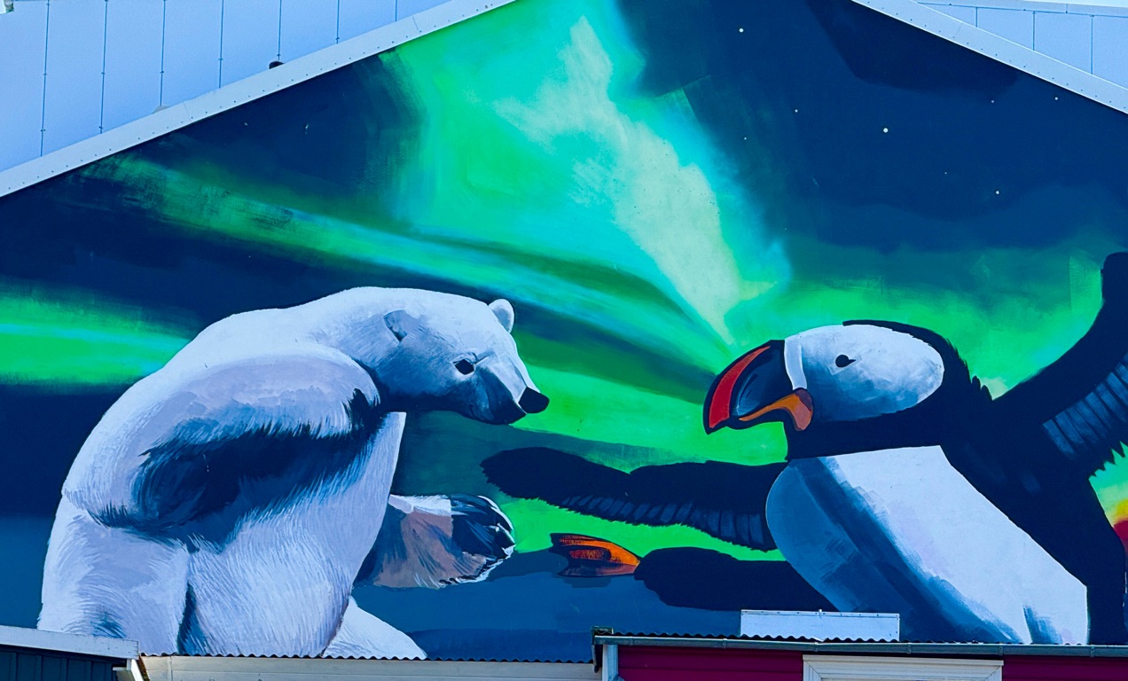
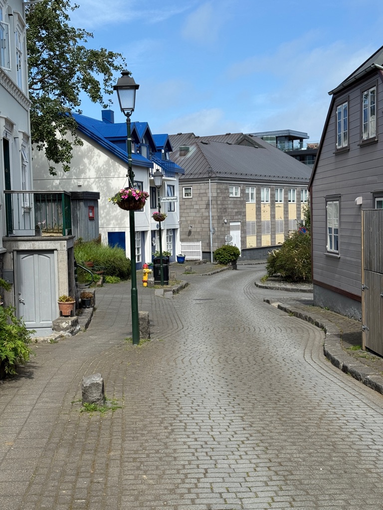
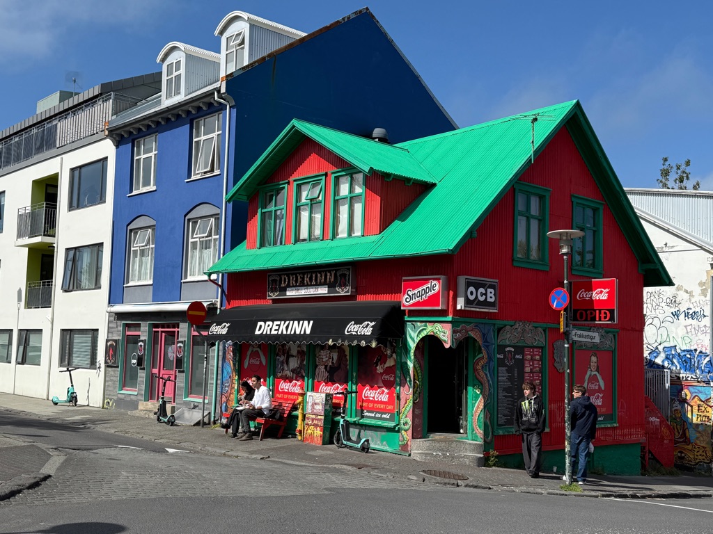
Some Reykjavik street scenes. Cute small town.

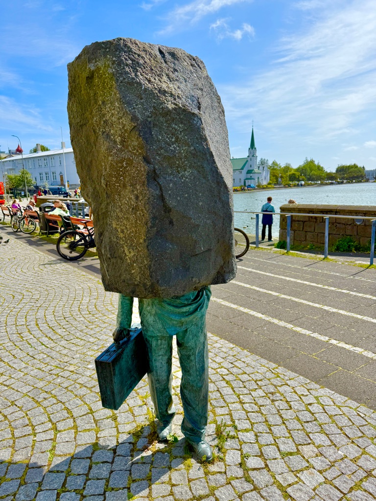
The Faceless Bureaucrat
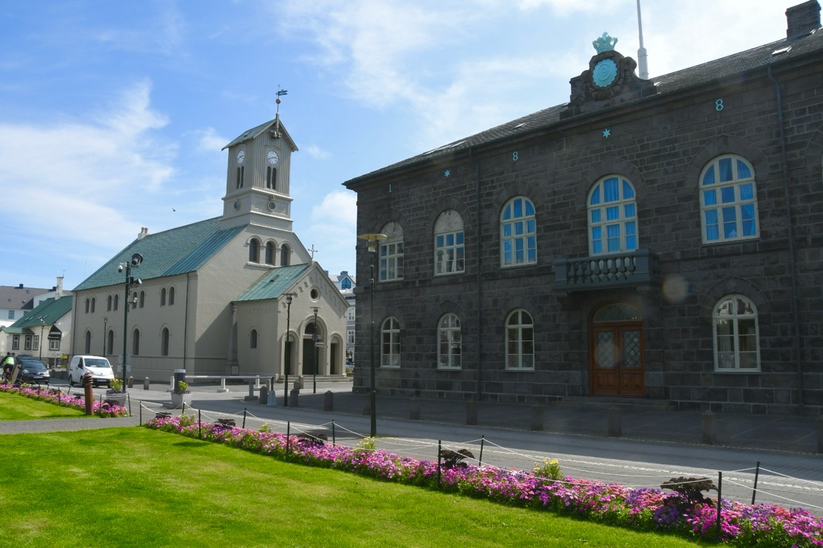
Alpingi (“all-thingy”). The Parliament House. And the Lutheran Cathedral. Yes, Iceland is a small country

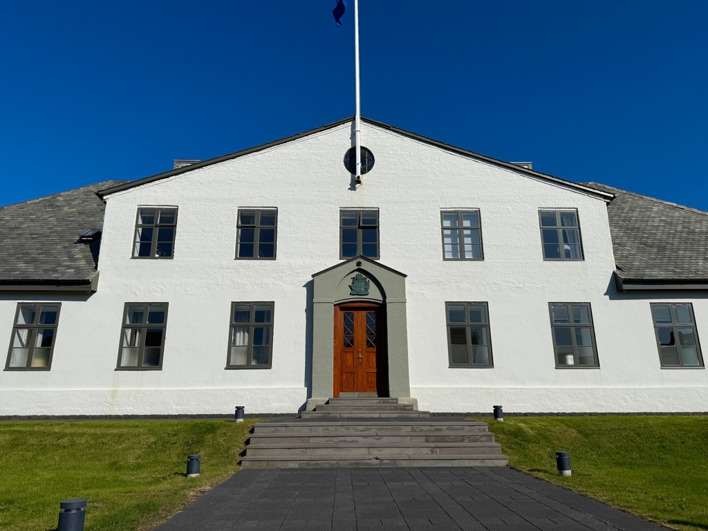
And if you still don’t believe me, this is the Prime Minister’s office
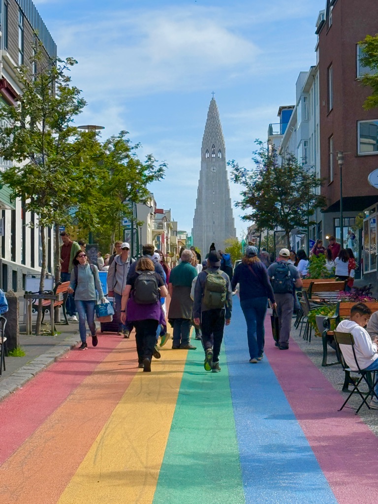
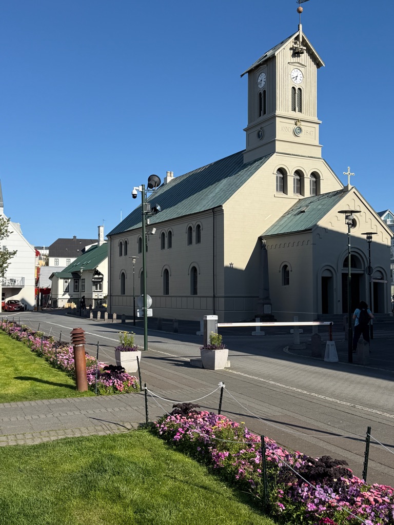
Ok I lied. Not everything is tiny in Reykjavik. This is the Hallgrimskirkja Lutheran Church.
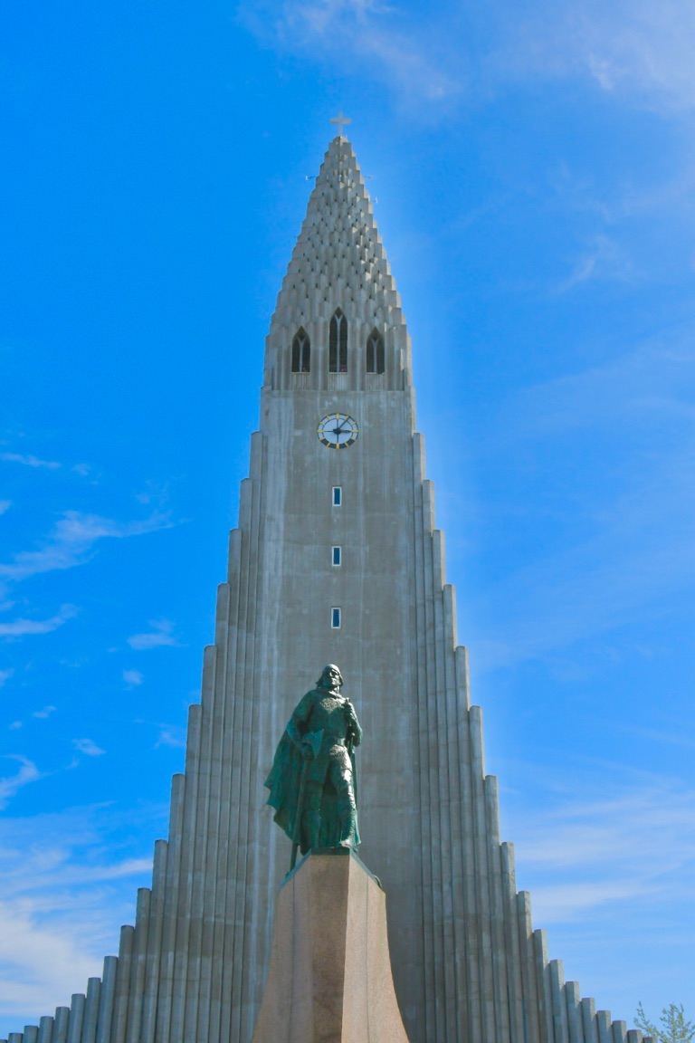
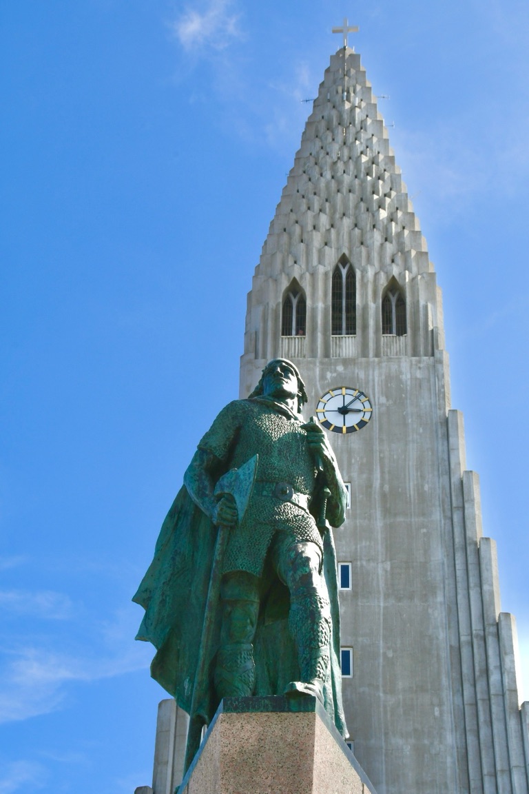
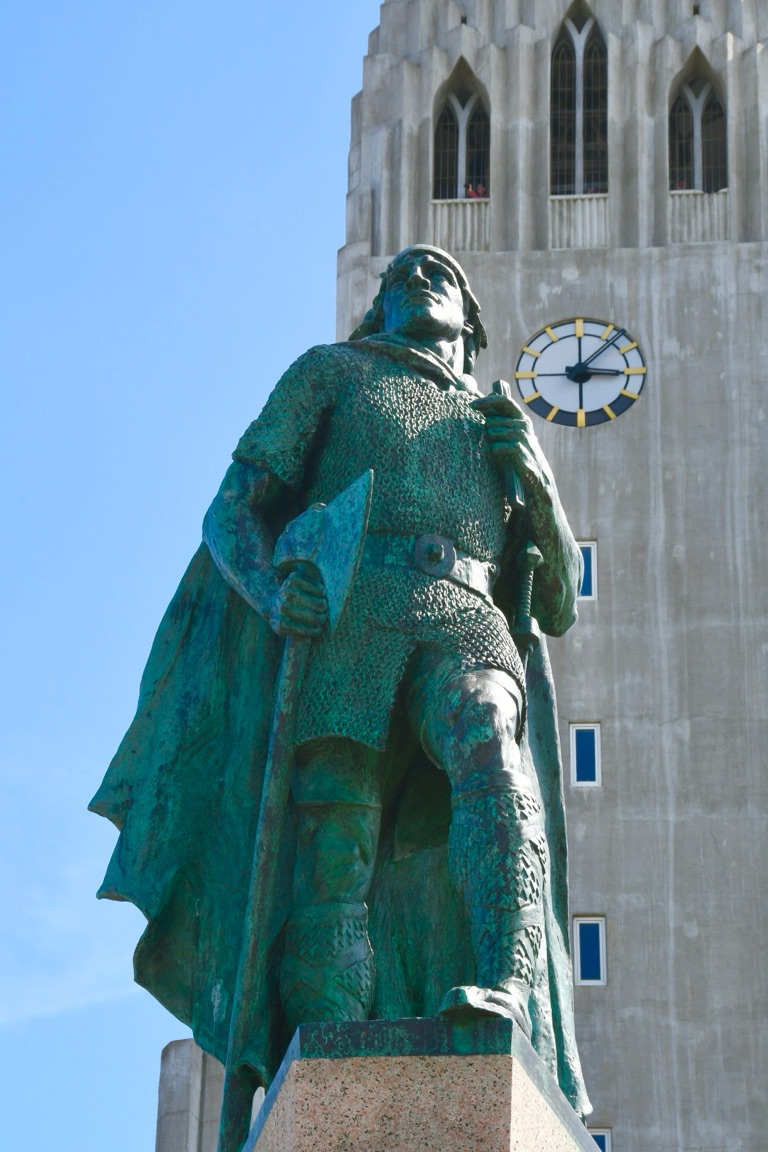
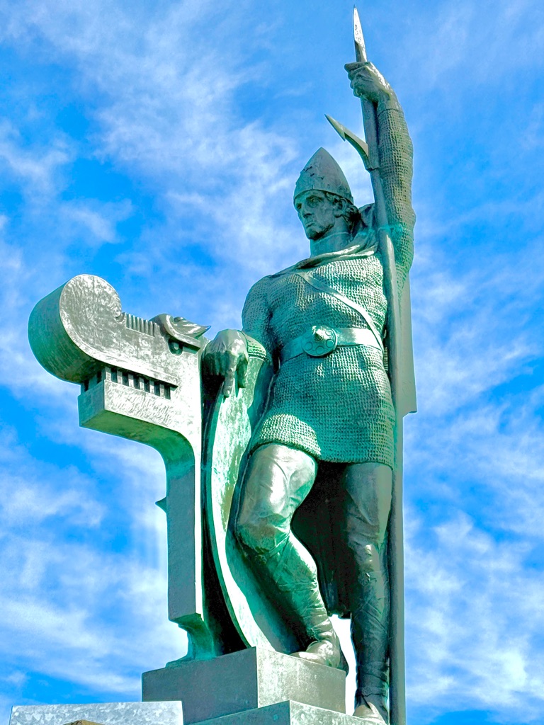
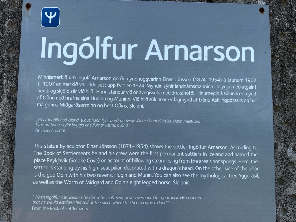
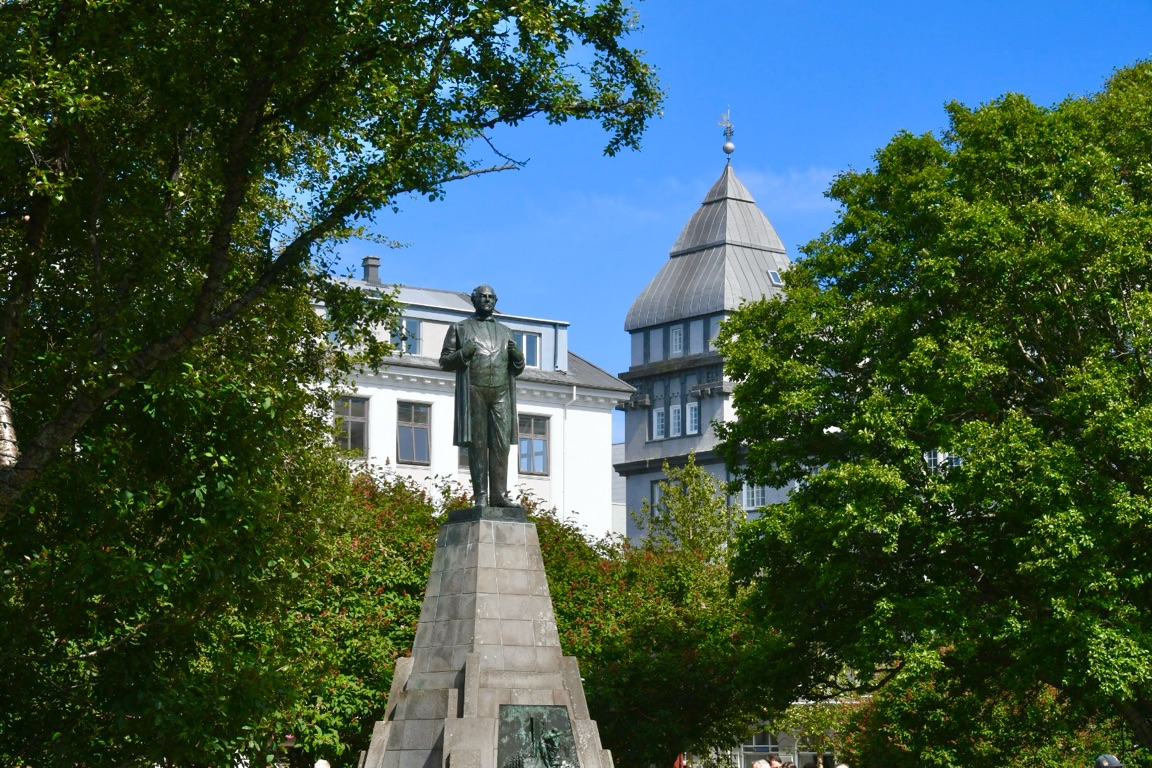
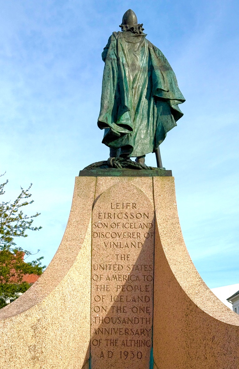
The man, the myth, the legend: Leifur Eiriksson
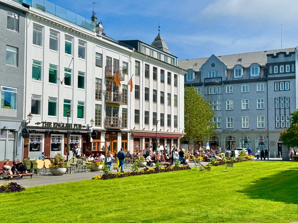
And that pretty much is all of Reykjavik.
Tomorrow will tour various sites (geysers, waterfalls) not far from town with a geologist. Meet up with group for 6 day hiking trip on Tuesday.
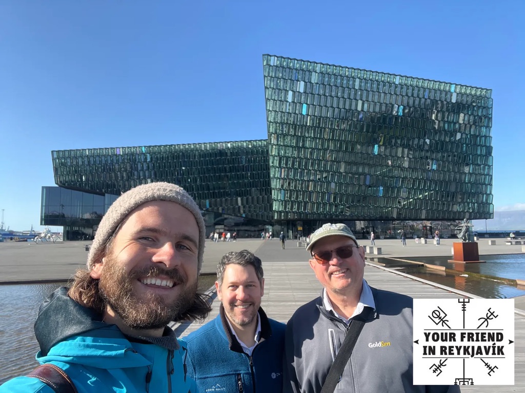
Guy on left is native Icelandic guide who I walked the town with in the evening. He shared lots of history (other guy was from Houston). Background is Harpa concert hall
![]()
![]()
![]()
![]()
![]()
![]()
OR
Copy the link to @rickkossik Journo below
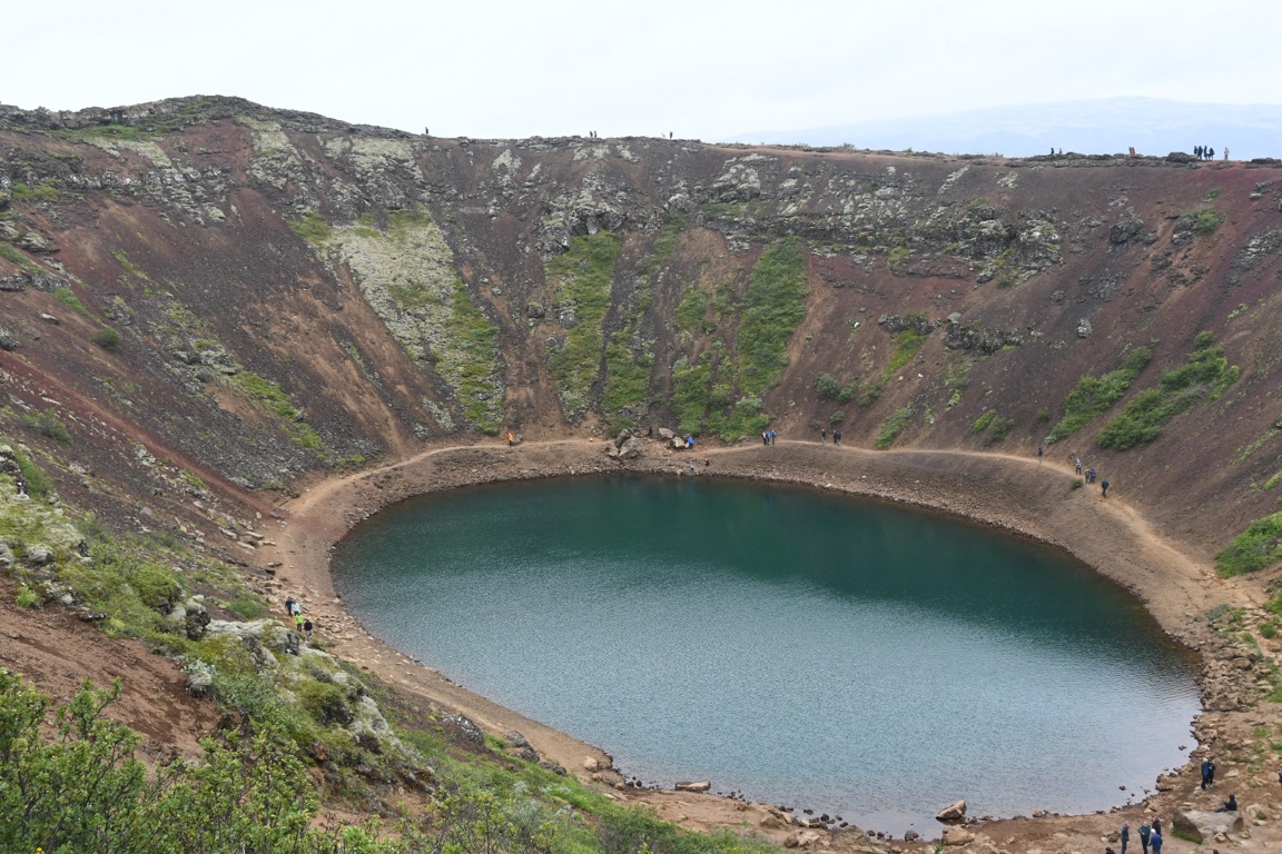
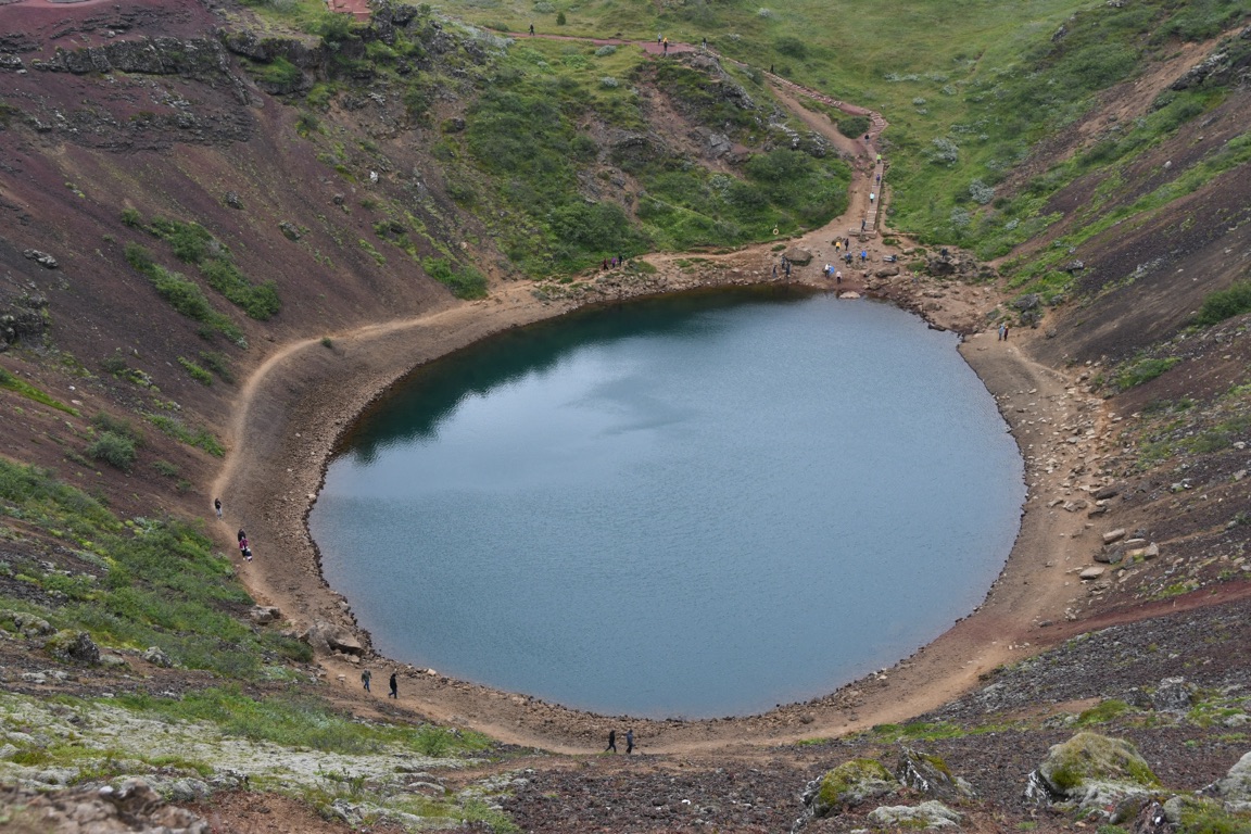
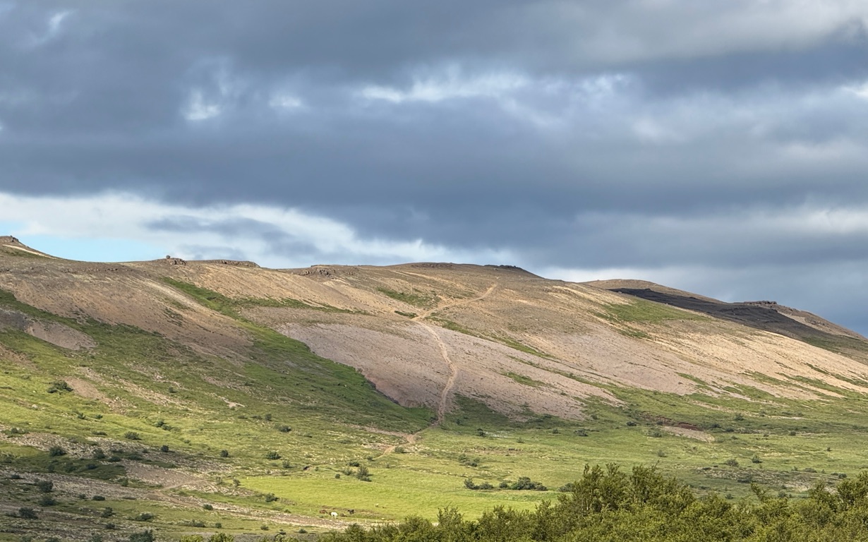
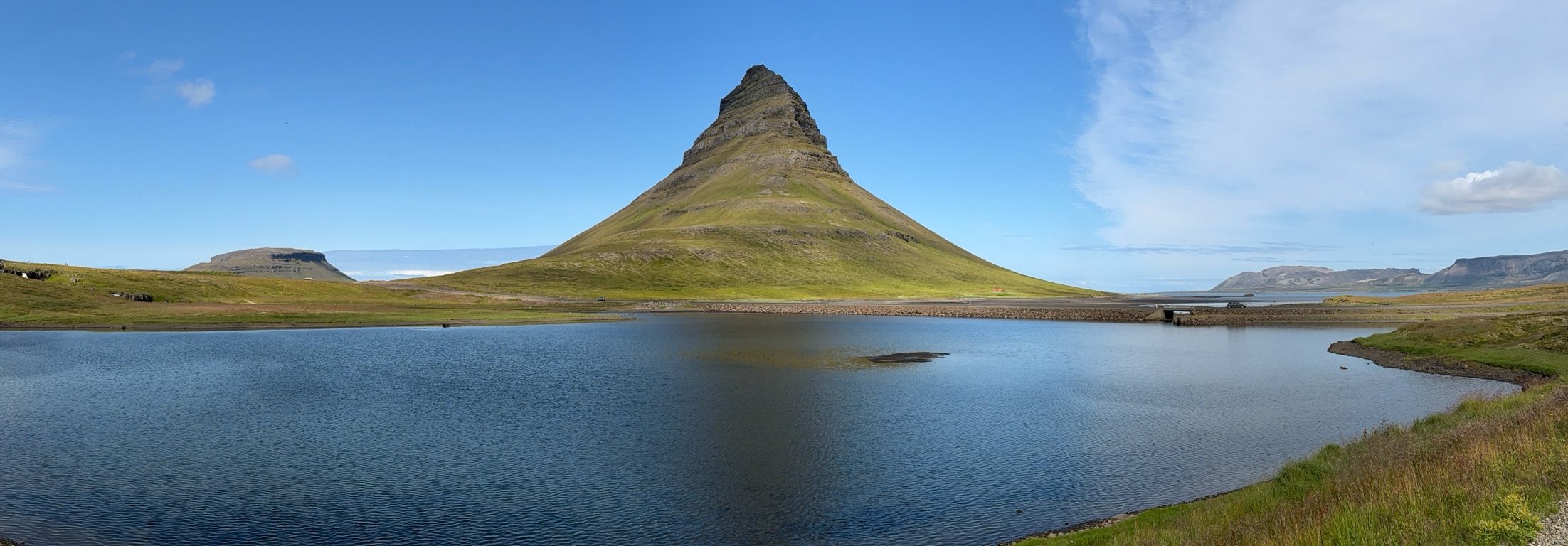
Took a tour of the “golden circle” tourist route just outside the city (an 8 or 9 hour loop with multiple stops - maybe 150 miles or so). Went with a small group (7). Guide was an Australian geologist who did her Masters in Iceland and married an Icelander. This trip is all about geology so she made it interesting. At the end of today I will share some of her insights into Icelandic culture.
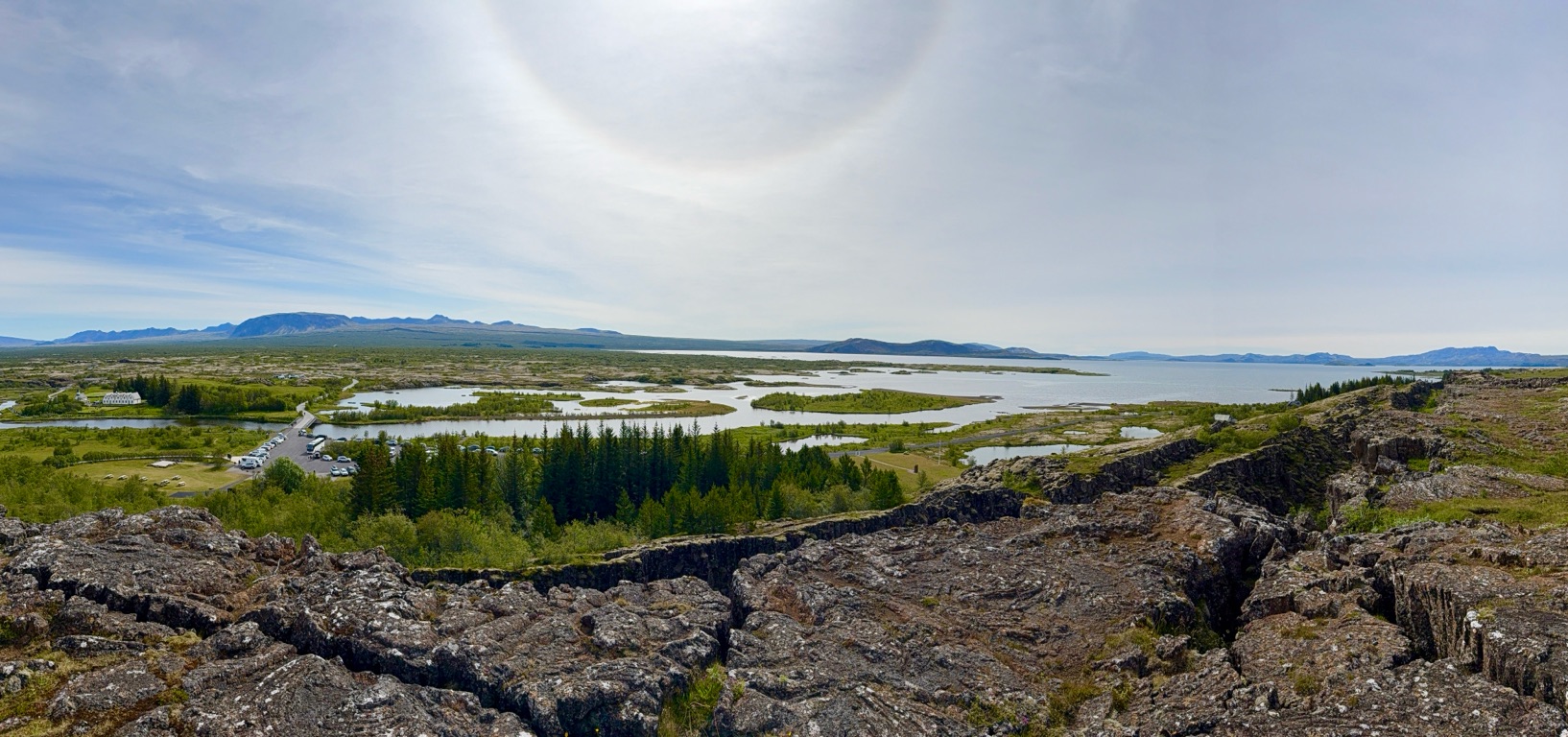
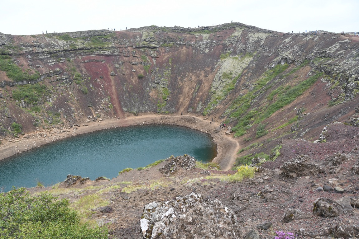
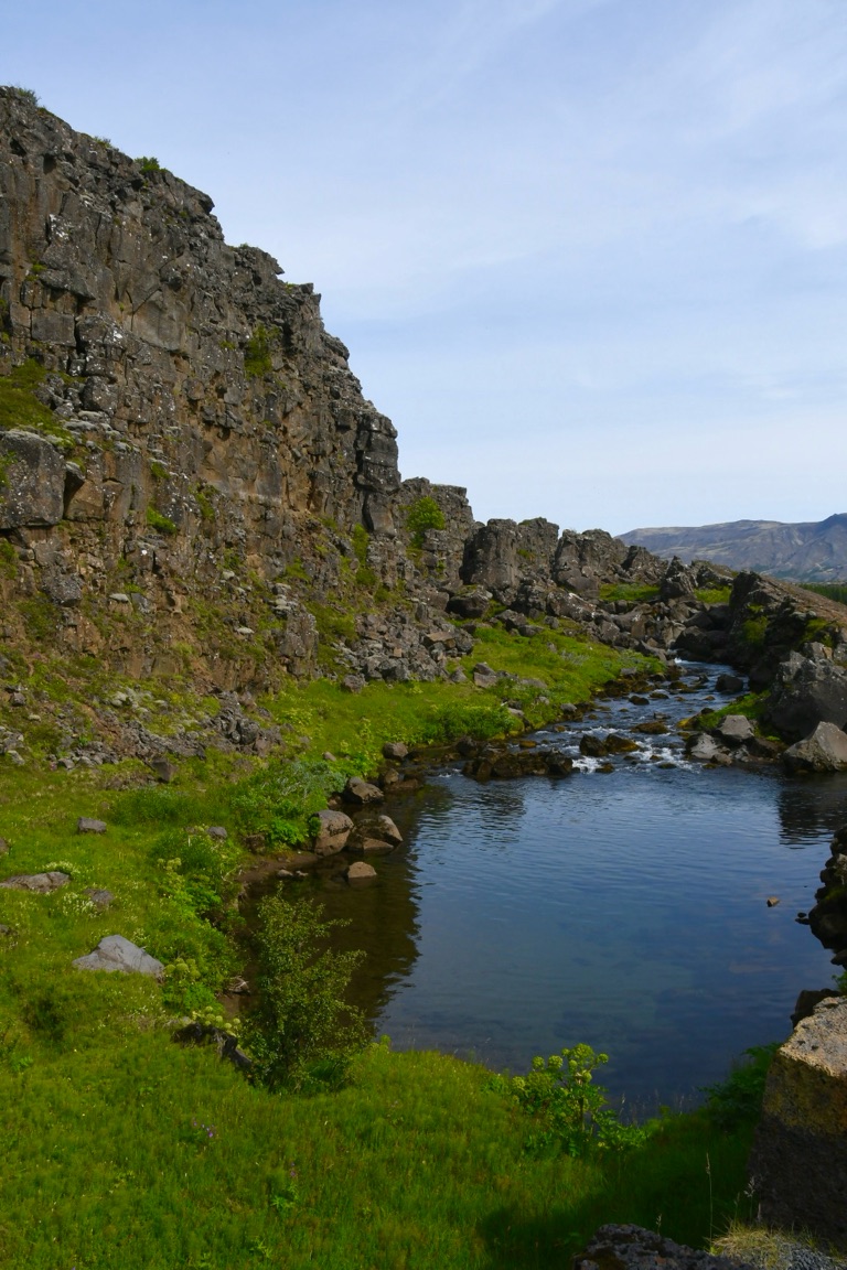
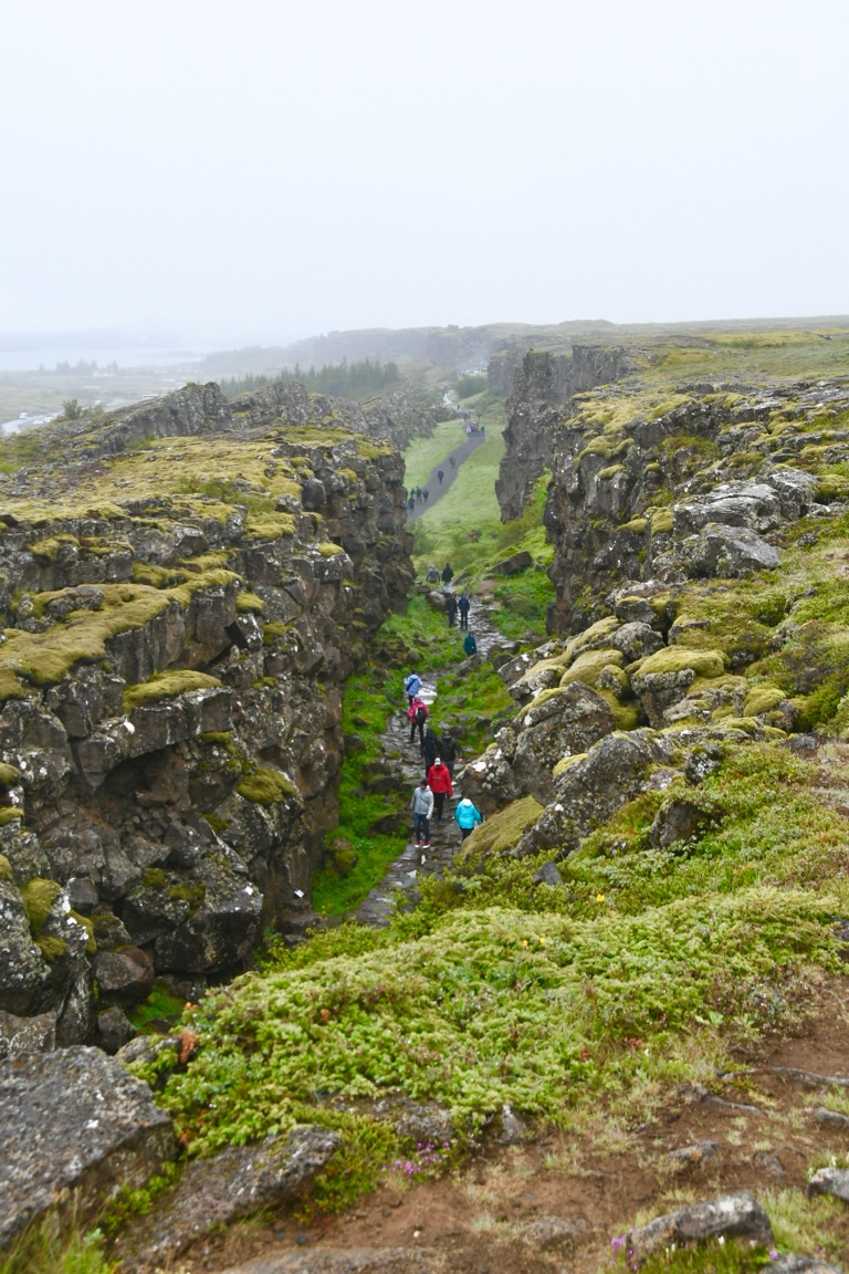
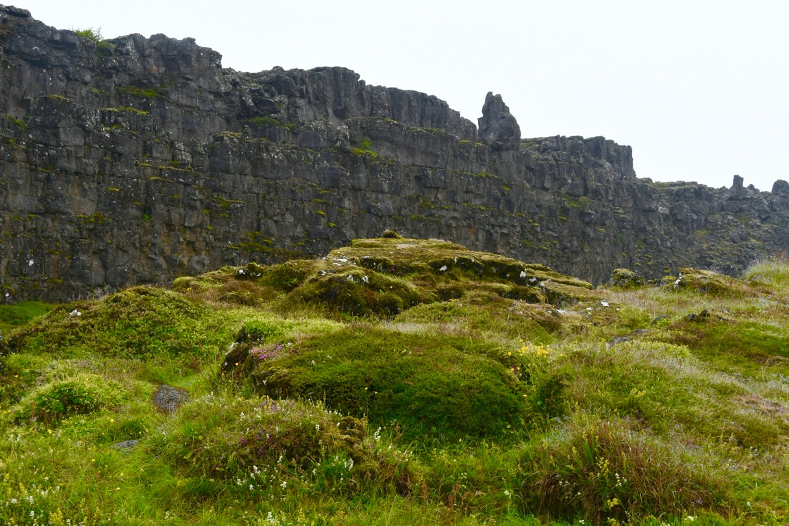
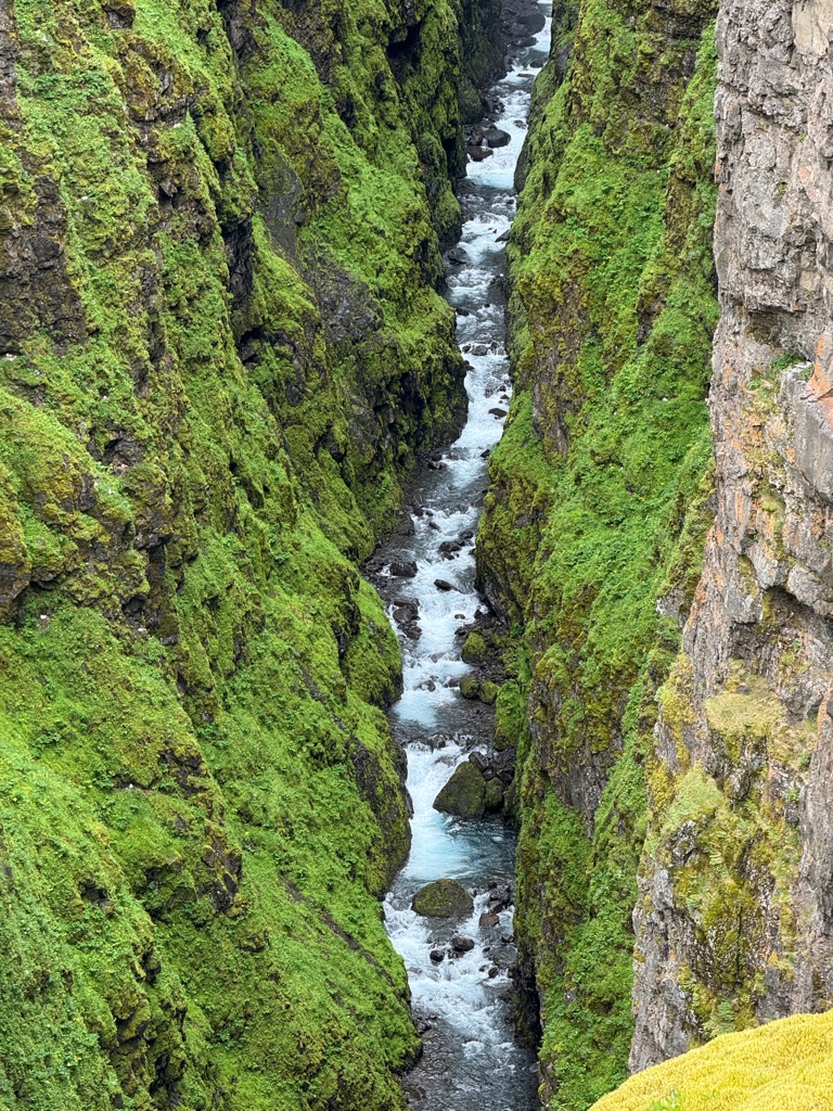
Lake in rift valley between North American and Eurasian plates
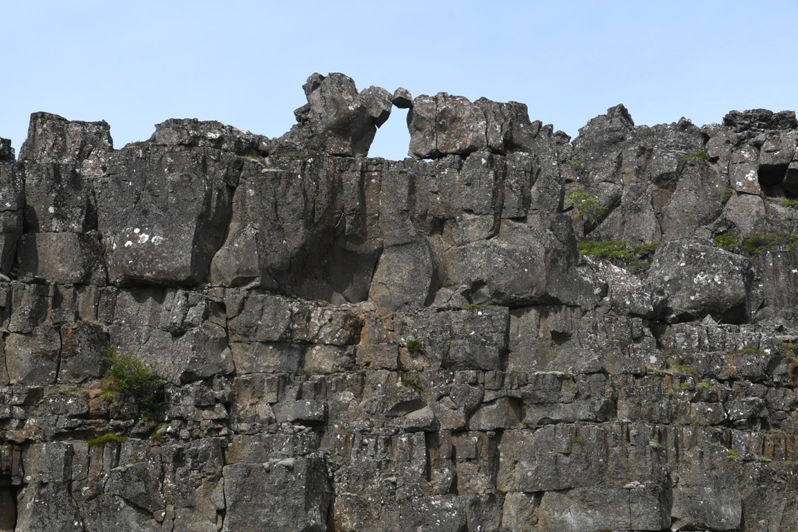
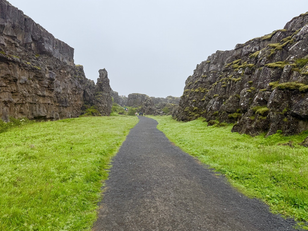
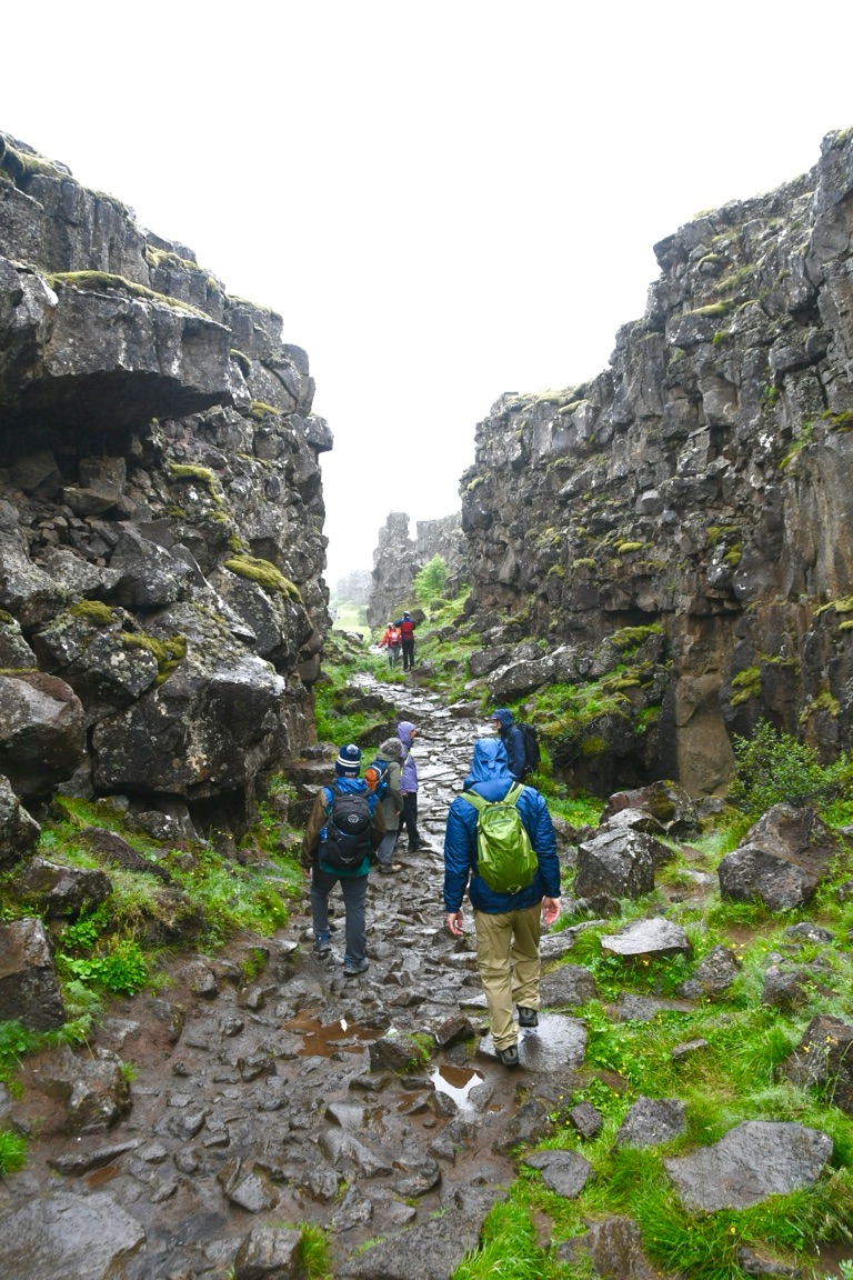
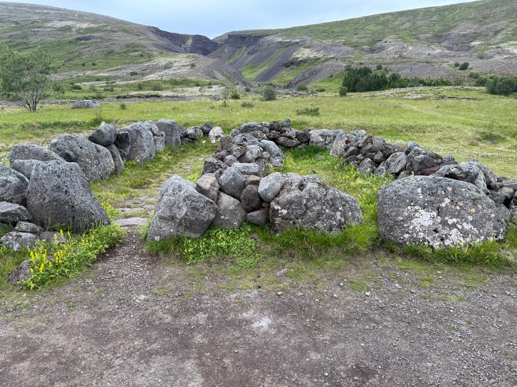
This is Thingvellir National Park. It is place where you can see the two plates moving apart. It also has tremendous historical significance to Iceland. You saw the Alpingi (Parliament) yesterday in the city. The first Alpingi met here inside the rift starting 1000 years ago. People (vikings) would travel here from all over the country for several weeks. Laws would be passed, crimnals would be tried, people would trade.
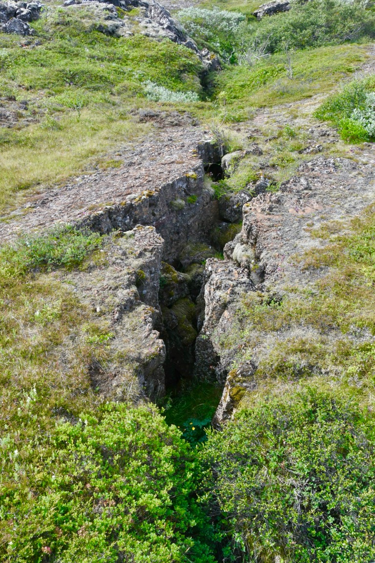
Fissure where earth is pulling apart
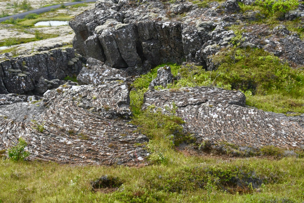
Ropey lava

Walking through the rift with all the tourists
Imagine this small valley full of tents and horses and markets.
Why meet here? This rift valley is sheltered and spectacular. Also provides a natural ampitheater for speakers.
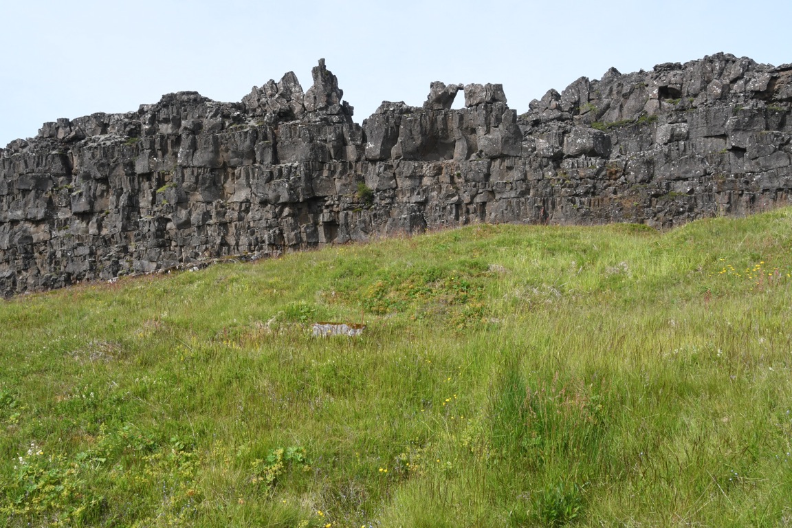
The speakers would stand up there (just in front of rock wall) while the people would be below (where I am standing)
The rock where speakers stood
The Drowning Pool
Trials would be held. Guilty would be drowned (women) or beheaded (men)
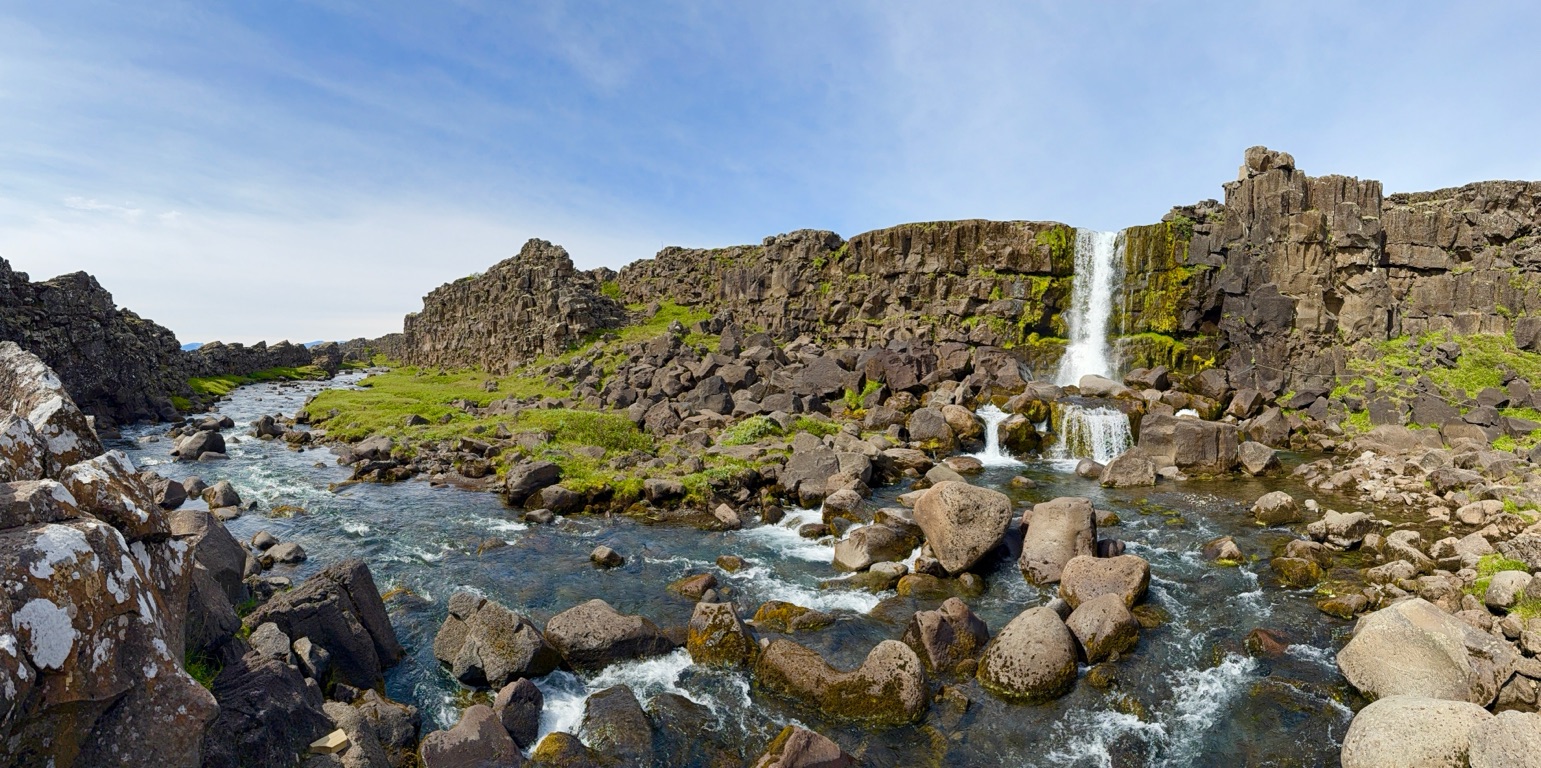
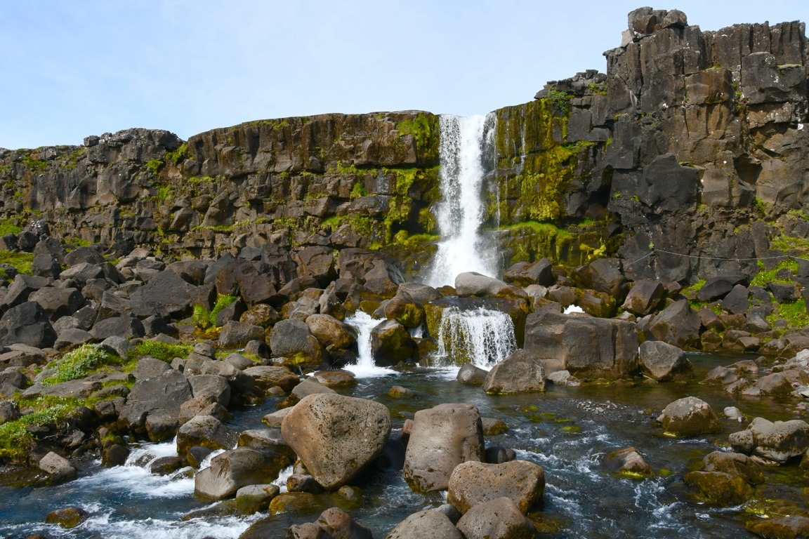
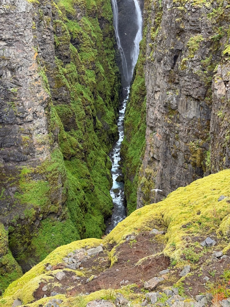
Waterfall toward the end of rift valley

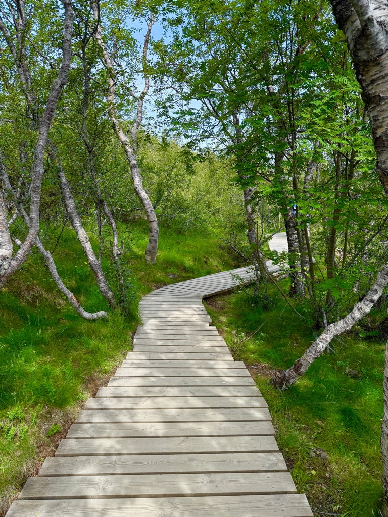
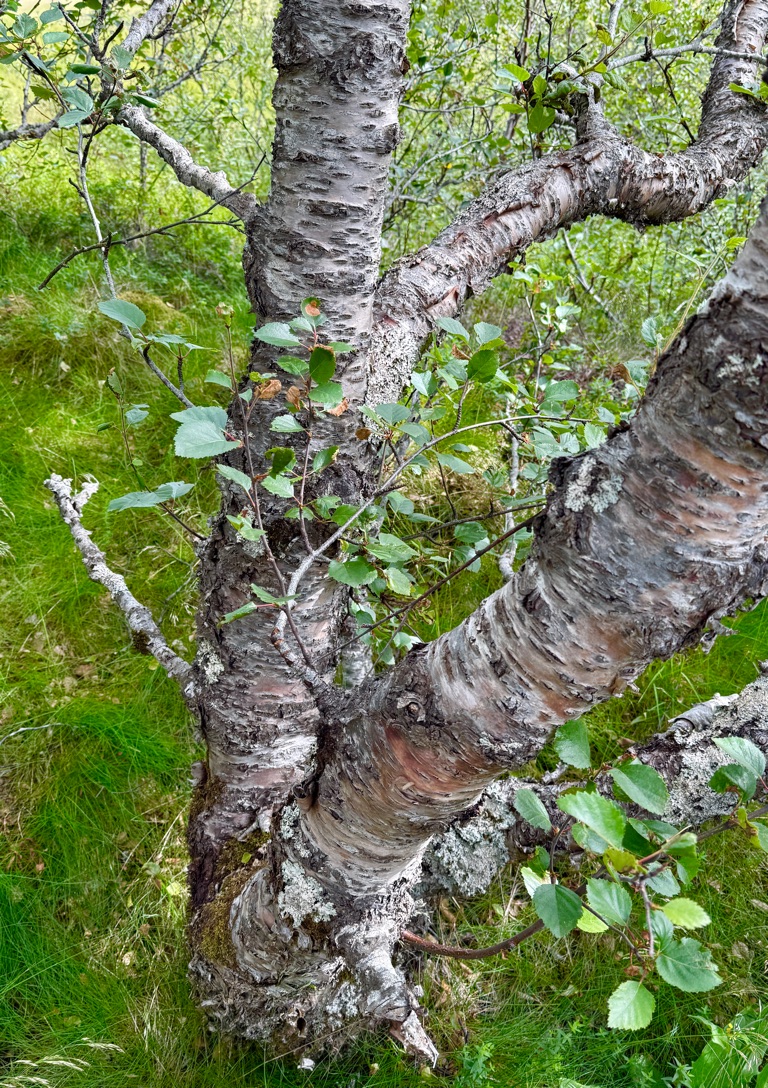
Arctic Birch. Only native tree. More like a bush, maybe 15 feet high. Almost all were cut down for firewood hundreds of years ago. This is one of the largest intact forest on the island
![]()
![]()
![]()
![]()
![]()
![]()
OR
Copy the link to @rickkossik Journo below
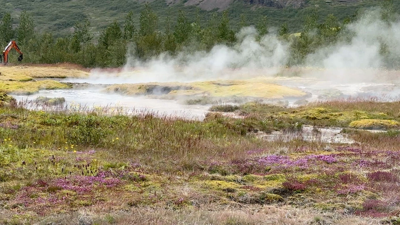
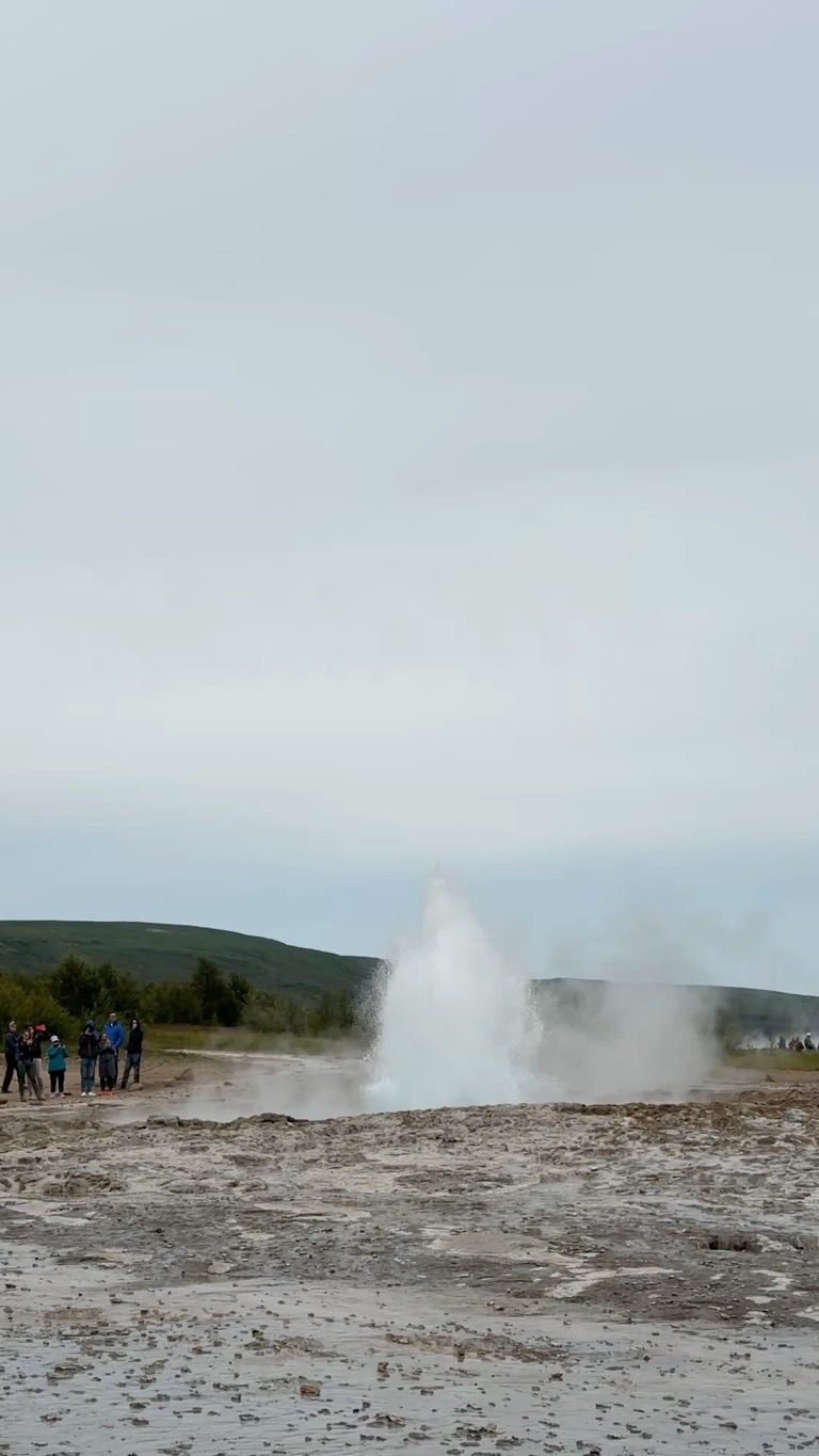
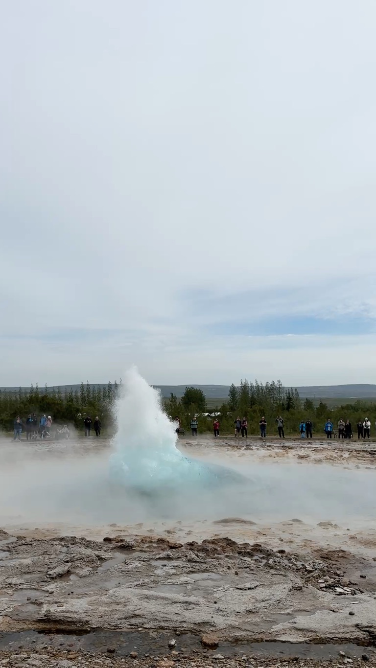
Geysir. A place, not a thing. Yes, that is where the word comes from. This specific place.
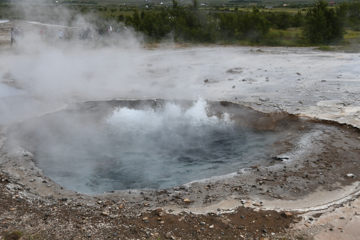
The hole on the left empties and fills about every 2 or 3 minutes
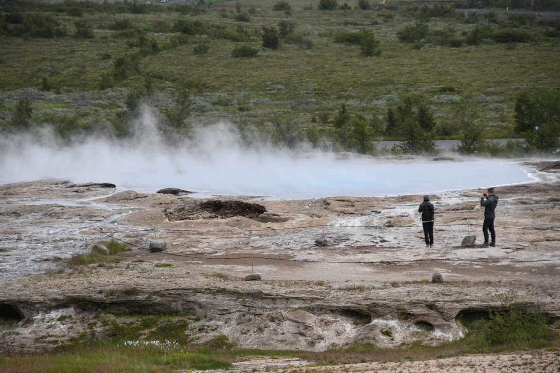
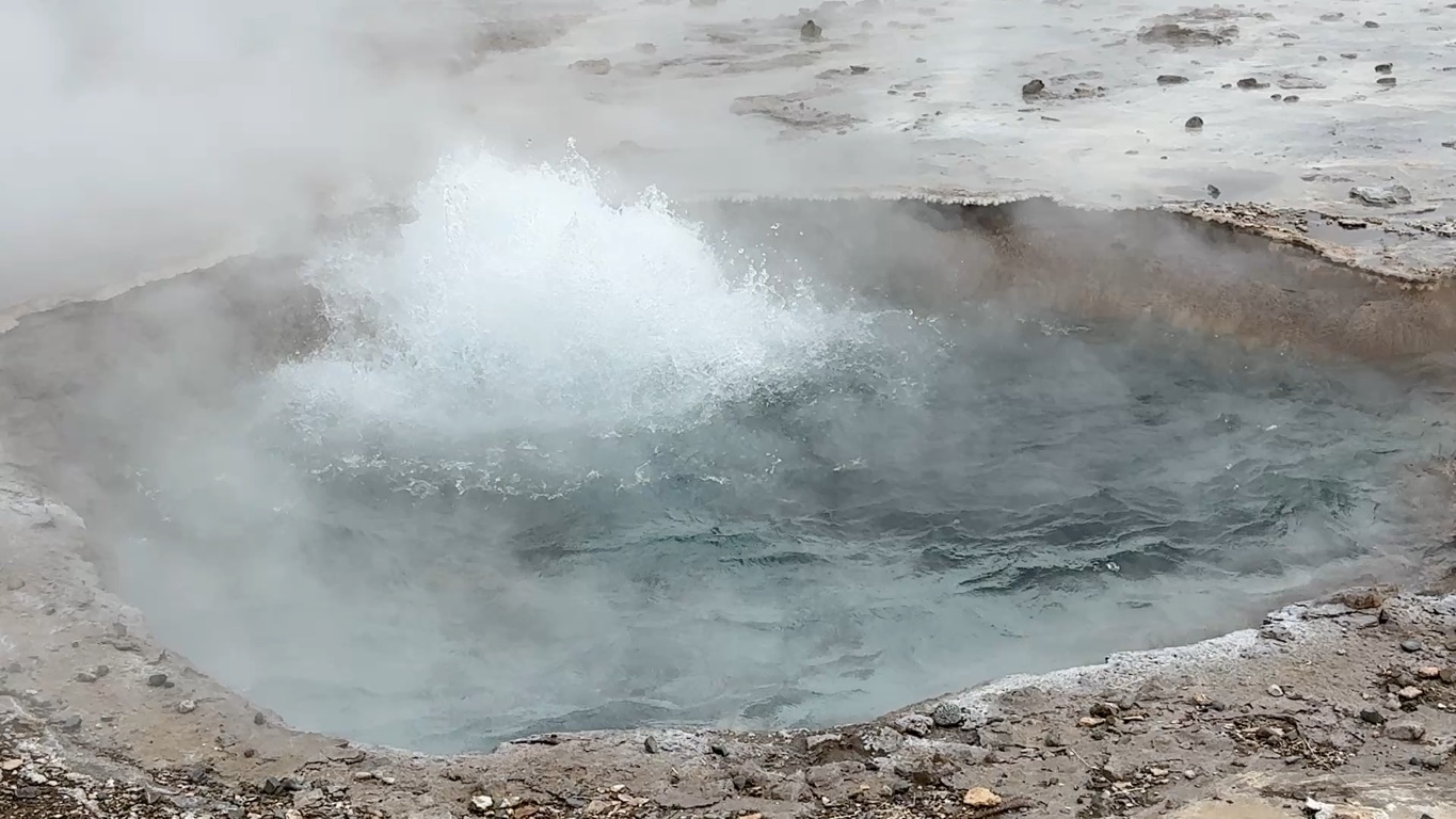
This is the original geyser at Geysir. Stopped erupting some time ago
Some short videos
![]()
![]()
![]()
![]()
![]()
![]()
OR
Copy the link to @rickkossik Journo below
![]()
![]()
![]()
![]()
![]()
![]()
OR
Copy the link to @rickkossik Journo below
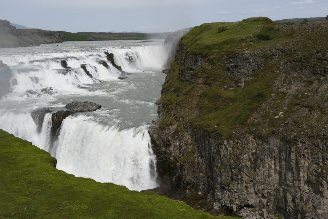
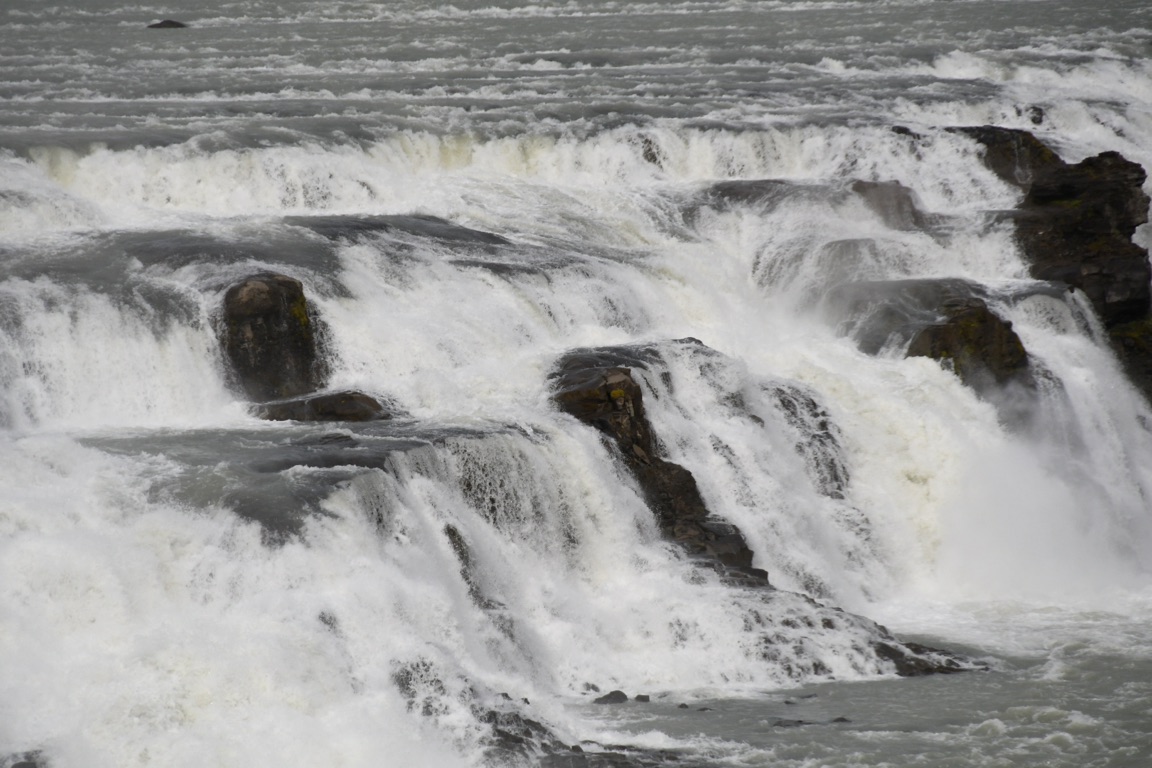
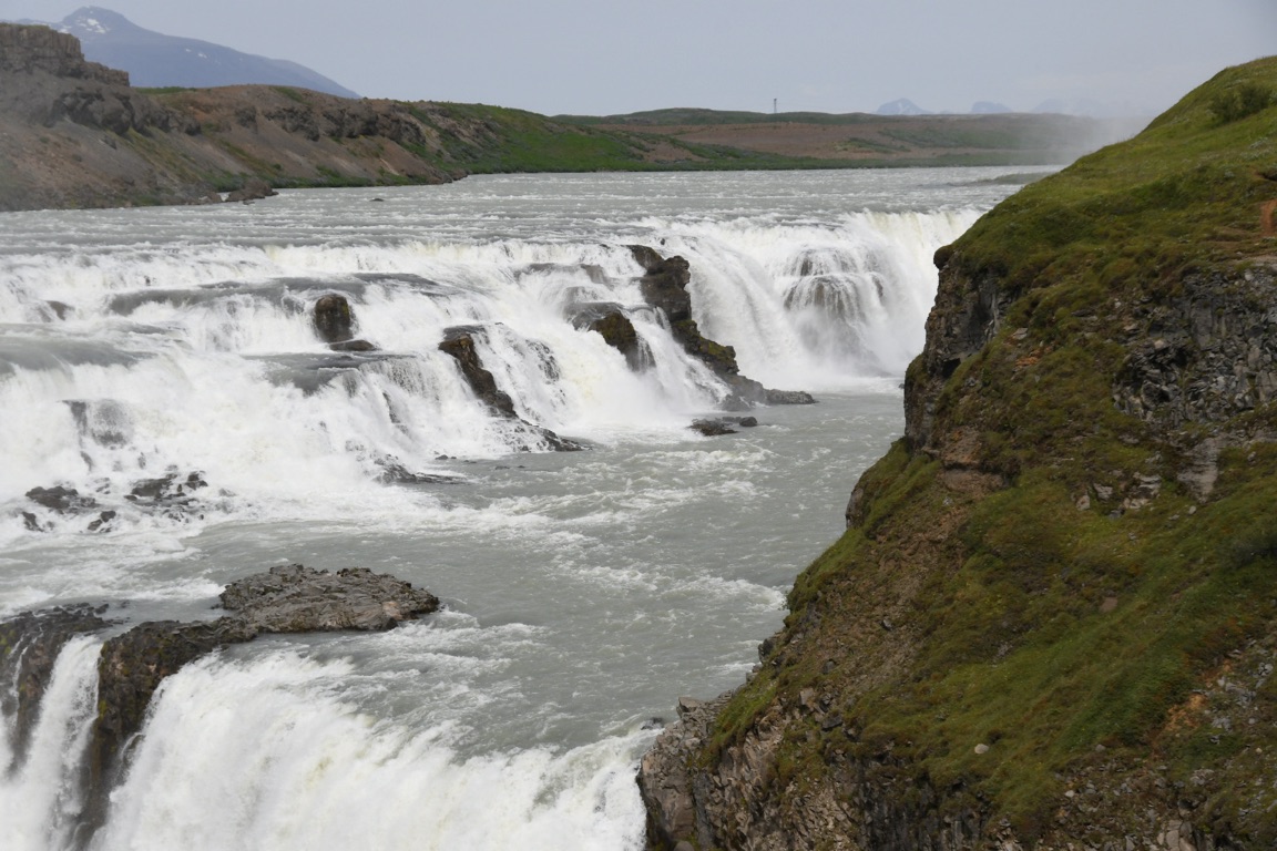
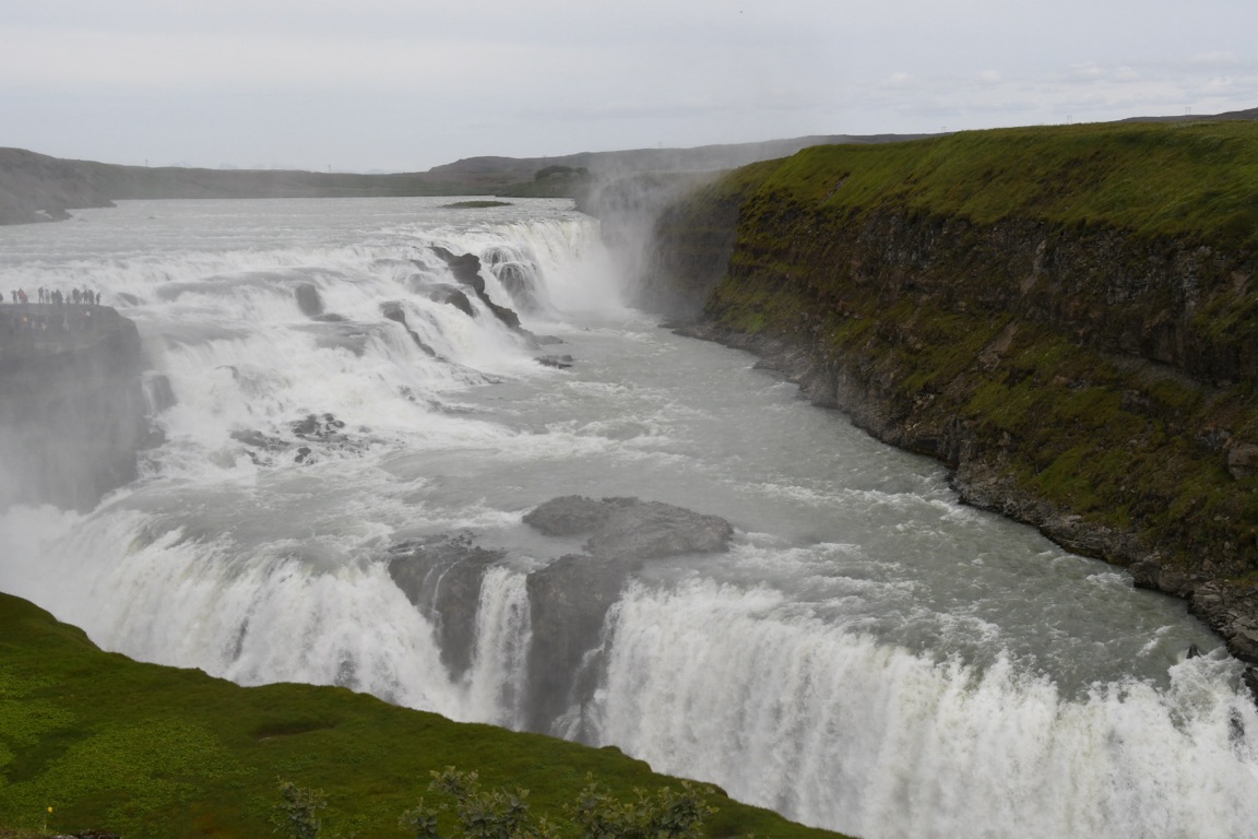
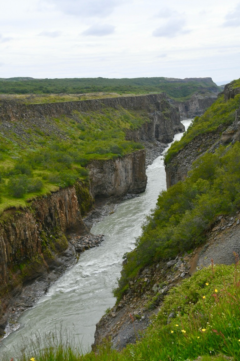
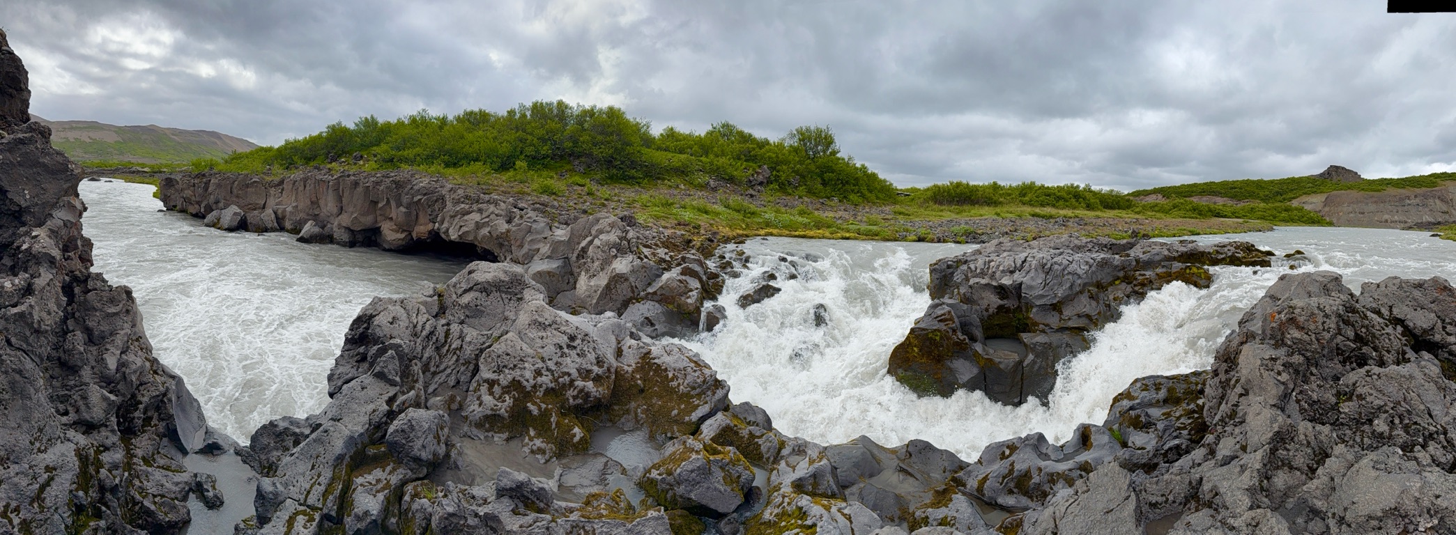
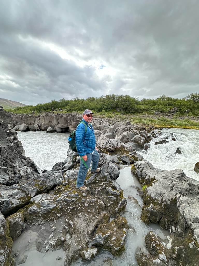
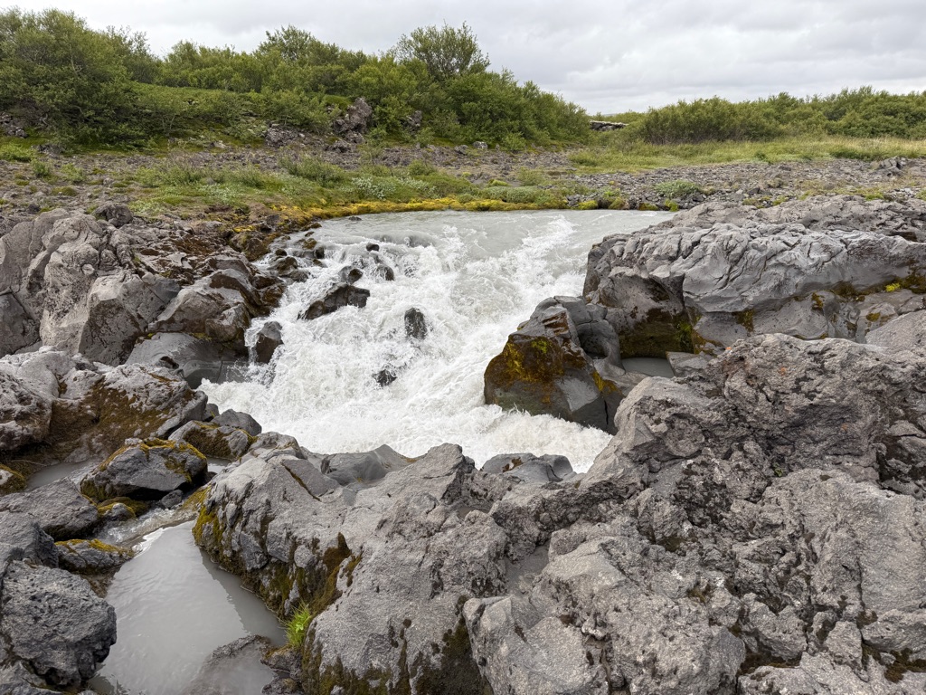
Gullfoss waterfall. A river running through the rift. Quite a waterfall.
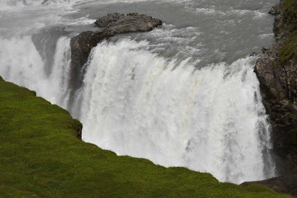
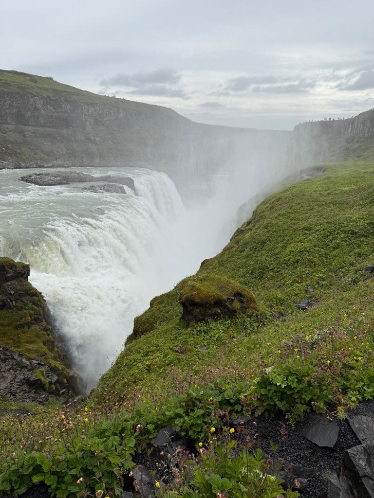
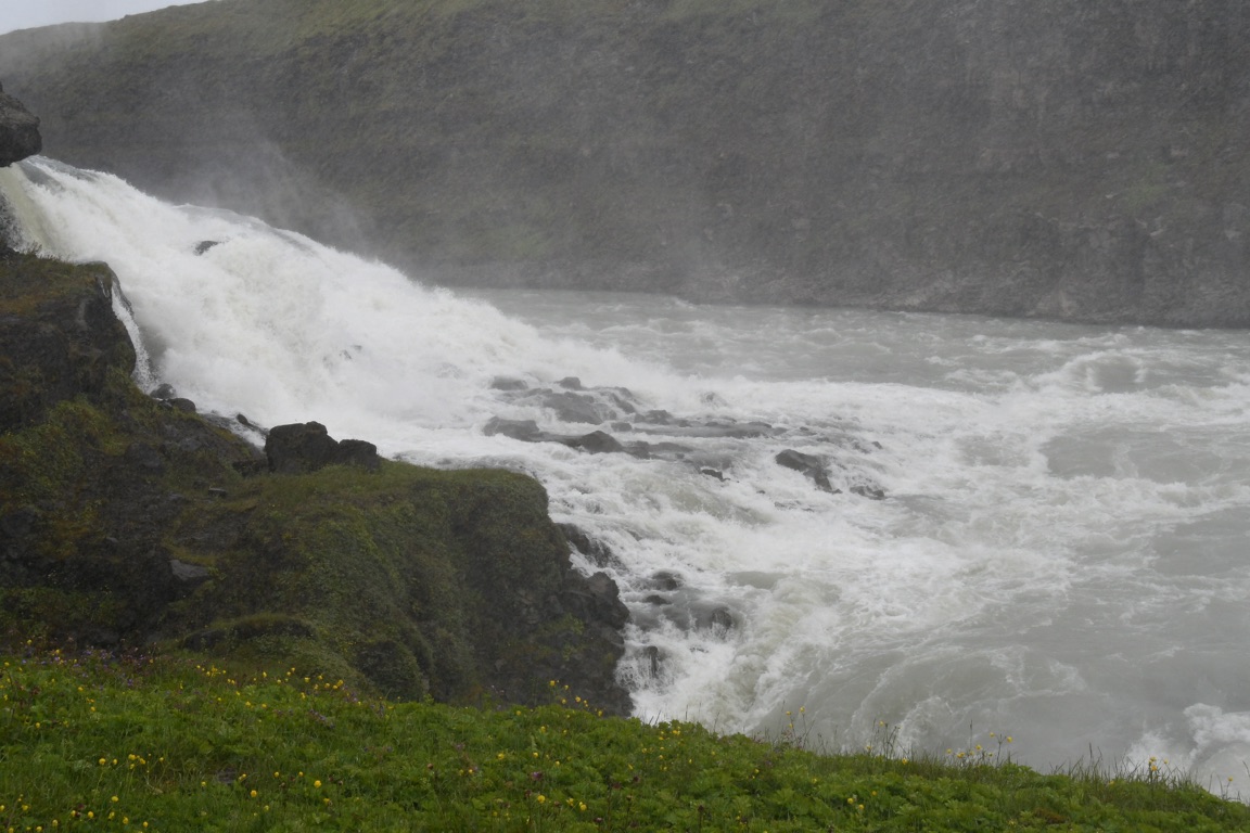
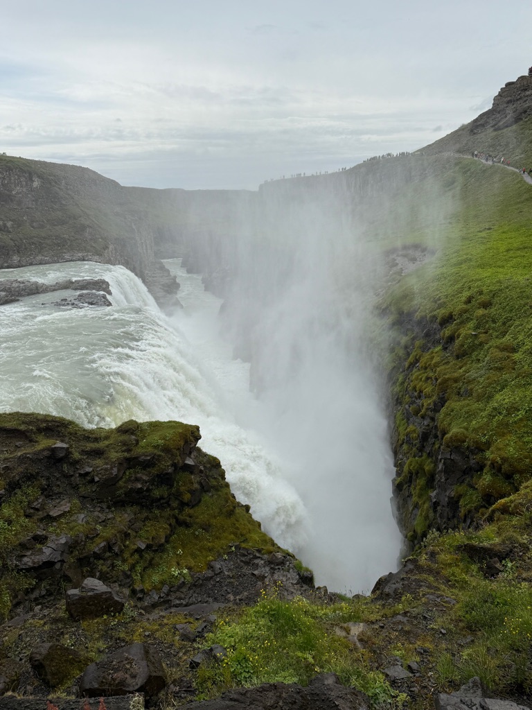
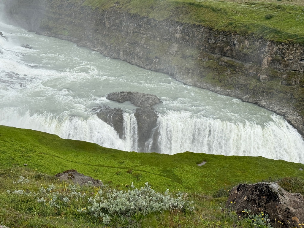
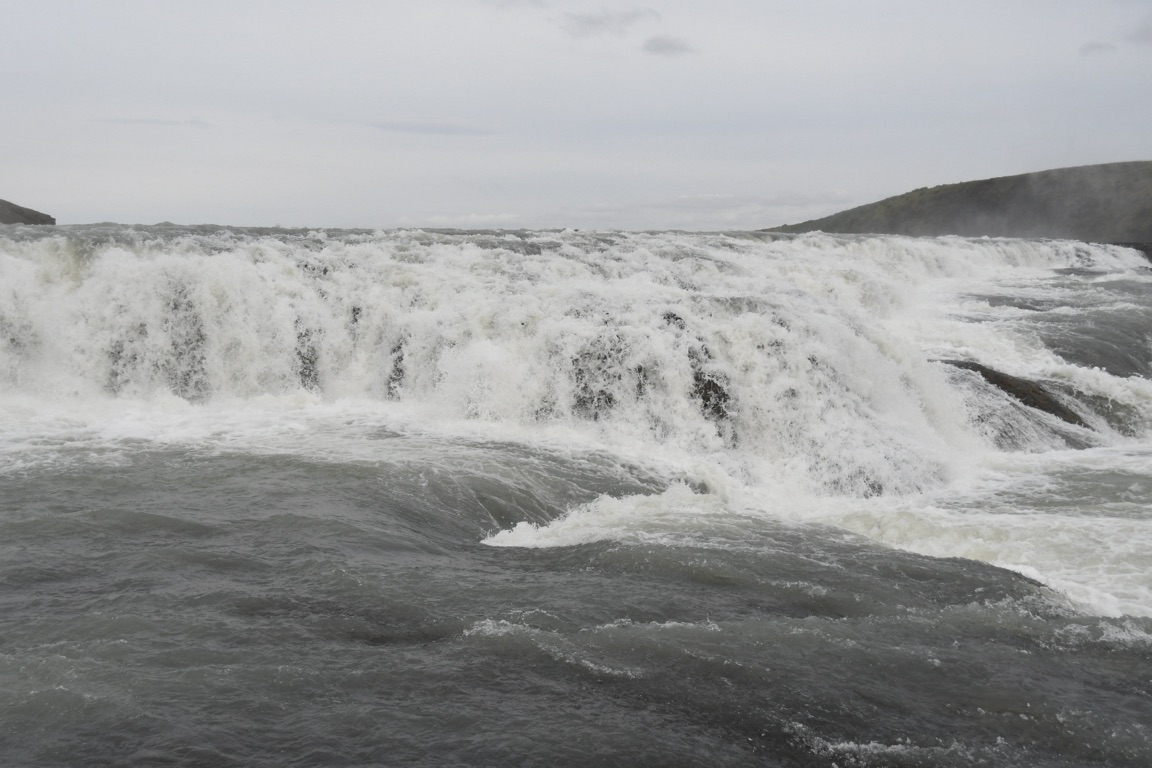
Looking downstream from waterfall:
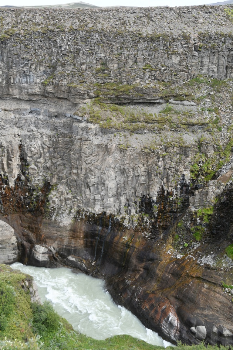
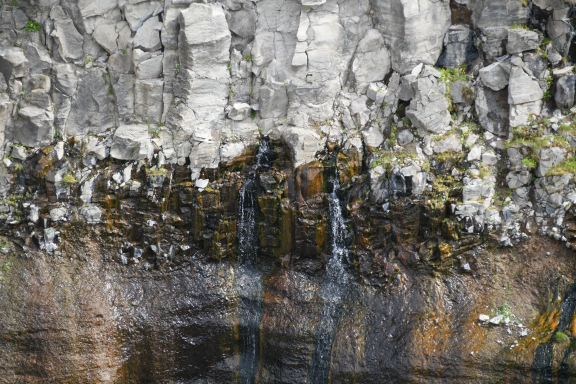
Nerdy comment #1: Note the water seeps. What you are looking at are alternating layers of flowing eruptions (columnar basalt) and explosive eruptions (ash). Ash is less porous, so water seeps out the face at that point.
Some videos of the waterfall
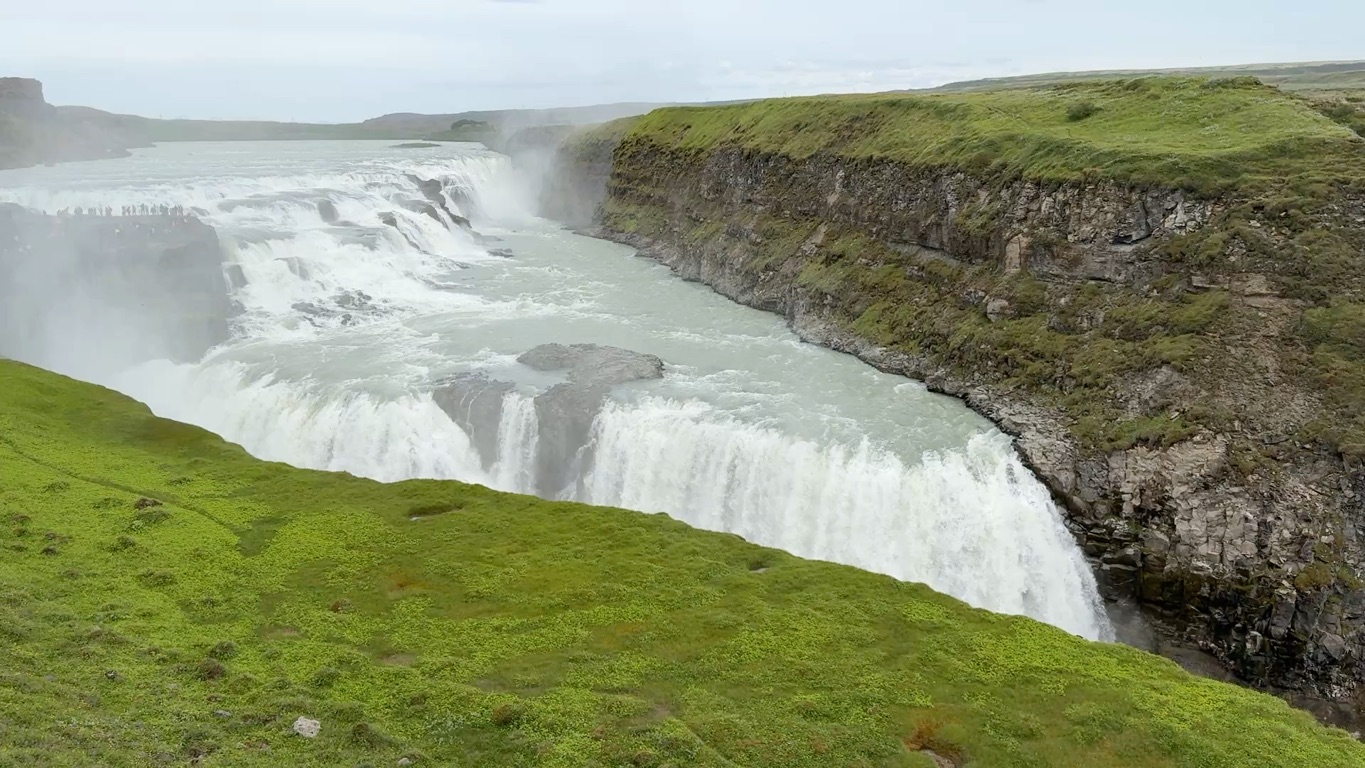
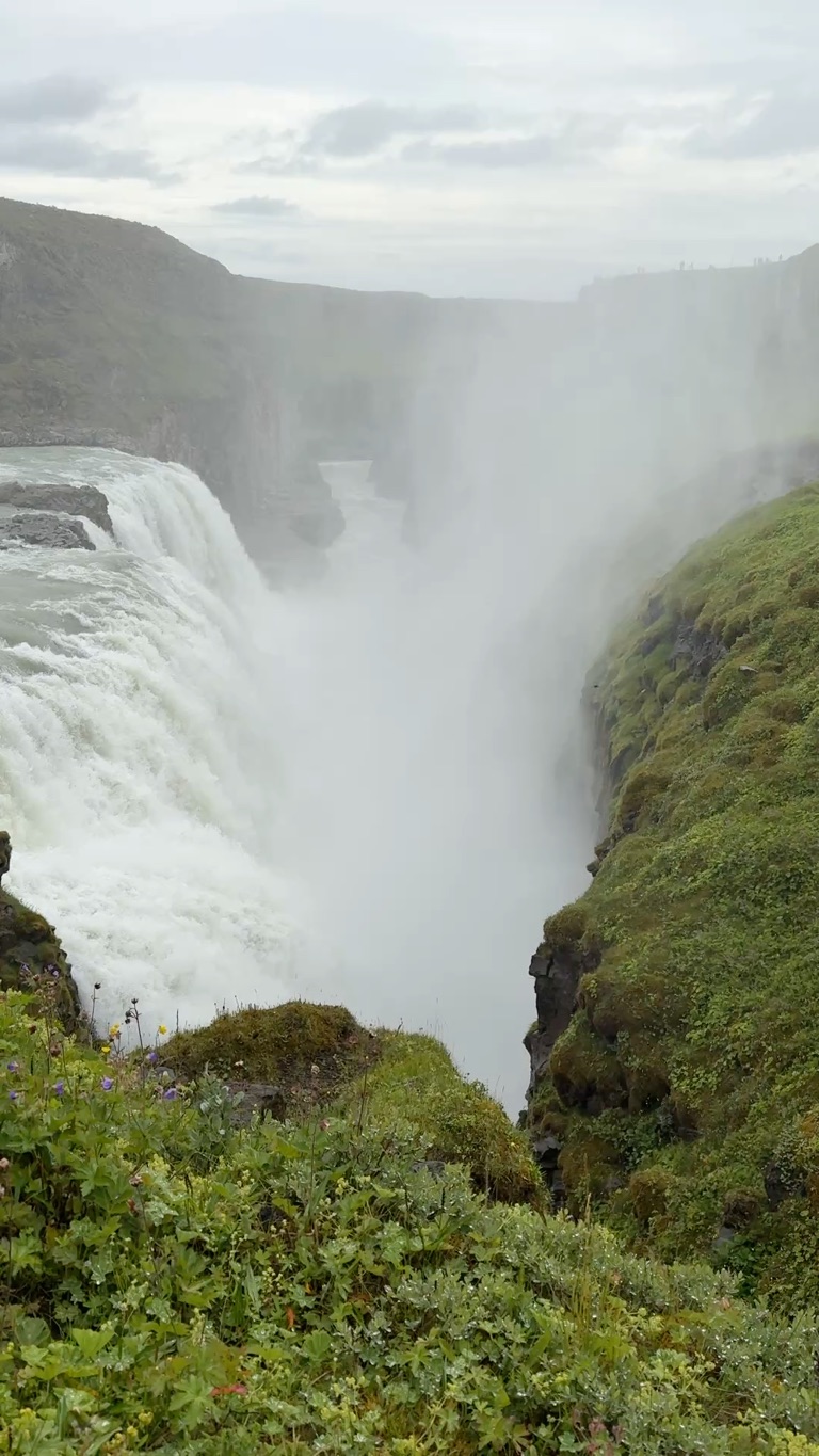
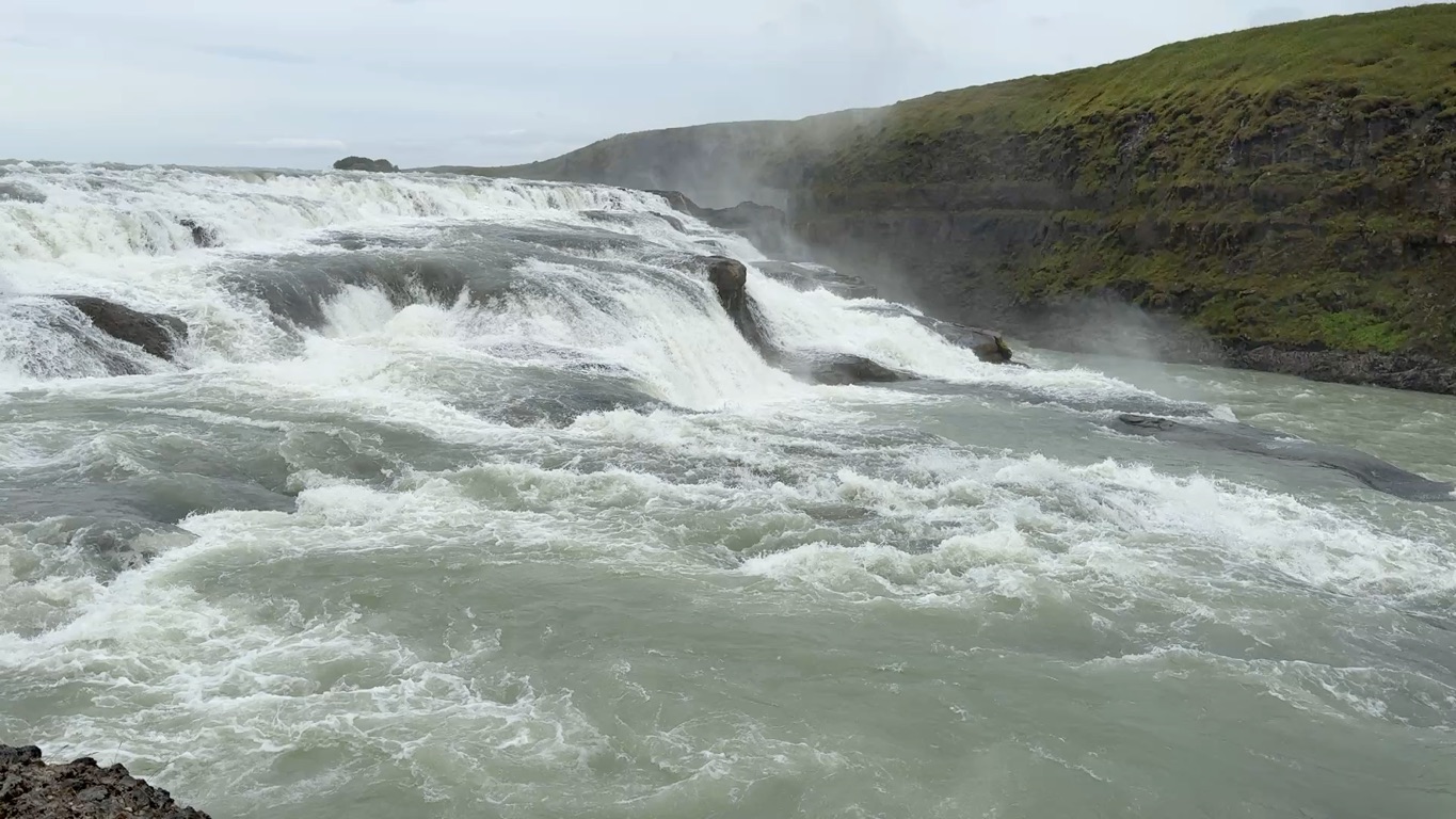
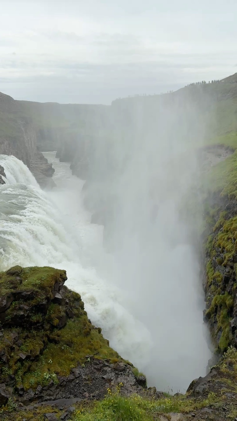
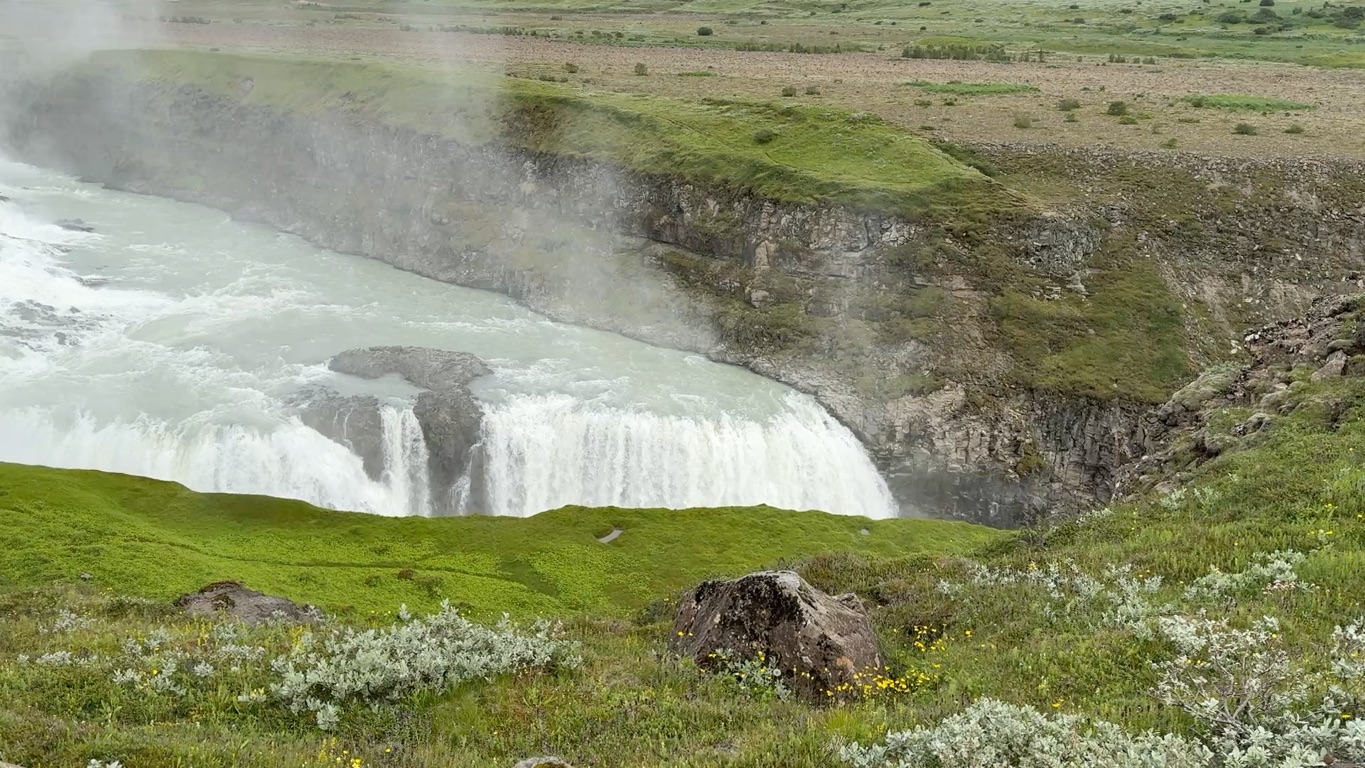
Nerdy comment #2: flow rate averages 100 m3/sec, and peaks at 2000 m3/sec. Being early summer, this would be toward the higher end. As you can tell from videos, loud and lots of spray.
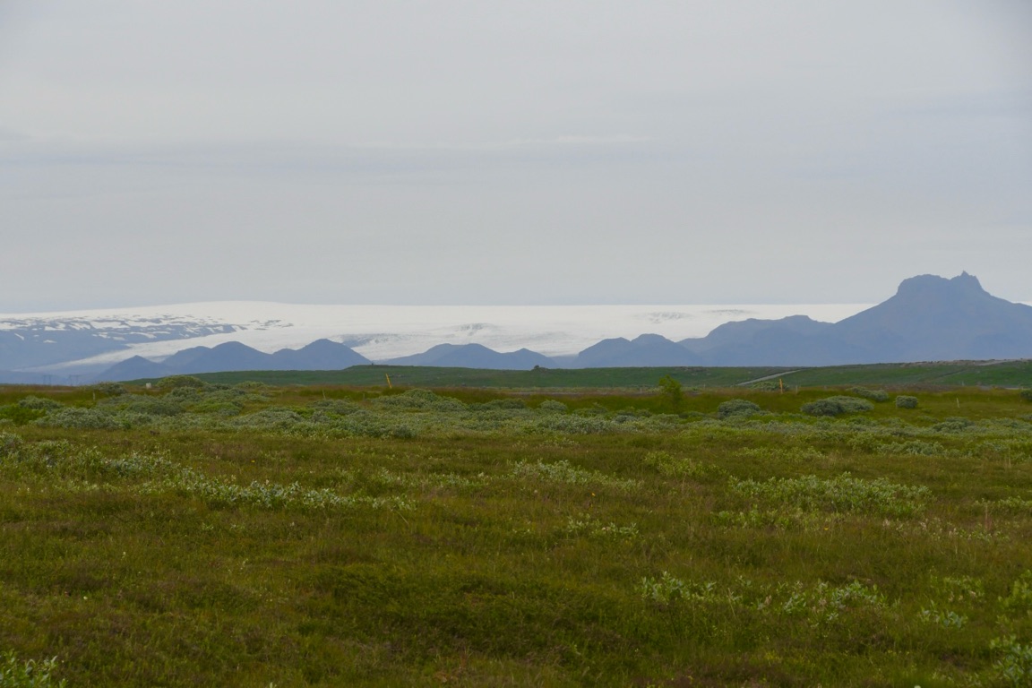
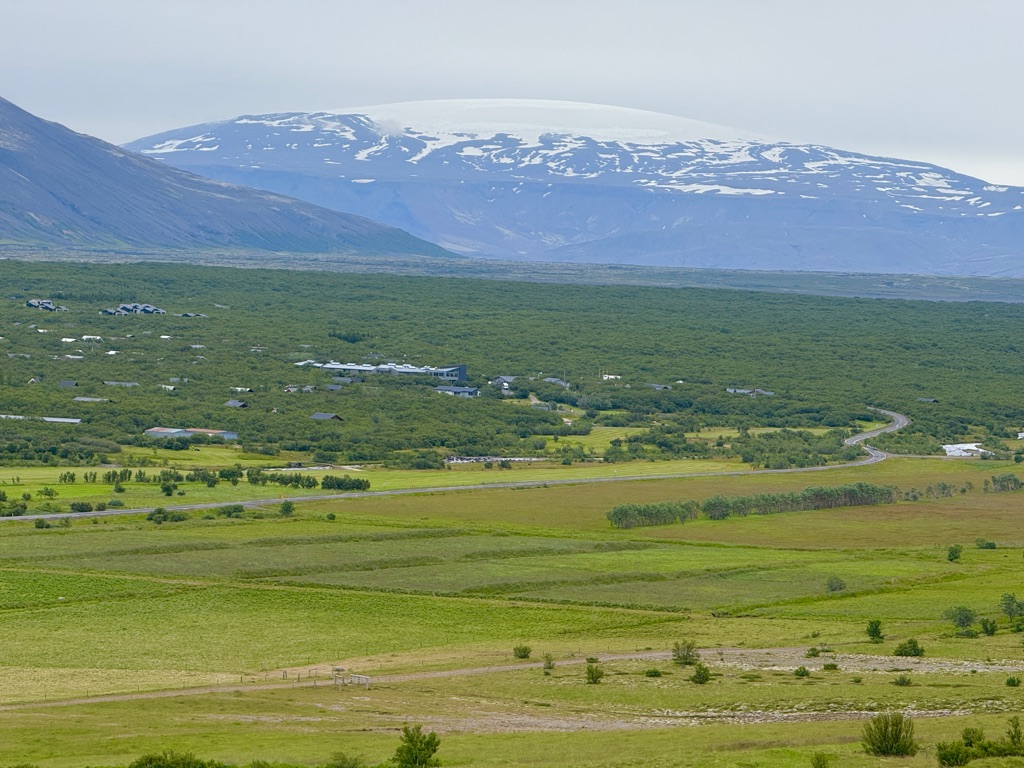
“Long Glacier” from where the river originates
![]()
![]()
![]()
![]()
![]()
![]()
OR
Copy the link to @rickkossik Journo below
![]()
![]()
![]()
![]()
![]()
![]()
OR
Copy the link to @rickkossik Journo below
Now a word about Icelandic culture. I have found them friendly but reserved. I pestered the guide with questions (because that is what I do). She said that Icelandic culture is somewhat closed. For example, if you are not a native Icelander, it is almost impossible to get a job outside of the tourist industry. She is a geologist and could never work here. She said that they would not get away with this if they were part of the EU, as it is blatant discrimination, but they are not members.
And it is also difficult to be accepted socially. Basically the Icelanders stick together. Sounds to me kind of like the Mormons. They are nice and friendly, but if you’re not one of them, you’re never really accepted into their circle. She is married to an Icelander, but feels like an outsider. They never speak English when she is with them at social gatherings (although they all can). And Icelandic is a very difficult language to learn.
![]()
![]()
![]()
![]()
![]()
![]()
OR
Copy the link to @rickkossik Journo below
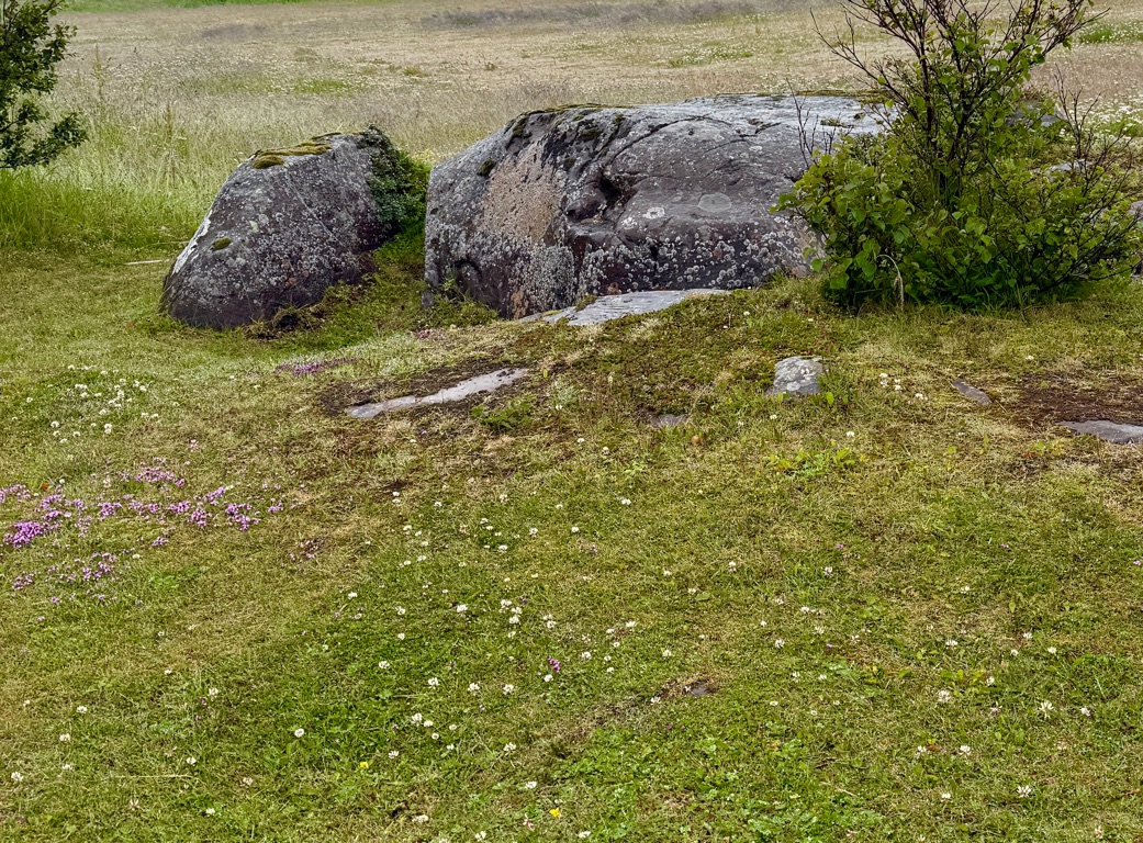
Meeting at a hotel on edge of town with the group to start the hiking trip.This was on the path there (saw one in downtown Reykjavik also).
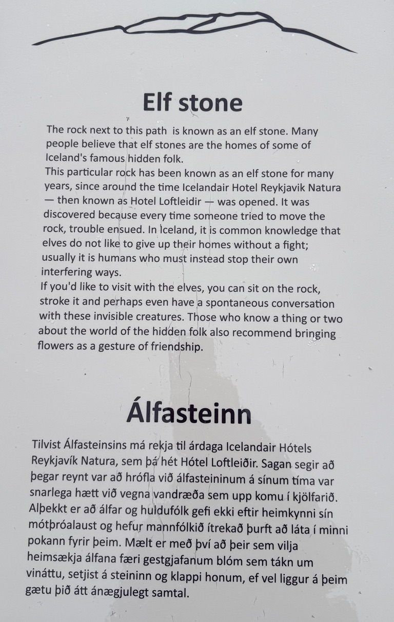
Tolkien was heavily influenced by Icelandic folklore. Icelandic elves are tall and handsome, like the elves in Lord of the Rings. Many of the names are also Icelandic, and Elvish (a language he made up) is similar to Icelandic.
![]()
![]()
![]()
![]()
![]()
![]()
OR
Copy the link to @rickkossik Journo below
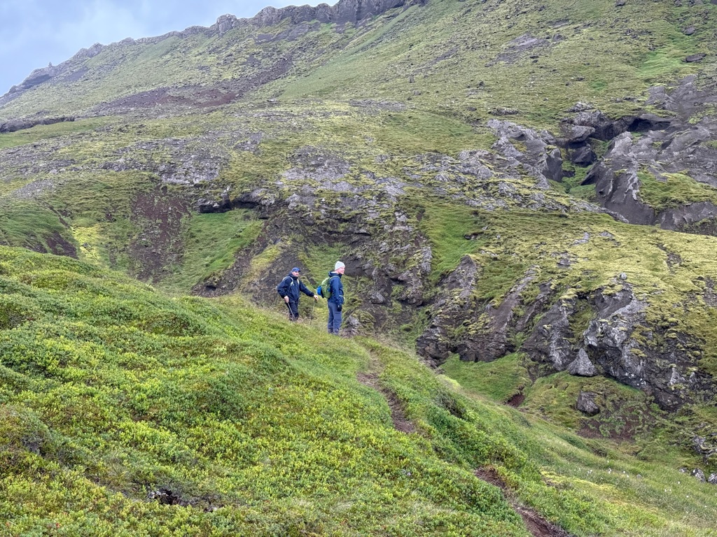
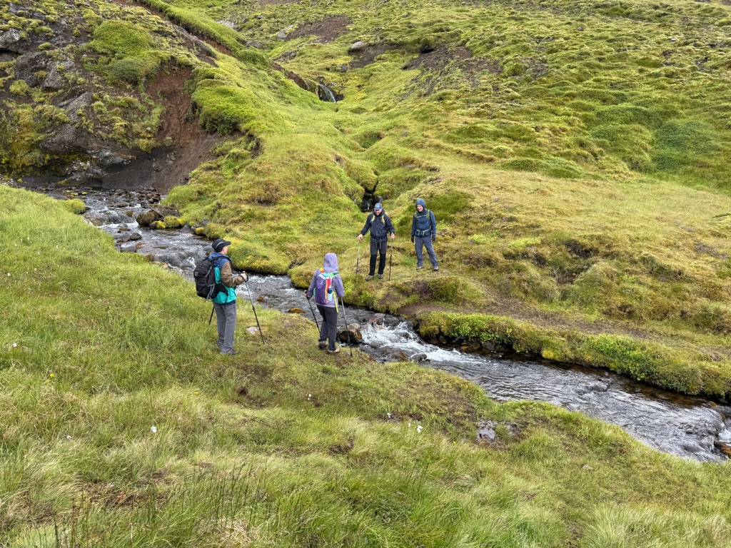
So we started our tour. 5 people and 2 guides.
In the morning we did a short hike 3.5 miles) at Thingvellir (location of first Parliament) that I visited yesterday. But we took a different route and guides added a few more details.
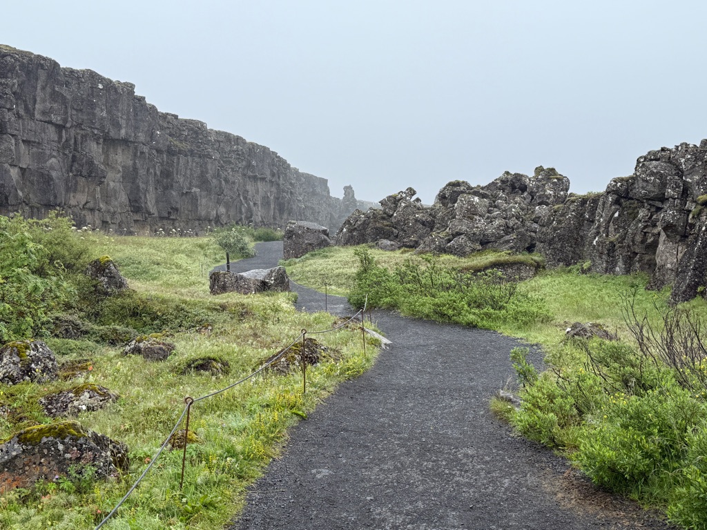
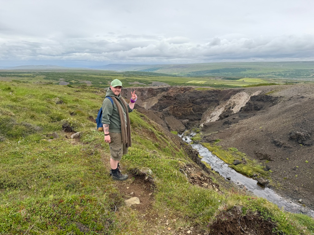
A couple more pics of the rift valley where all the people would meet for 2 or 3 weeks every year. It is about a mile long. You can really imagine all the tents and markets that would have been set up.
Turns out some people would have had to travel up to 17 days to get there.
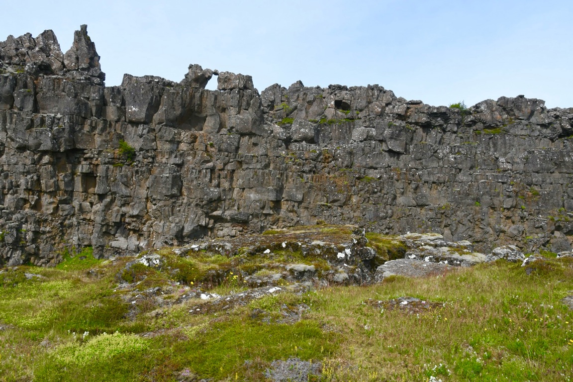
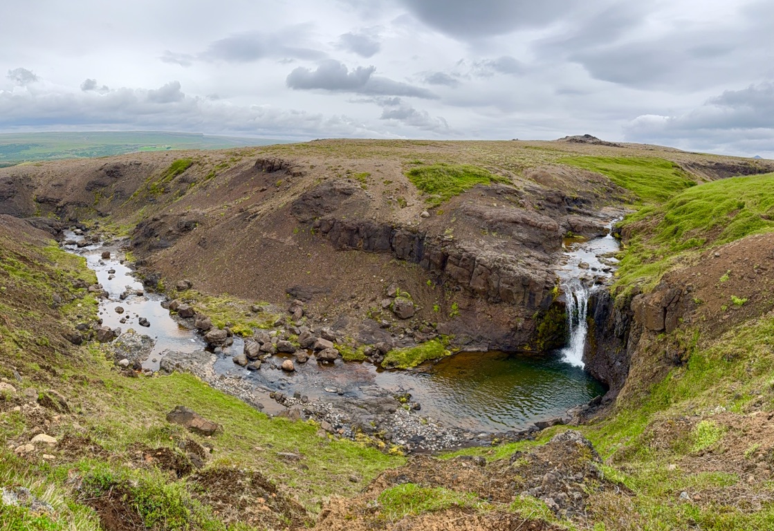
And here is a better pic (crowds gone today) of the rock where speakers stood to talk:
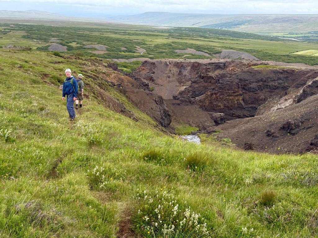
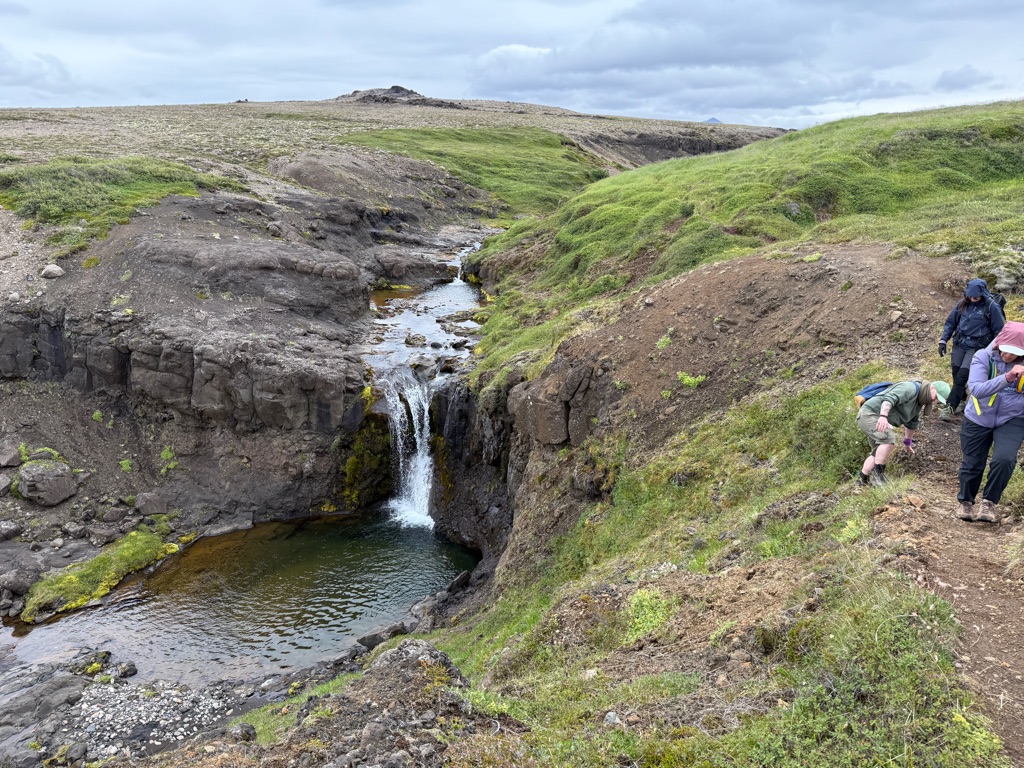
Remember the small waterfall into the rift from yesterday:

Turns out it is not natural. 1000 years ago they diverted a stream to provide an easier fresh water source during their annual meetings.
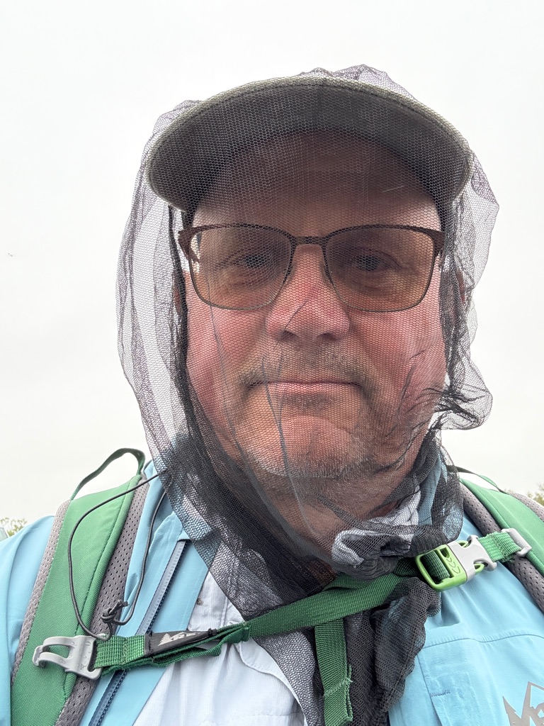
The midges were out in the morning. Had to wear a net;
![]()
![]()
![]()
![]()
![]()
![]()
OR
Copy the link to @rickkossik Journo below
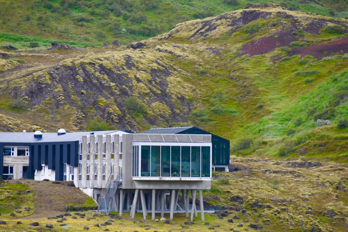
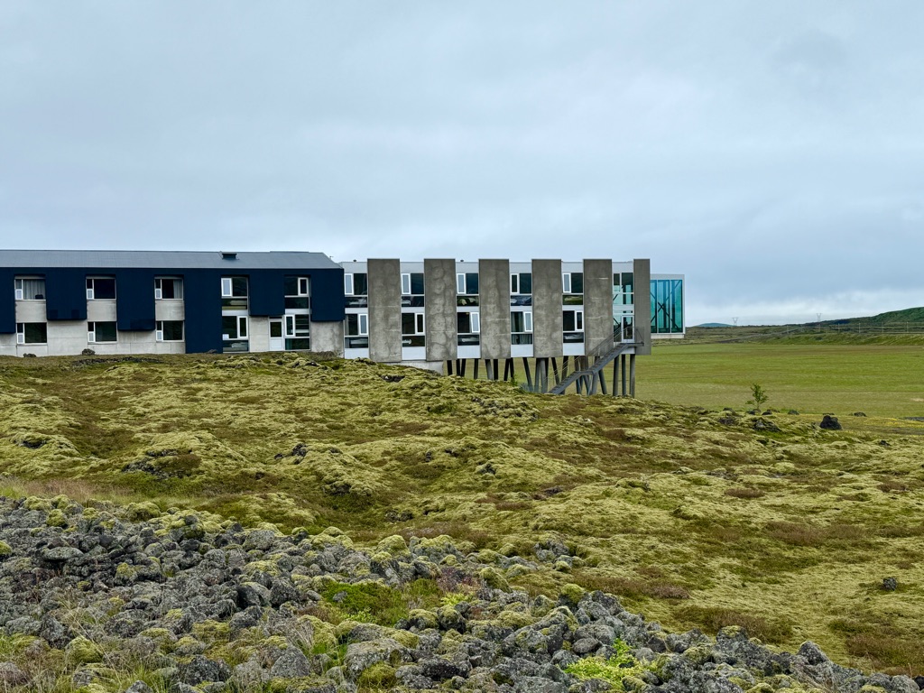
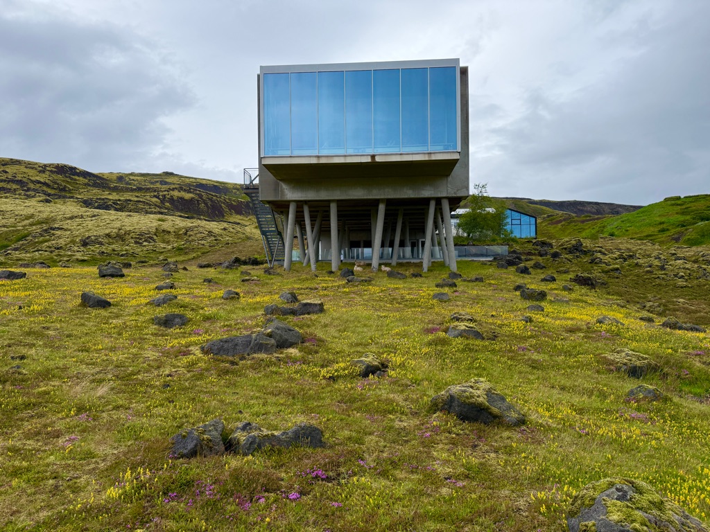
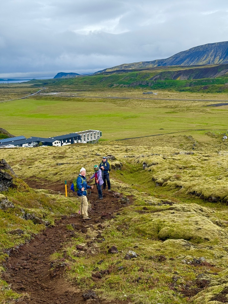
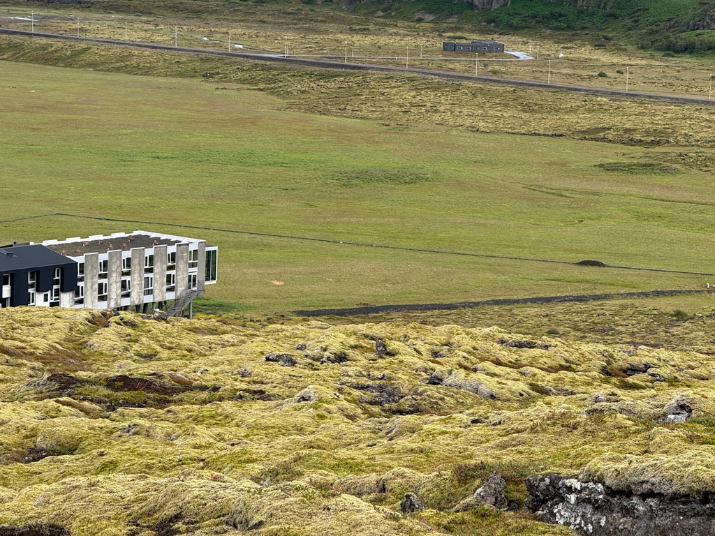
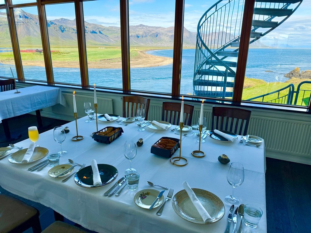
We then drove to the other side of the lake to our hotel and had lunch. Hotel was pretty cool:
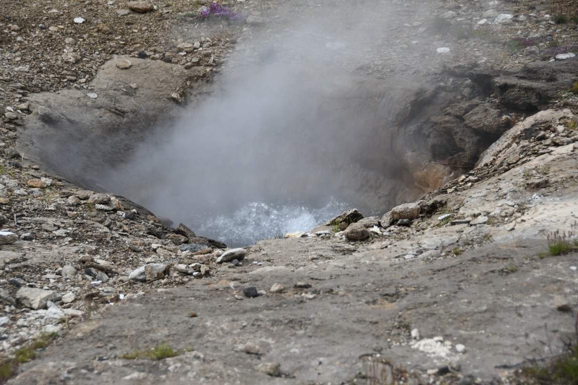
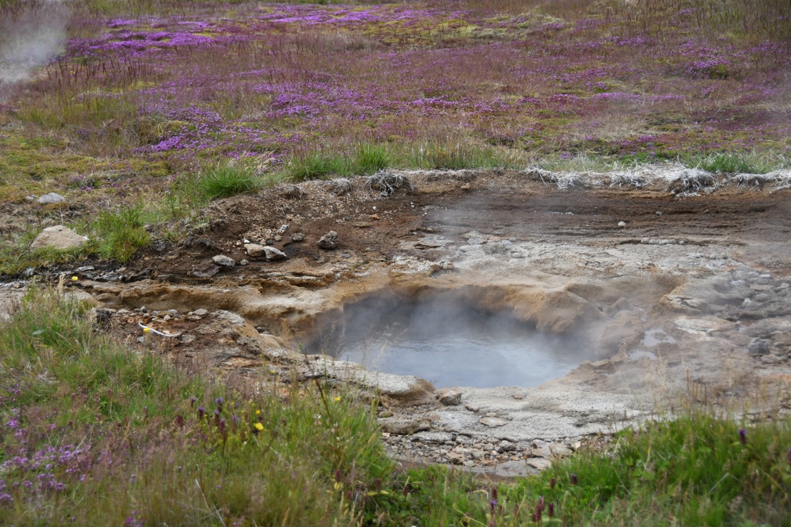
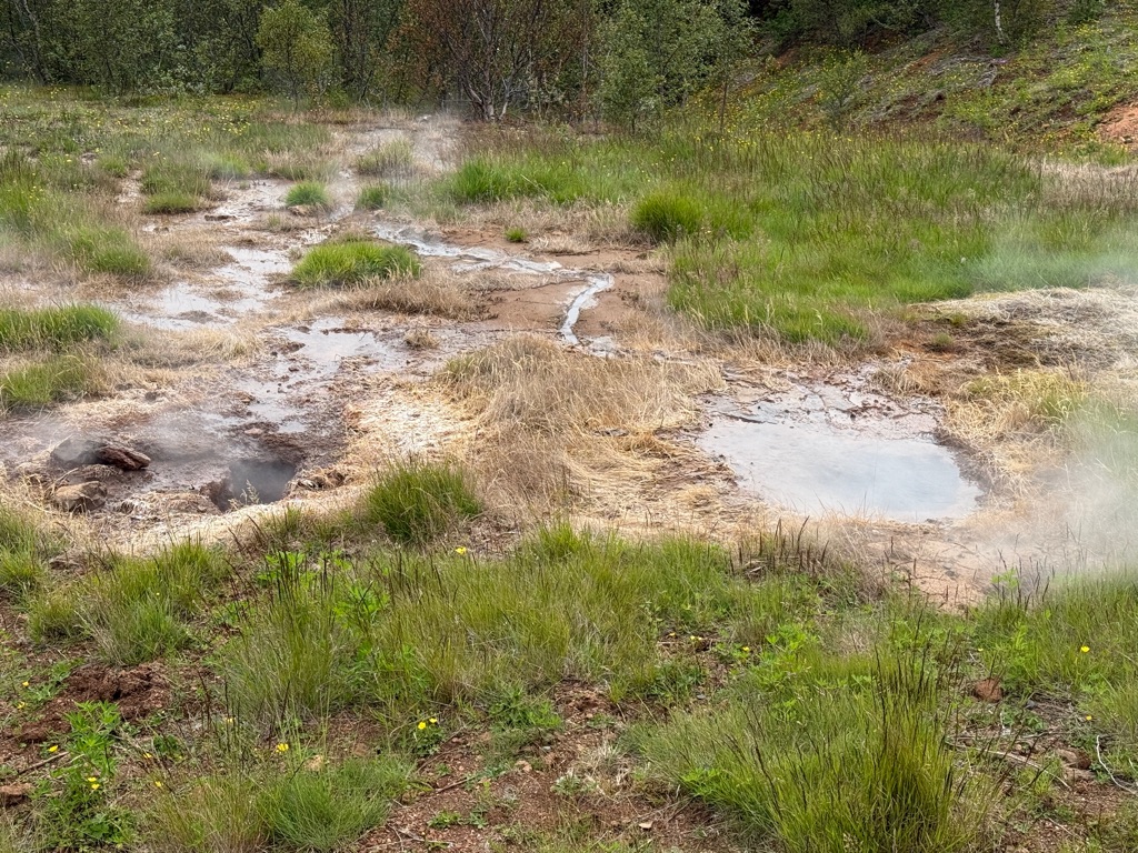
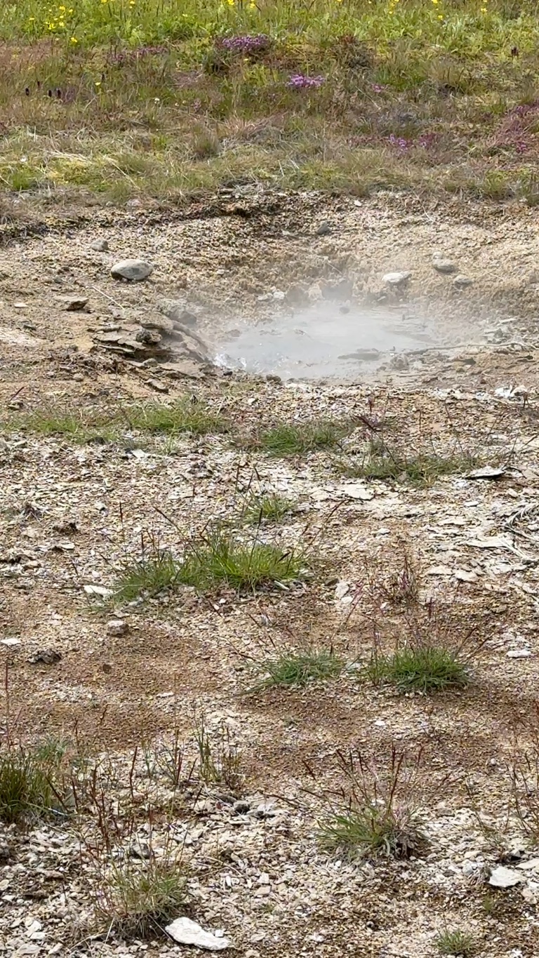
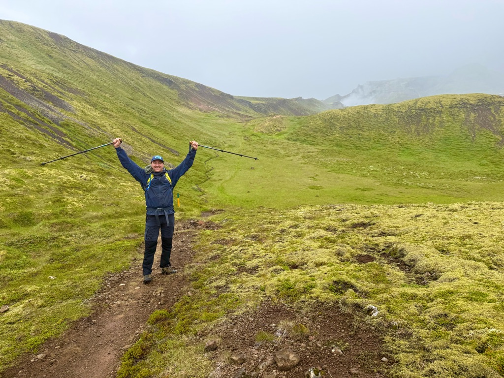
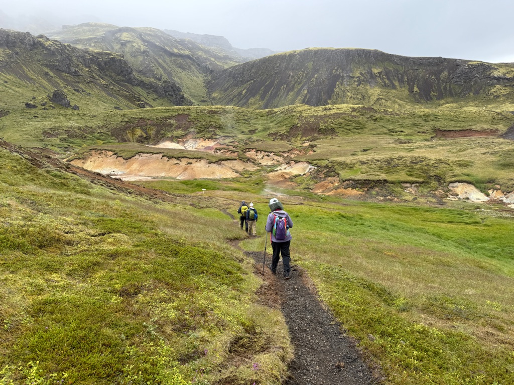
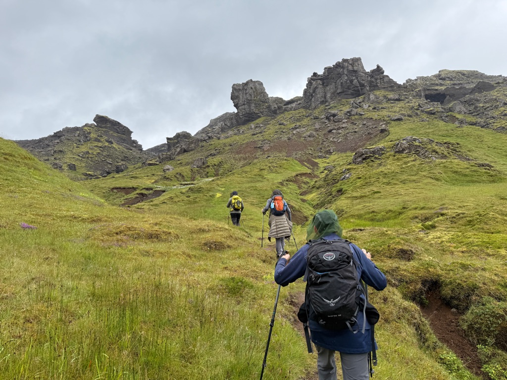
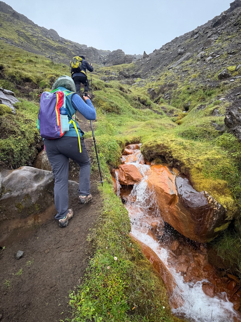
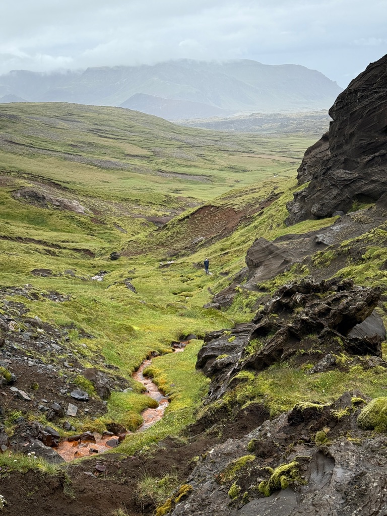
After lunch we did a fairly steep 5.5 mile loop (up and down about 1000 feet) from the hotel through geothermal fields. Basically Yellowstone with no people (we saw 5 the entire hike).
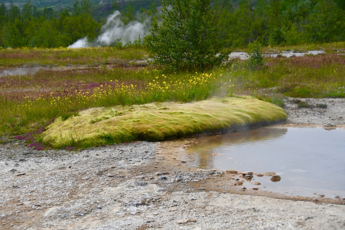
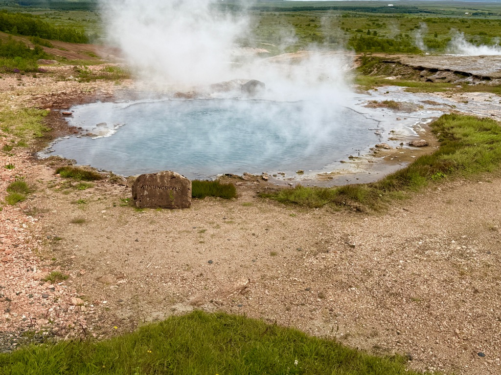
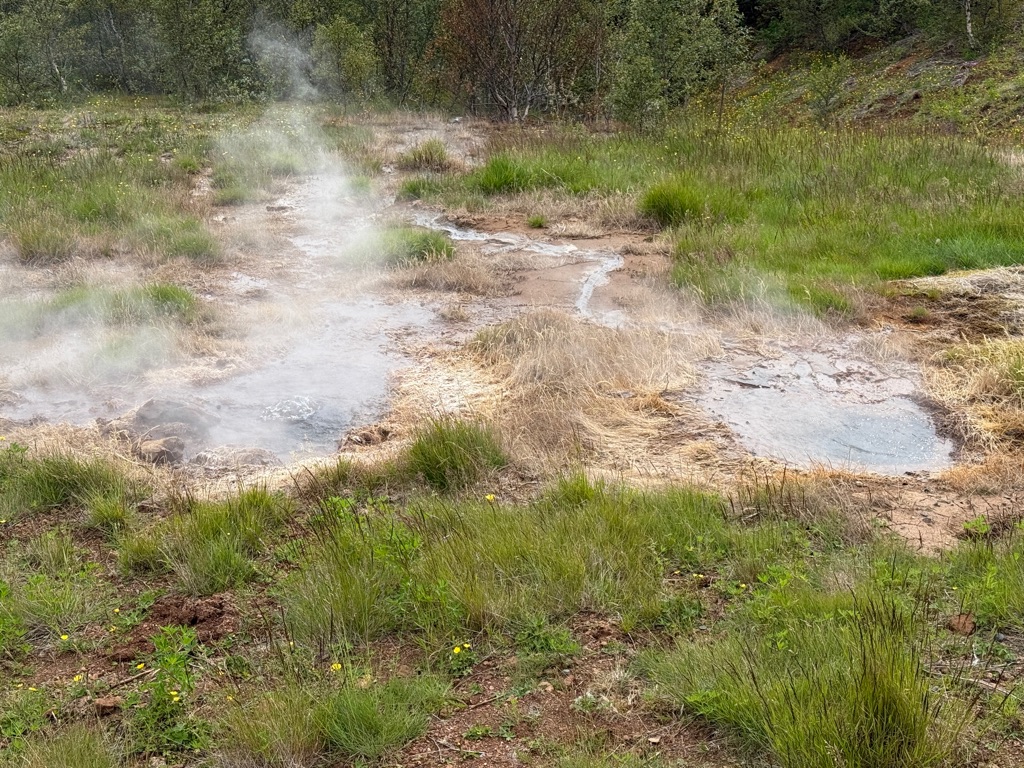
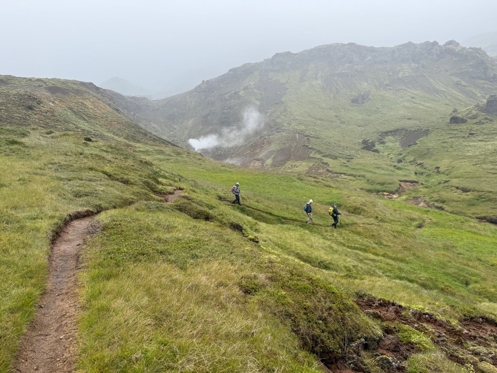
Lots of hot springs, hot streams, steam vents for the whole hike. And no people. Had the entire landscape to ourselves. Entire area smells of rotten eggs (sulphur) everywhere (entire hike, outside hotel).
One of our guides. Note trail behind him
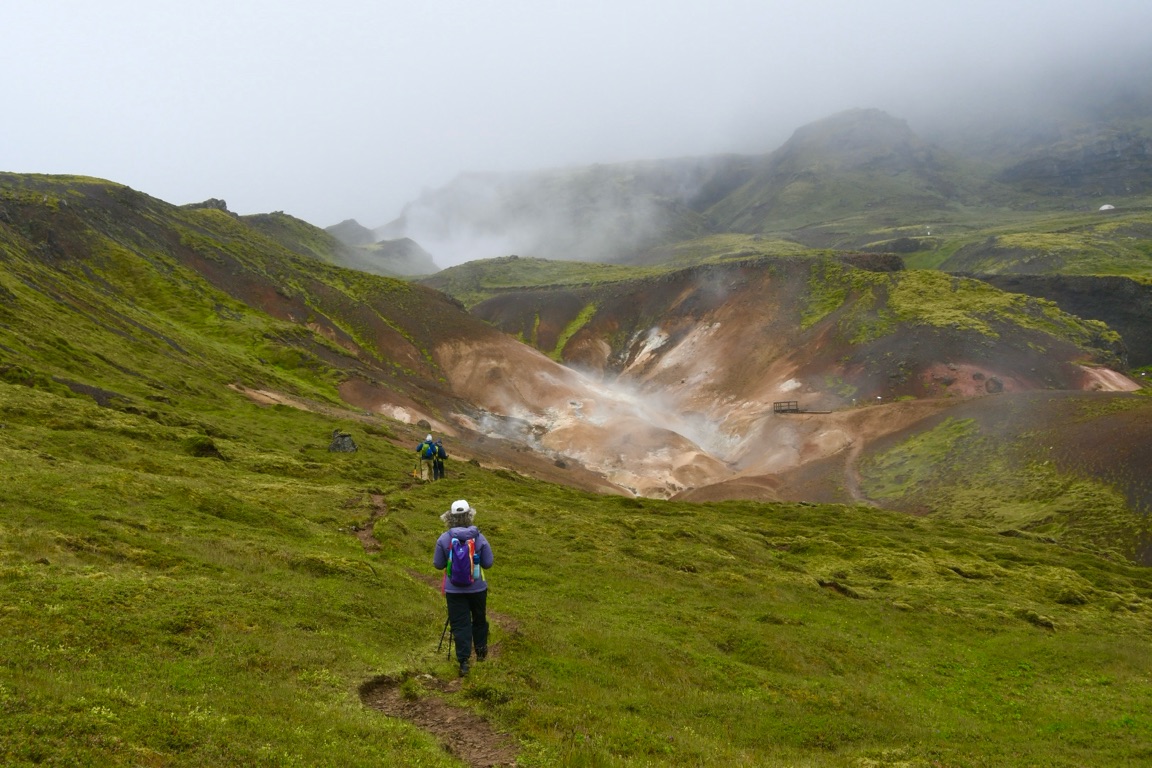
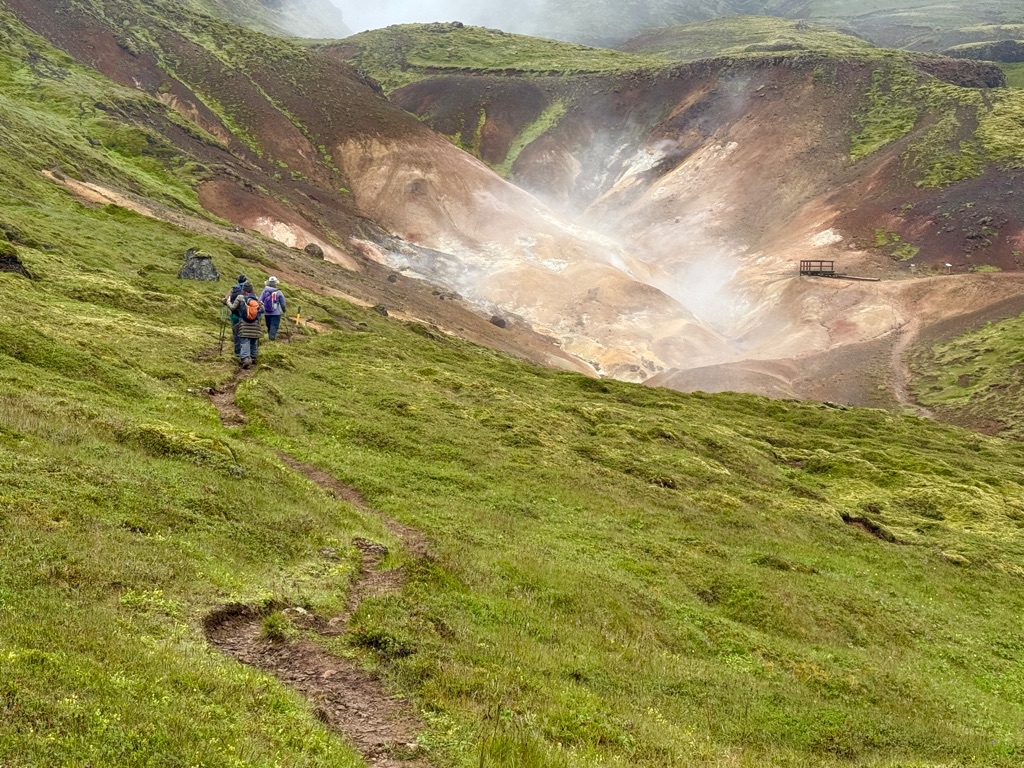
Steam vents and hot springs everywhere
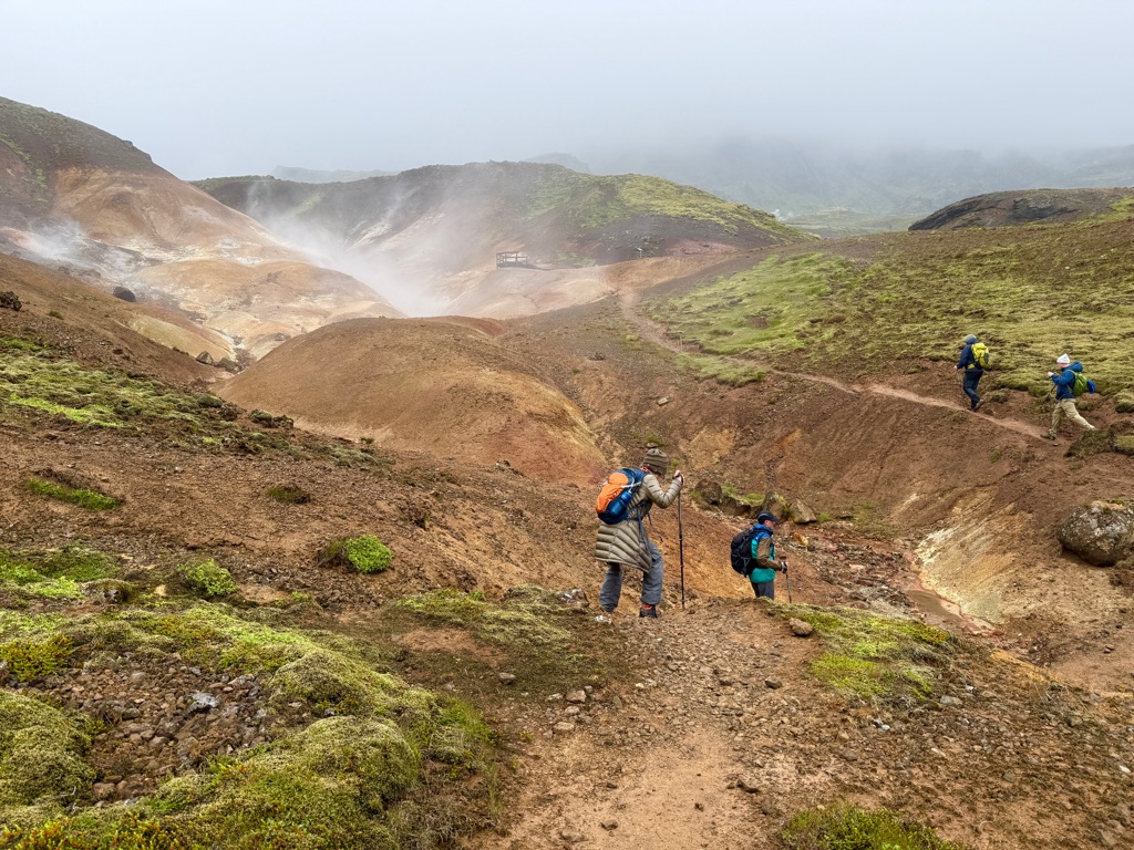
Steam vents all around us the entire hike
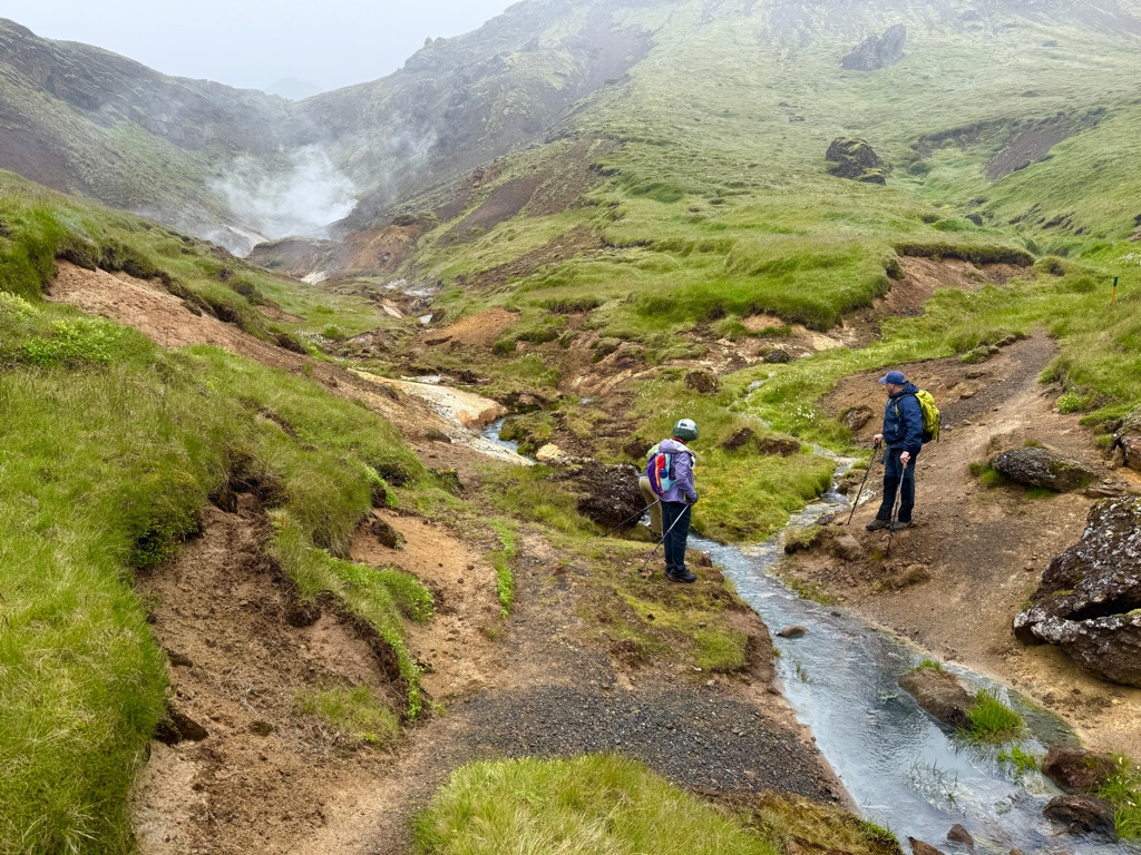
Water in streams is hot
Note color (from minerals)
Note steam vents (fumeroles)
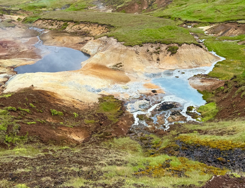
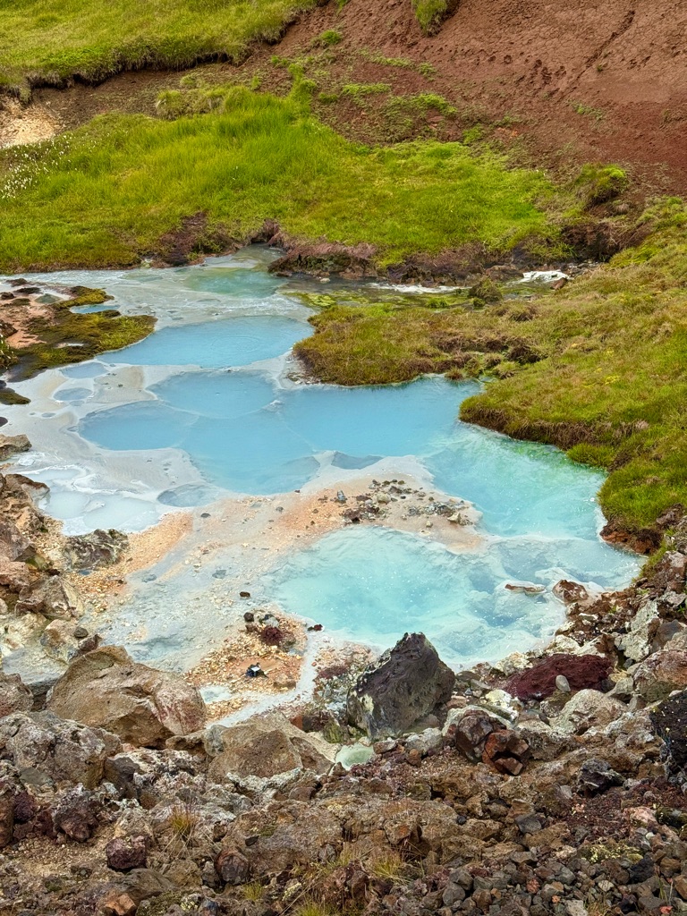
Colors very pretty due to minerals in the hot pools
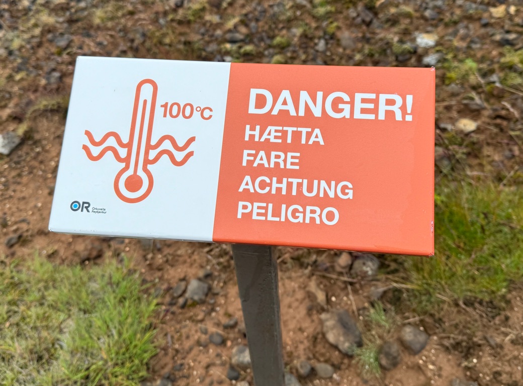
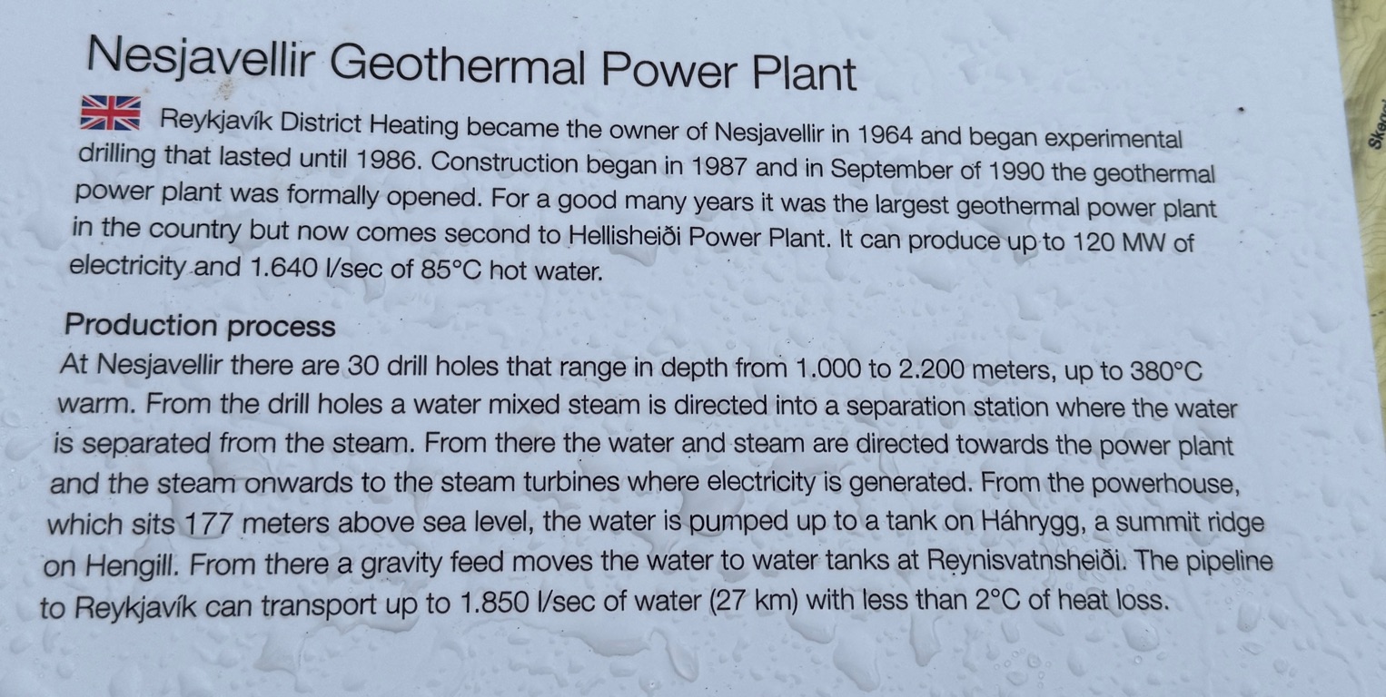
But this area was not pristine. There were 30 geothermal wells scattered around. Up to 2000 m deep. Water well above boiling (under pressure). Up to 380 degrees C!!!
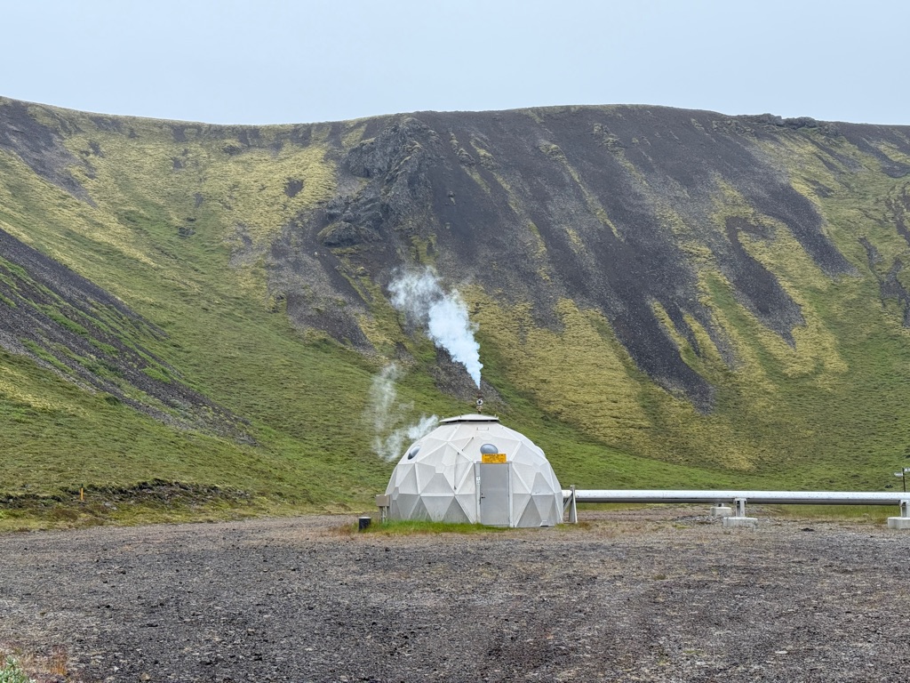
The dome is a well. Water is gravity fed in insulated lines all the way to Reykjavik.

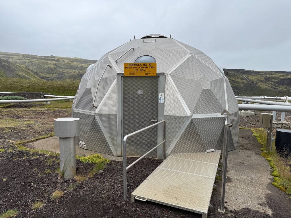
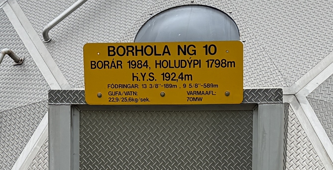
I think this borehole is shallow (192m), and flows 1.8 km to join with the main pipe to the city.
Some facts about the geothermal plant:
Heading back from hike to hotel far below:
Lake in the rift valley in background
Approaching hotel from steep downhill
Back at hotel had dip in hot pool (fed by hot springs), then drinks and dinner
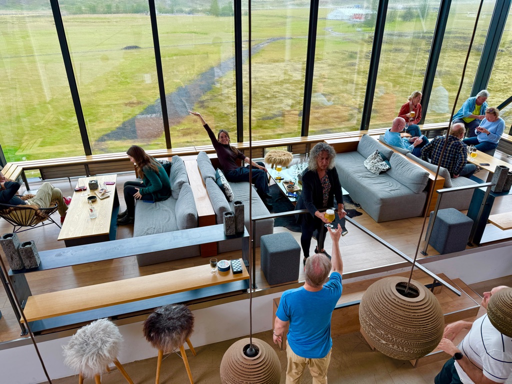
Cool bar area
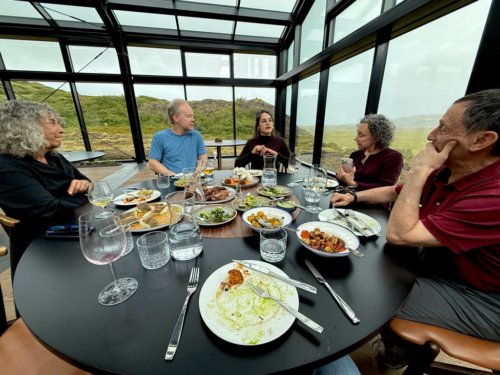
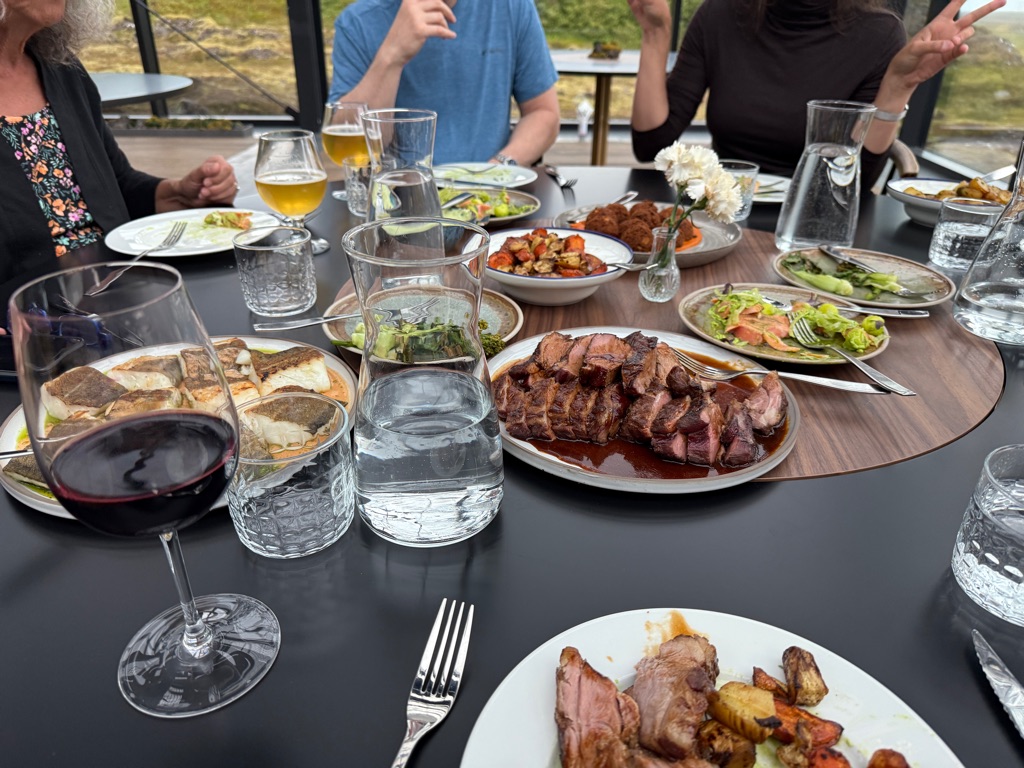
Massive quantities of food (lamb, arctic char - mild salmon flavor, and cod)
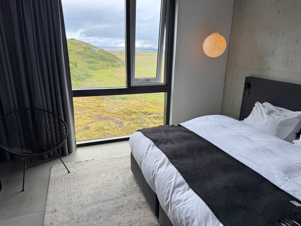
Very nice room

Madeline would have loved the Icelandic horse mural
![]()
![]()
![]()
![]()
![]()
![]()
OR
Copy the link to @rickkossik Journo below
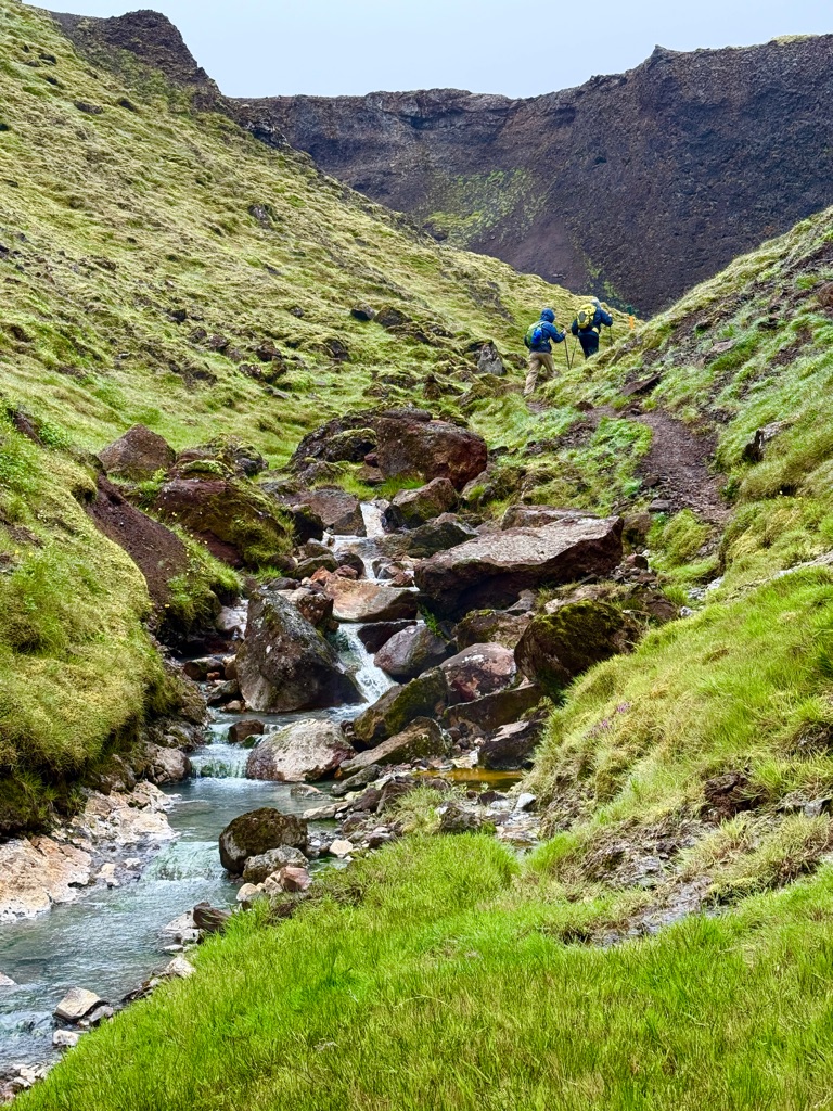
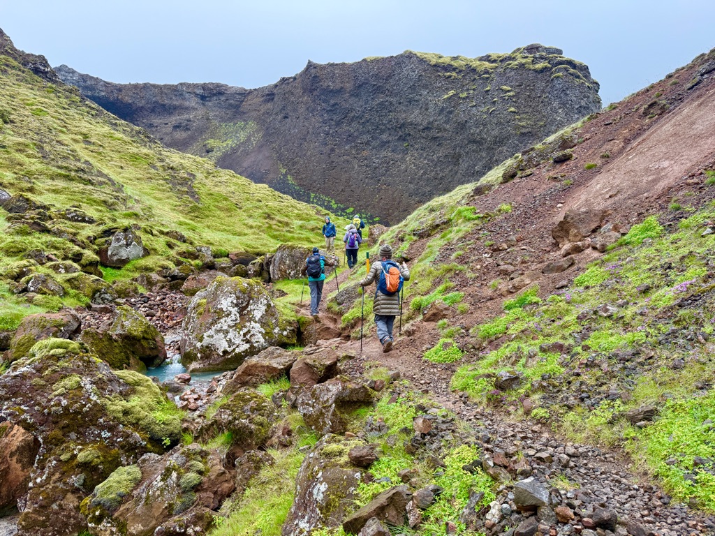
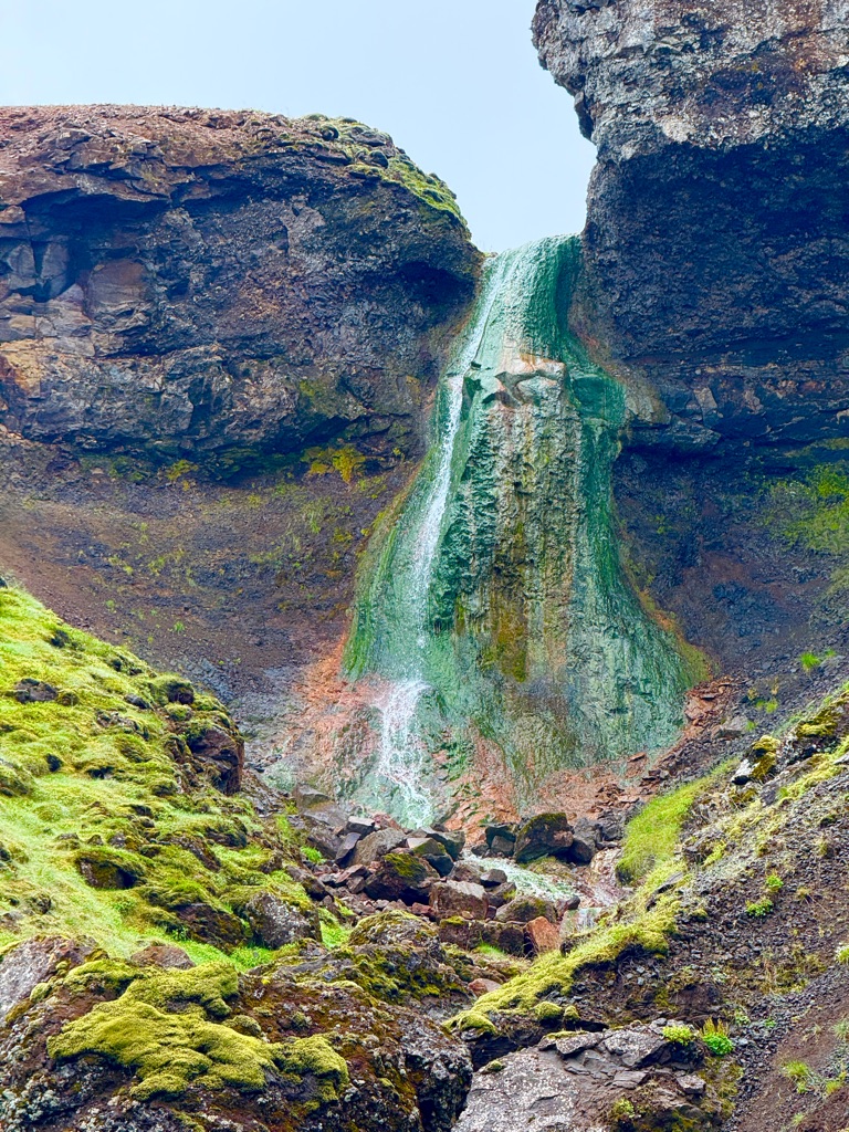
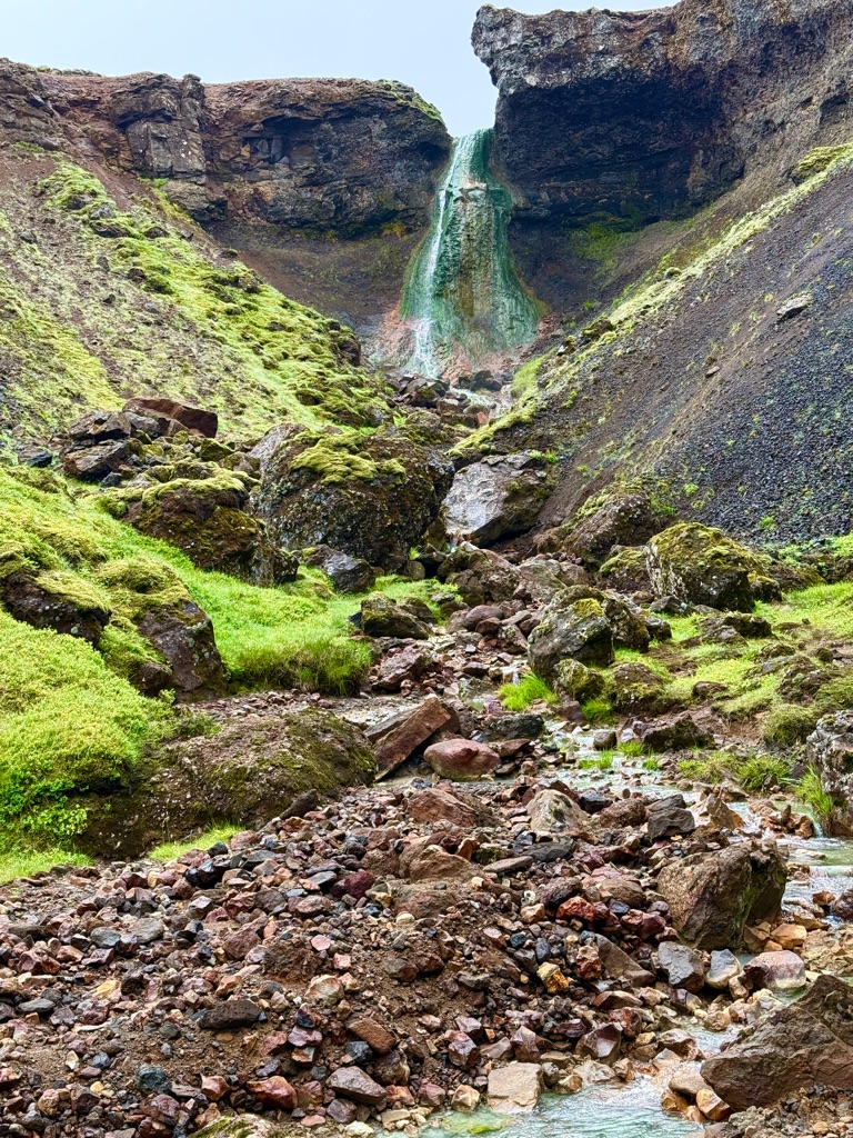
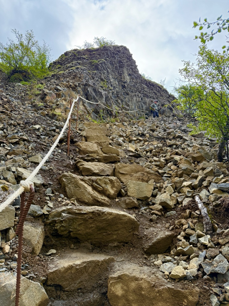
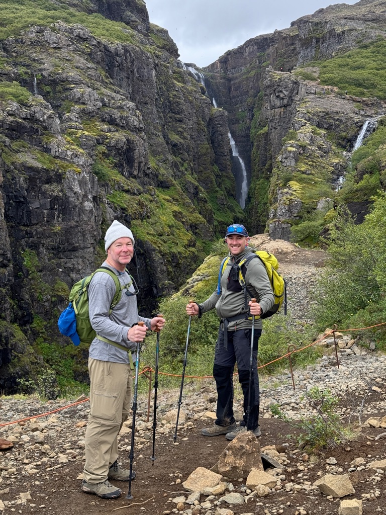
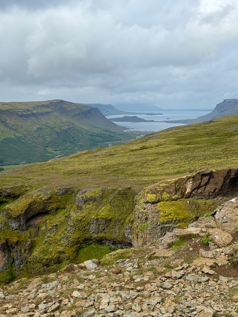
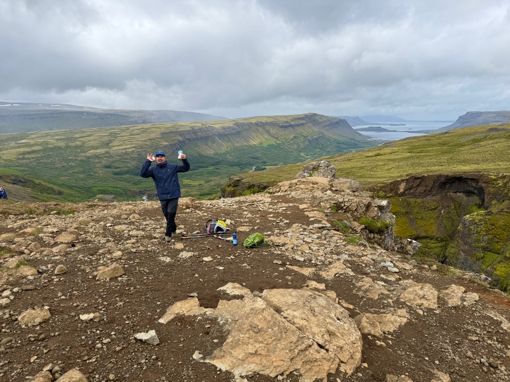
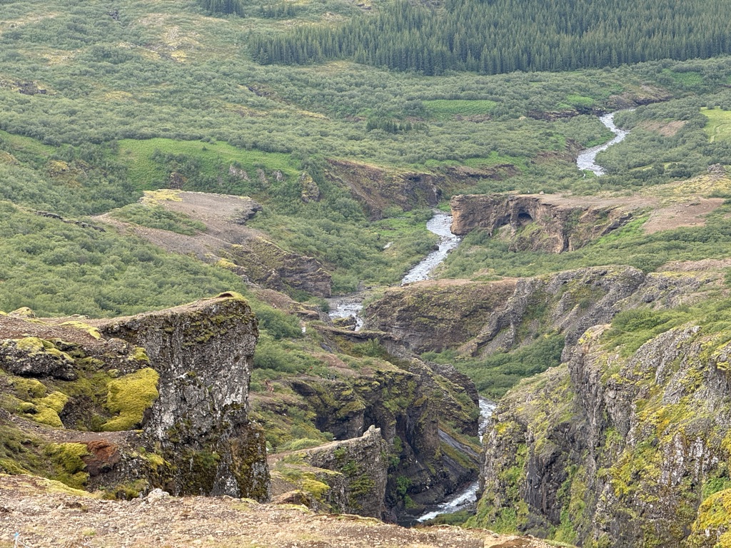
So the morning hike was really cool. Only two of the five chose to do it (it was a bit dicey); others did an easier one. Glad I did this one. About 3 miles and 1000 feet, but those 1000 feet were not spread out evenly! Very, very steep in spots!
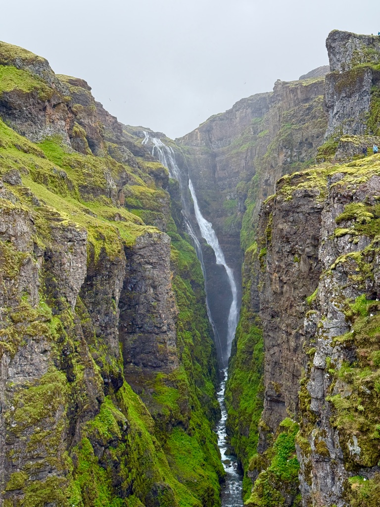
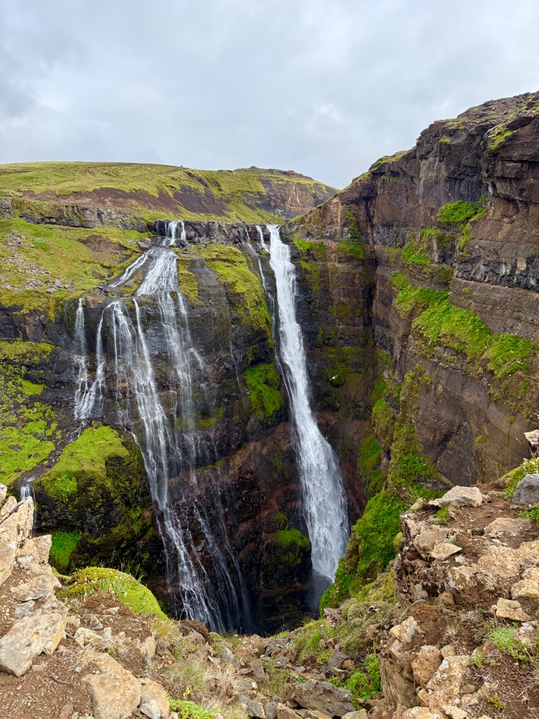
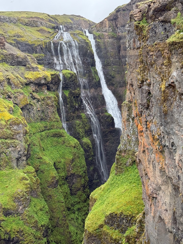
The waterfall is at the head of a fjord. It is 200 m high (650 feet). River then runs out about a mile or so into the fjord.
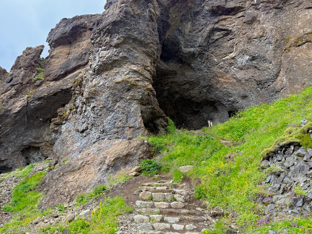
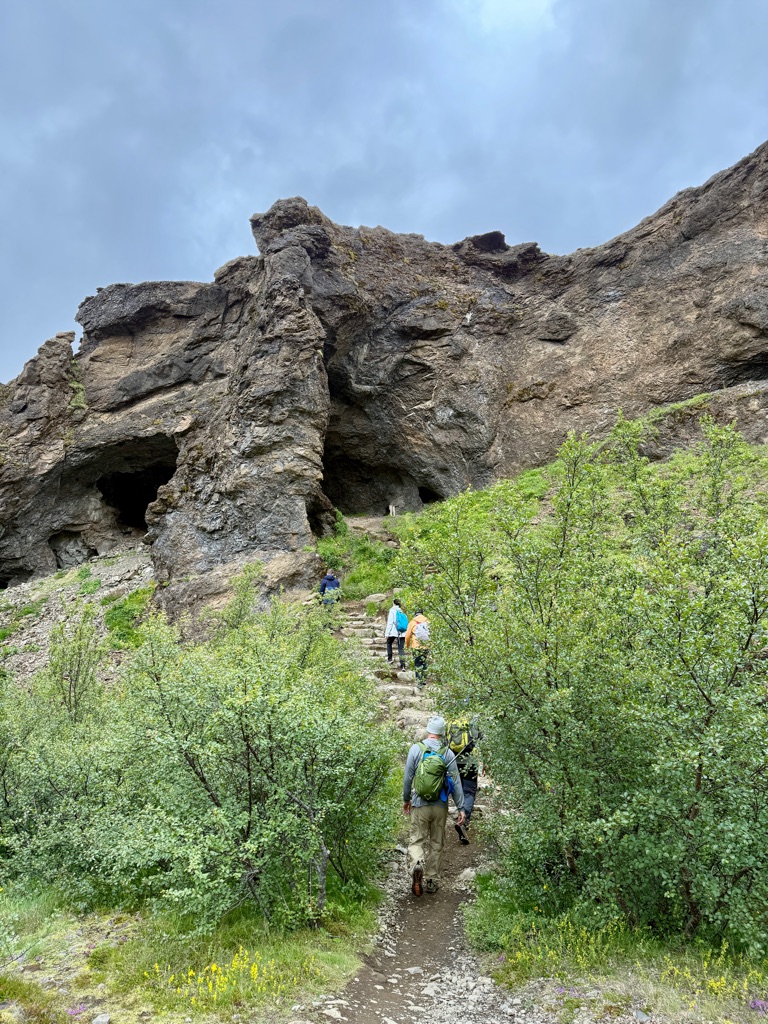
Hike starts out in a pretty cool way. You need to go through a small cave.
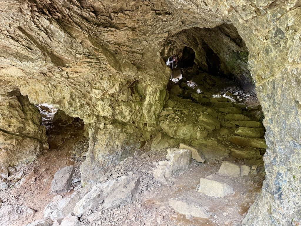
Entering cave
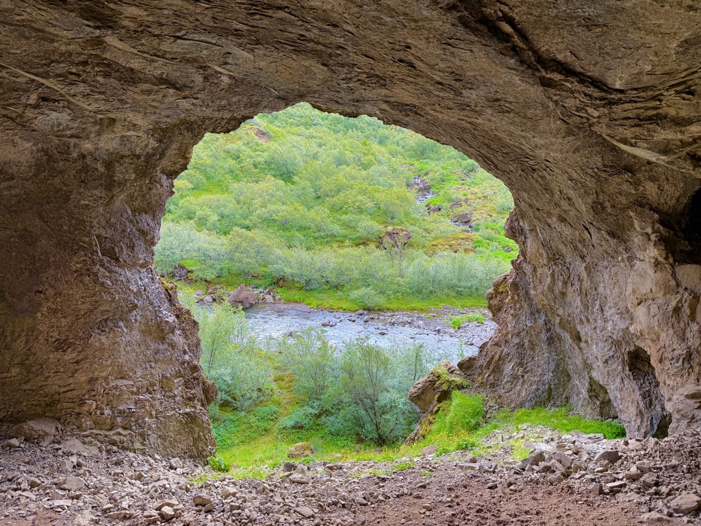
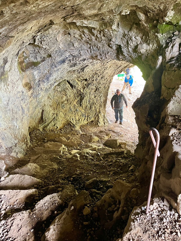
Looking back up after passing through cave
Next came a bit of a dicey part. Crossing a stream (from the waterfall) on a log.
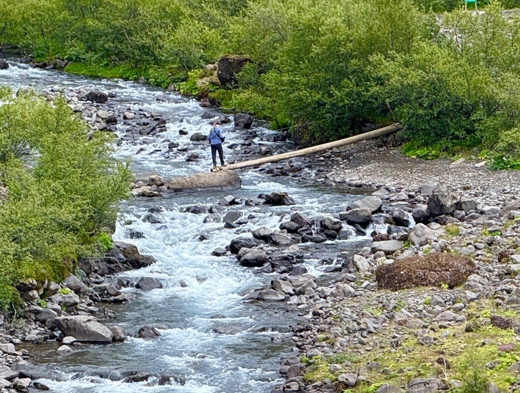
Yikes


Looking back at log:
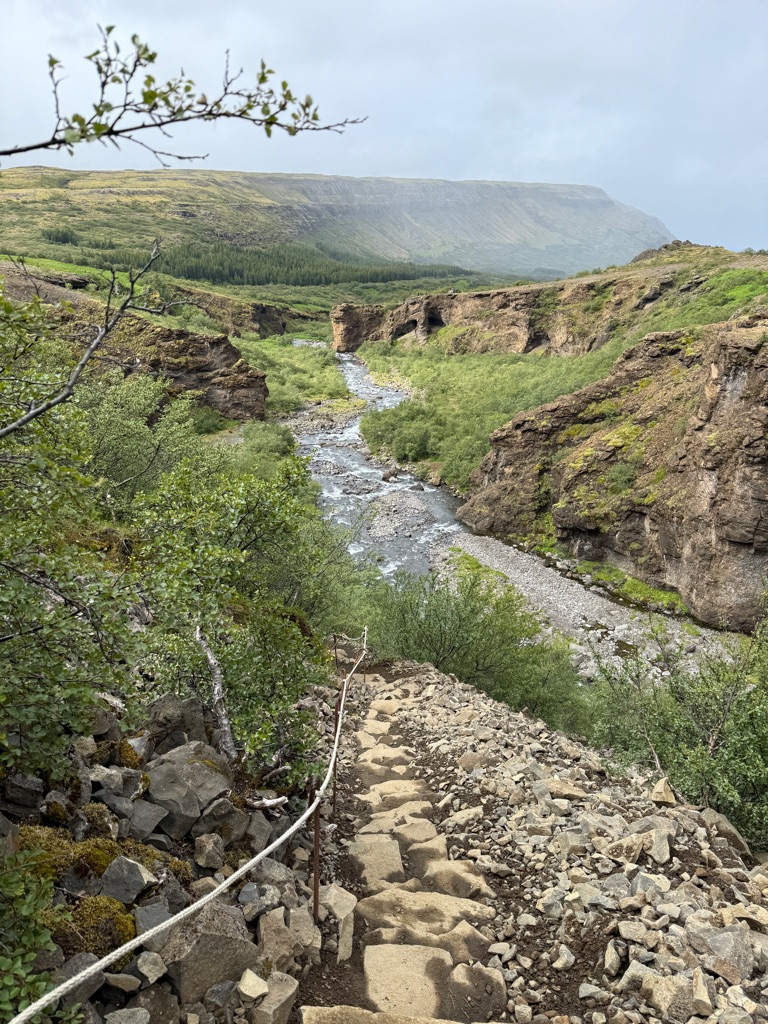
Much of the trail up had a guide rope (it was steep)
A little higher looking back at crossing:
You can see the cave on the right (crossing is below cave)
About halfway up (guide on right)
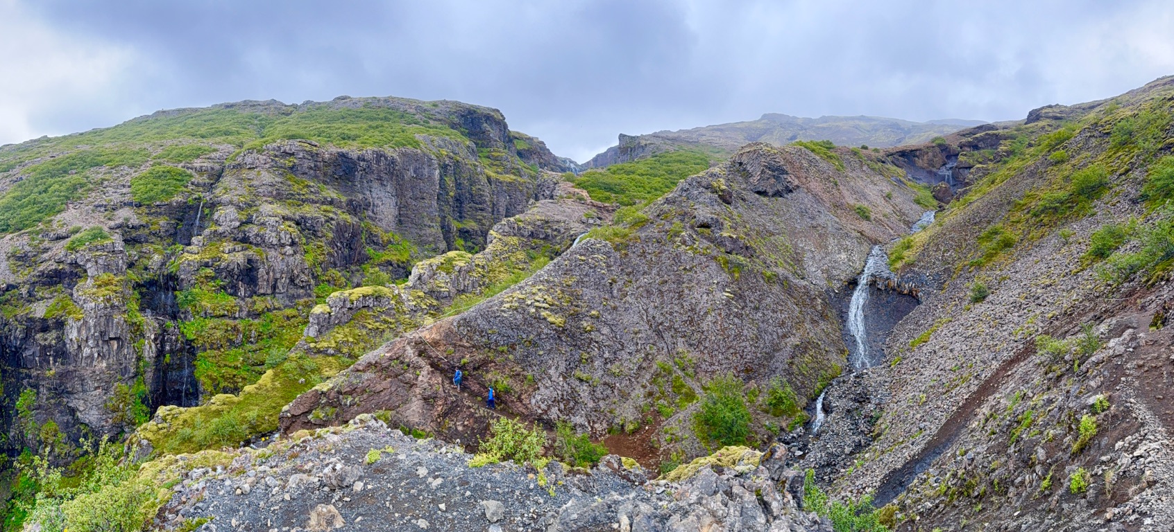
A little further
The top!

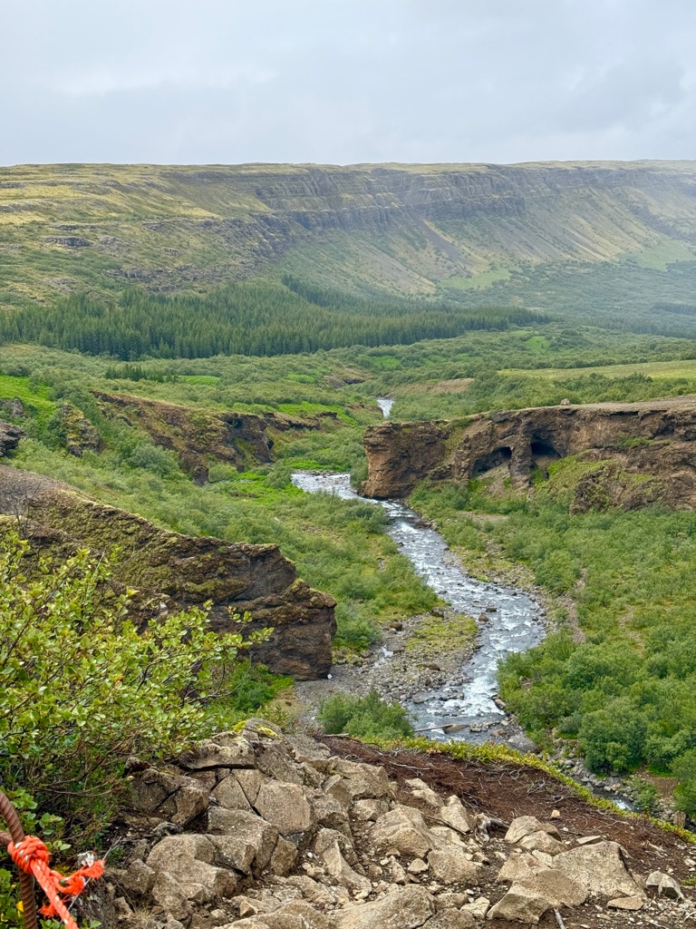
Staring down into the gorge (650 feet down)
Looking back at the fjord
You can see cave on the right
Back at bottom (just crossed river, heading back into cave)
![]()
![]()
![]()
![]()
![]()
![]()
OR
Copy the link to @rickkossik Journo below
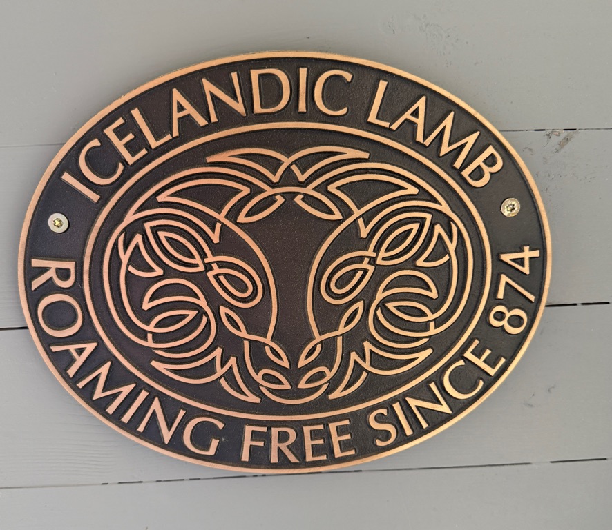
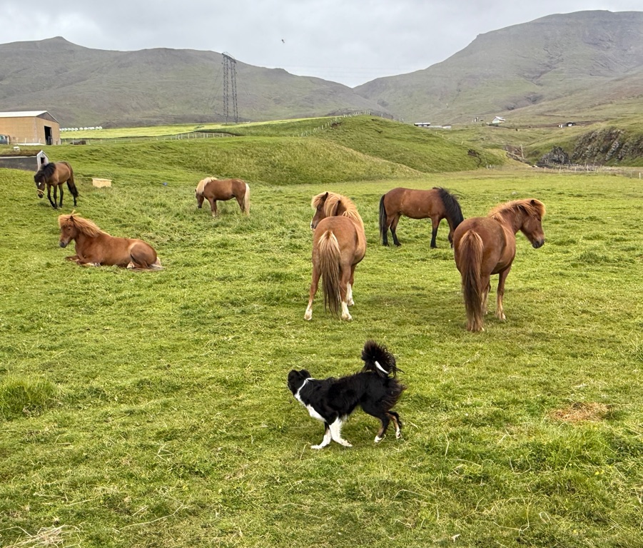
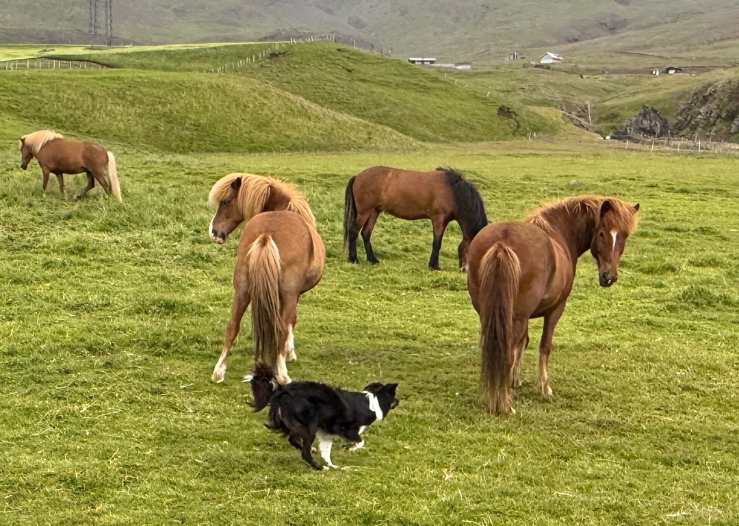
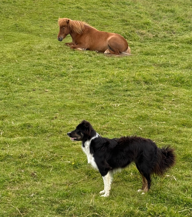
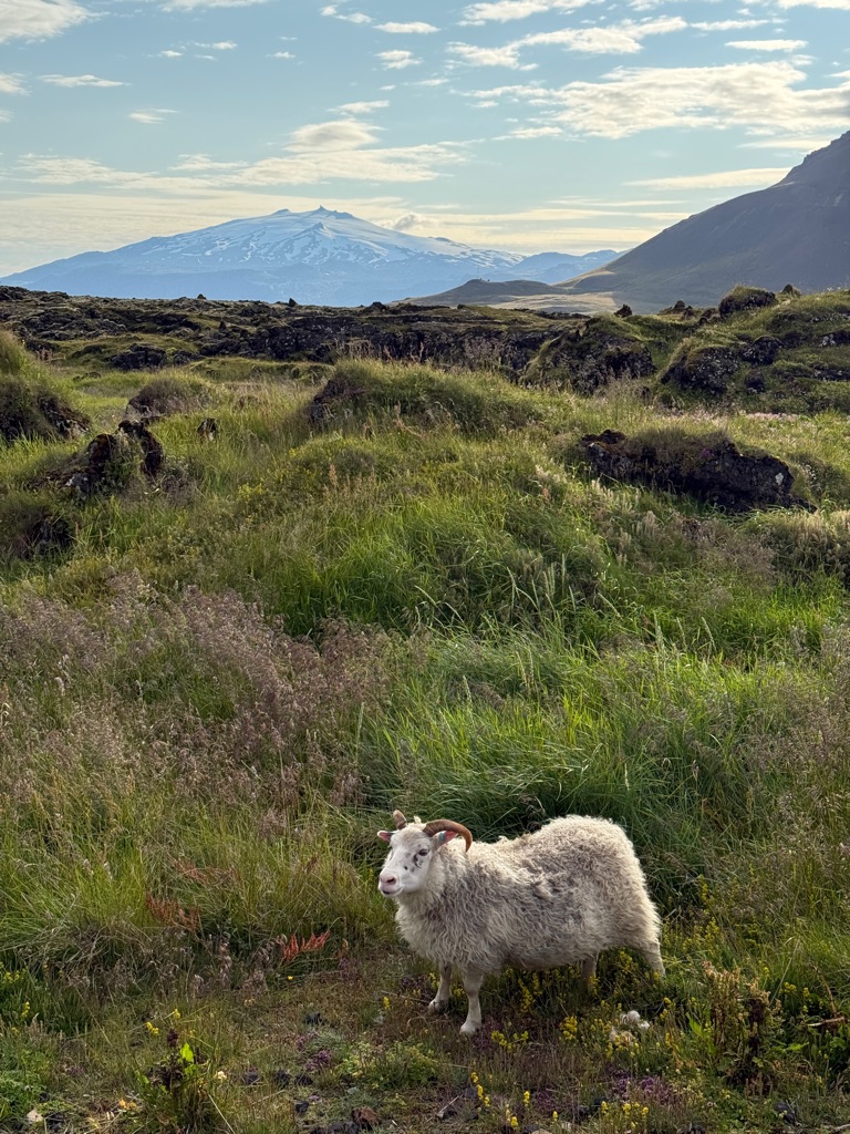
Had late lunch at a sheep farm. 2000 sheep, 4 sheep dogs. The sheep spend summer free-ranging in the mountains. The guy who runs the farm gave us a 15 to 20 minute talk after lunch. Very intetesting.
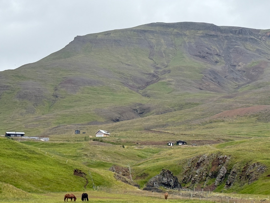

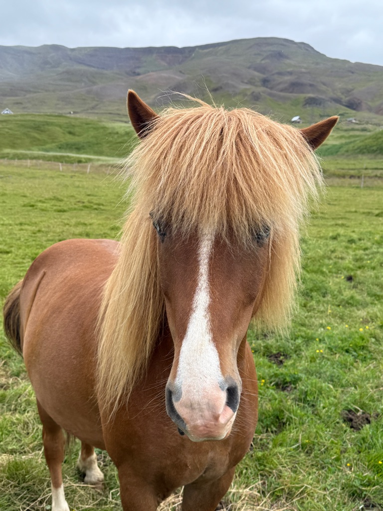
Icelandic horses with very impressive hairdos:
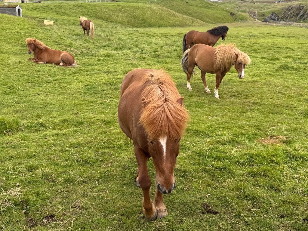
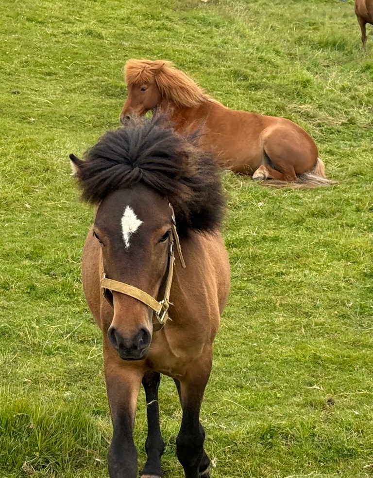
Sheepdogs are bored so try to herd the horses, who just seem irritated:
![]()
![]()
![]()
![]()
![]()
![]()
OR
Copy the link to @rickkossik Journo below
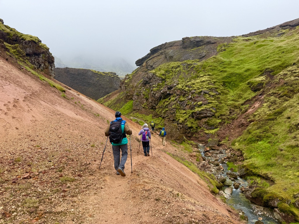
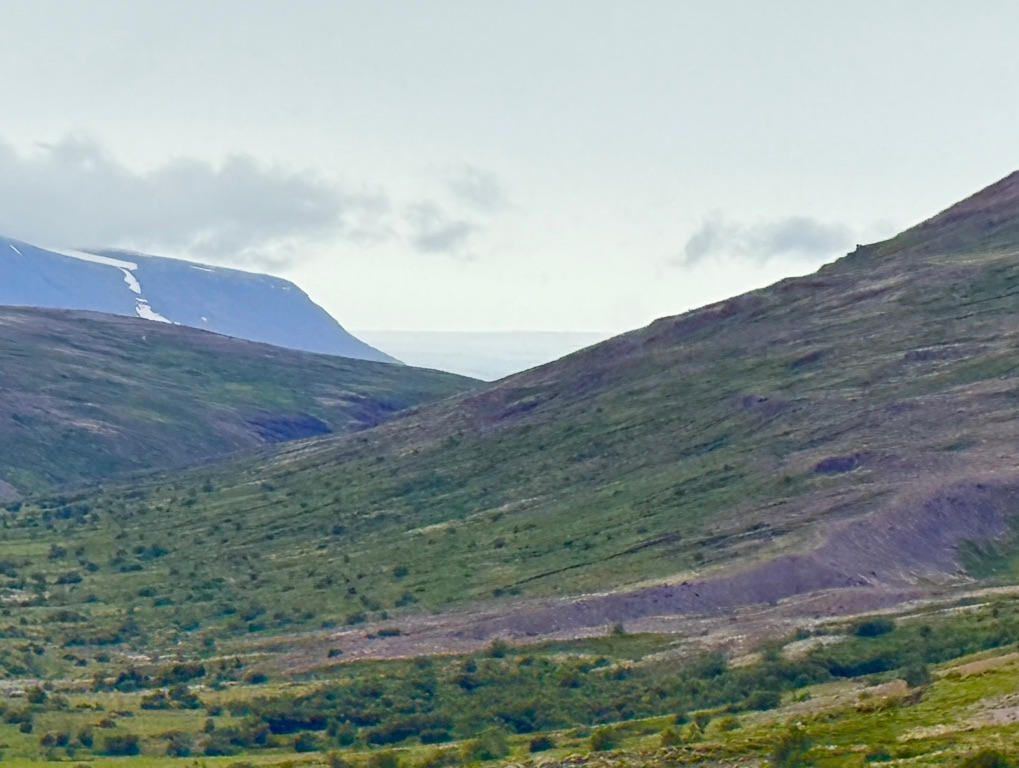
Arrived at next hotel and did an easy 3.5 mile hike nearby before dinner. Walked along river draining from glacier that we will visit tomorrow.
Note white color (very close to glacier)
Should be fun day tomorrow. Morning hike up to canyon that has hot springs (with changing room next to it so we will dip). Afternoon is snowmobiling and snowshoe hike on glacier.
![]()
![]()
![]()
![]()
![]()
![]()
OR
Copy the link to @rickkossik Journo below
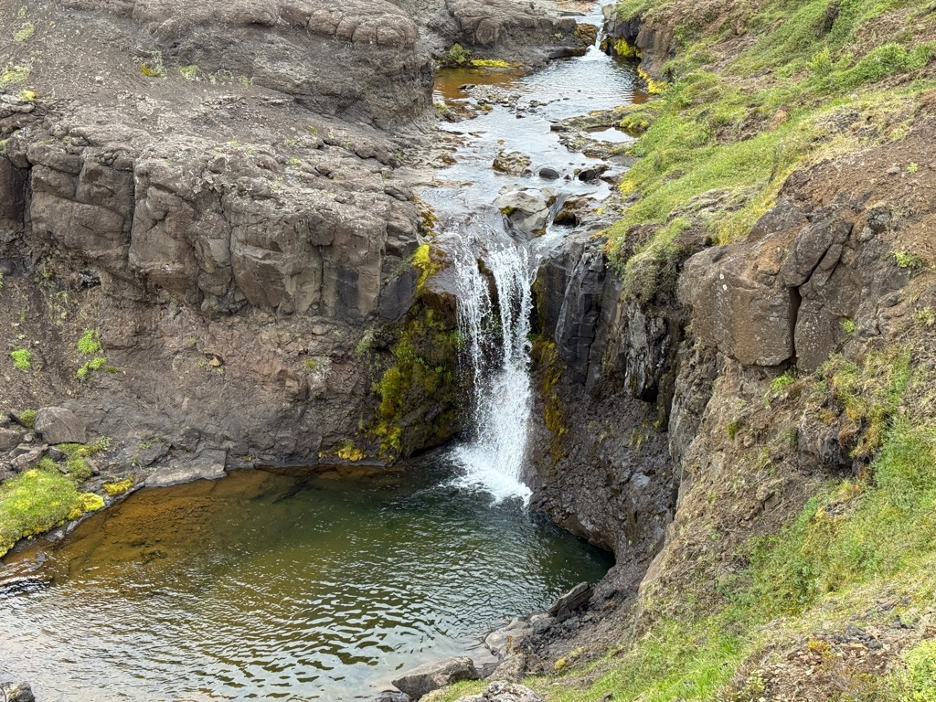
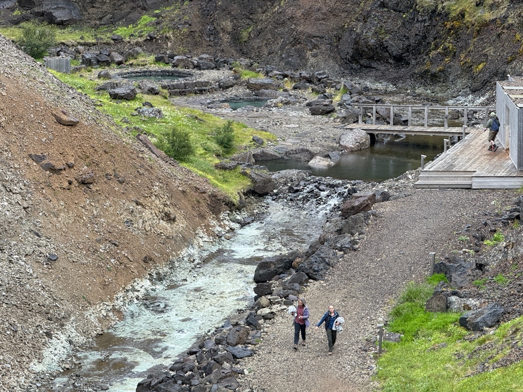
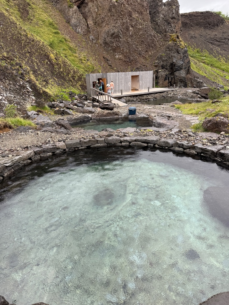
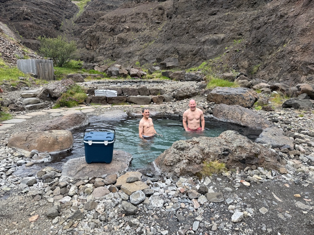
We started the morning by hiking up to some hot springs in a canyon. Had a local Icelandic guide. All Icelanders can trace their geneology back 1000 years. This guy was proud to point out that he was a descendent (33 generstions) of Leif Erikson.
The area we are in is Husafell.
Husafell stone
The “ fold” where the stone is used (it lies just to the right)

Story of the stone is here (its pretty famous throughout Iceland): https://en.m.wikipedia.org/wiki/H%C3%BAsafell_Stone
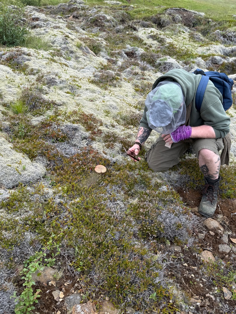
Pointing out an edible mushroom
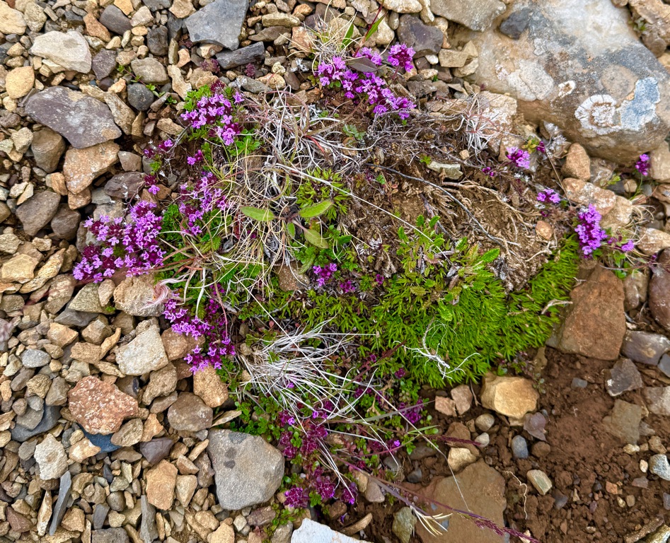
Arctic tyme. All over the place. Garnished lots of our meals
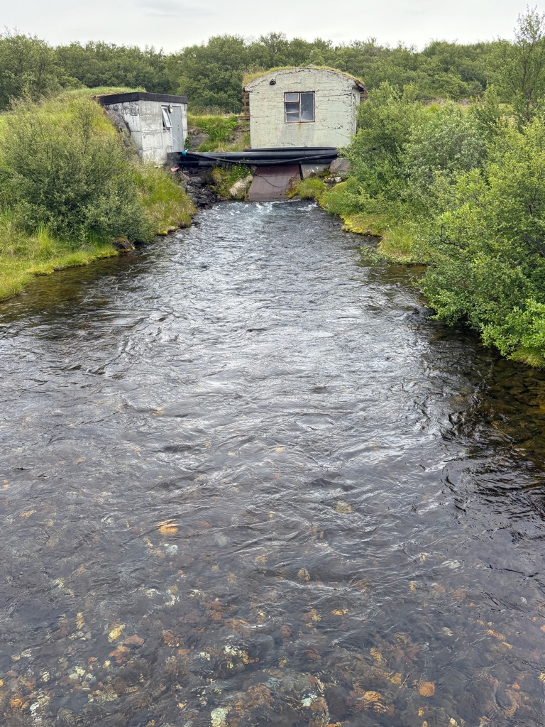
One of several small hydro plants on the hotel property (this one from 1940)
The trail
Looking back as we climbed:
This is a dome shaped glacier. Hotel is large building left center of picture
In this V you see the glacier we will drive to this afternoon
Hiked up to ridge and the down into canyon:
Our destination:
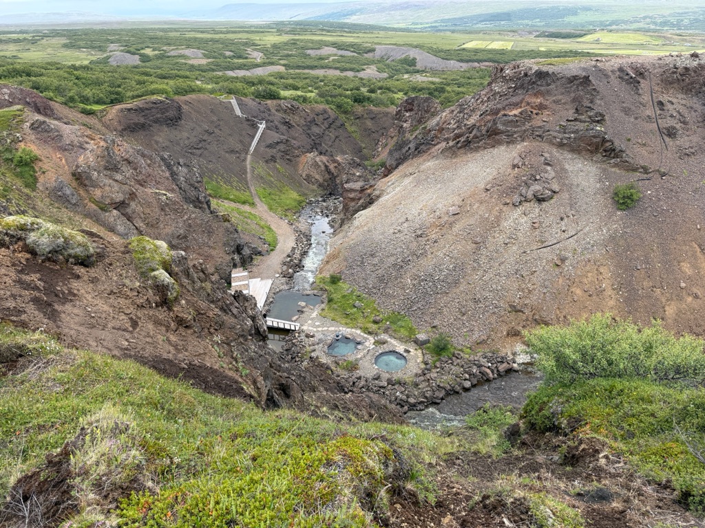
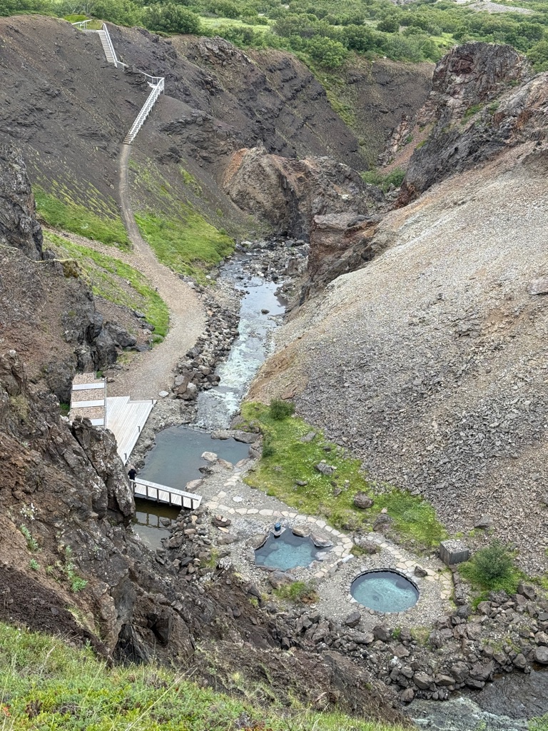
Two hot pools, river pool (40 degrees) just below. I did cold (very briefly)

![]()
![]()
![]()
![]()
![]()
![]()
OR
Copy the link to @rickkossik Journo below
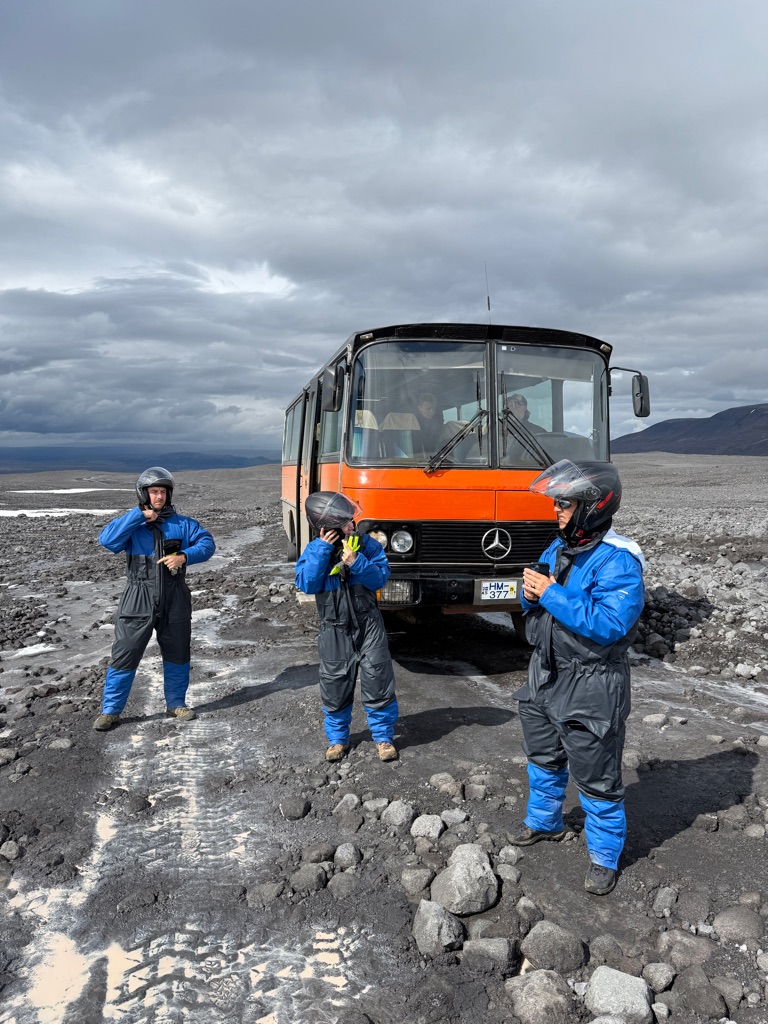
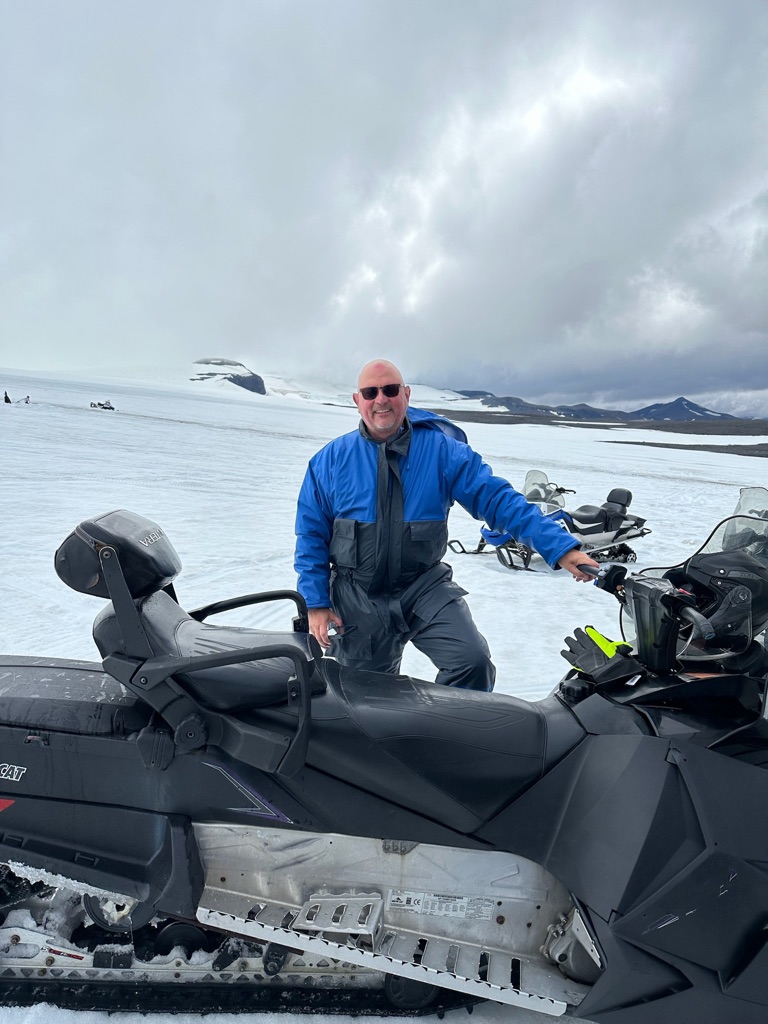
In the afternoon we drove this vehicle up to the Langjokull glacier. This is the glacier that has a river (one of many) that led to that huge waterfall from a couple days back. The thing is massive: 50km (30 miles) by 30km (18 miles).
We got on some snowmobiles and rode on the glacier.

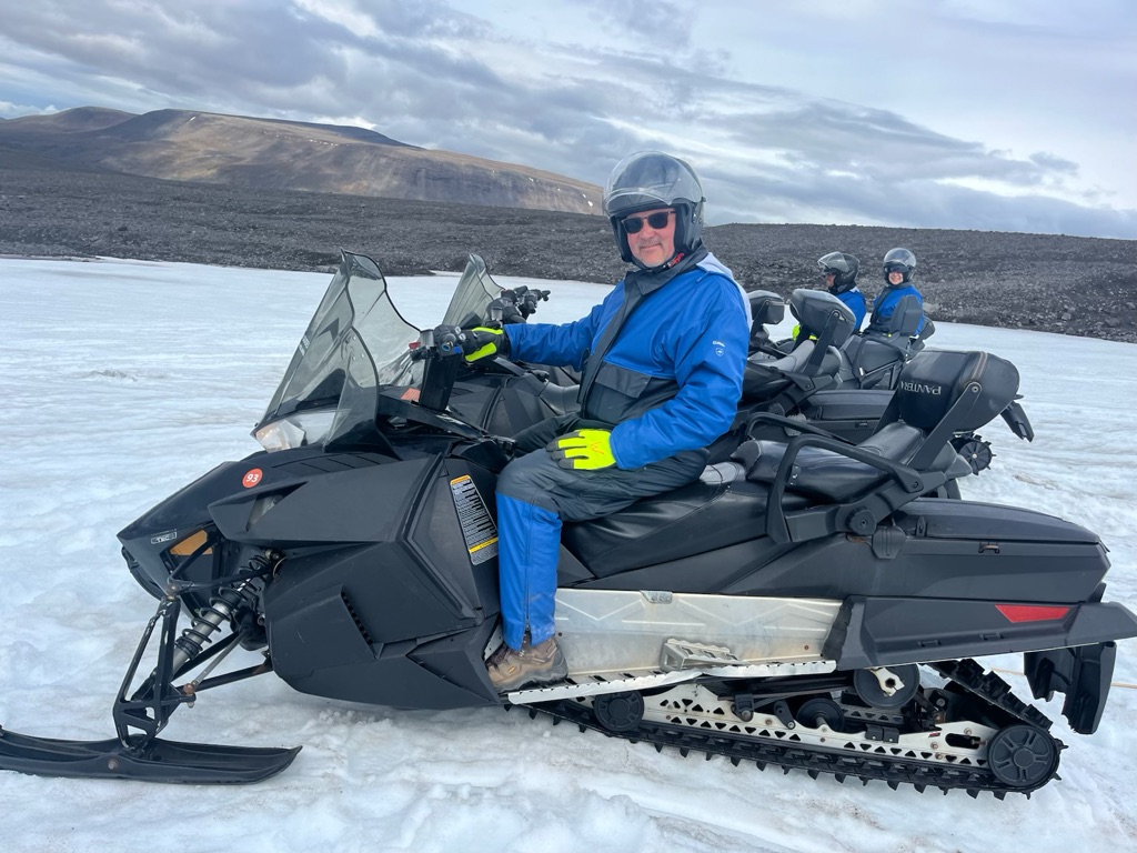
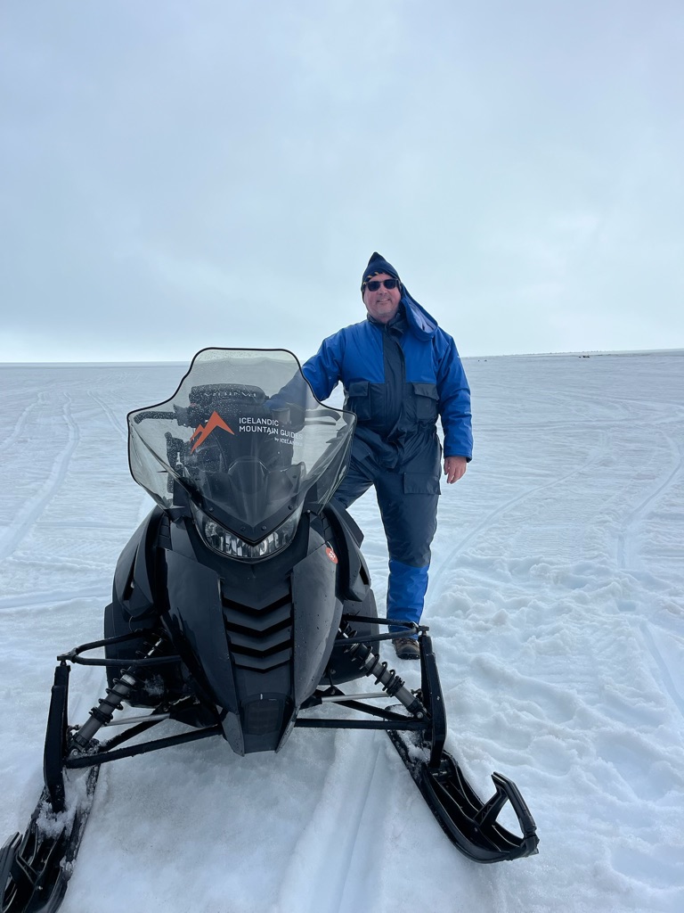
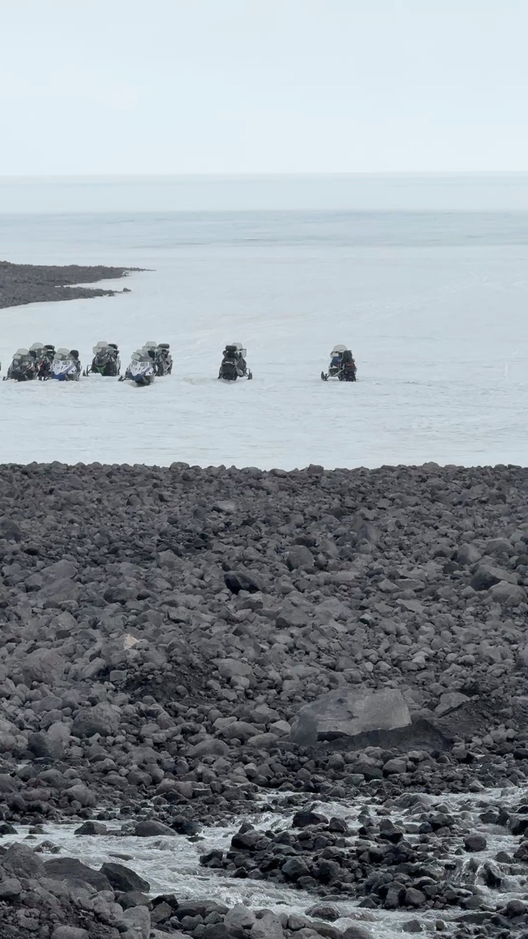
We actually crossed multiple crevasses (that were covered in snow). In some cases we drove through blue pools of water. It was actually a bit unnerving. The guide (an Islandic guy) had a GPS unit and he said it had the crevasses marked, indicating which were safe to cross (no idea how that works; sounds like BS).
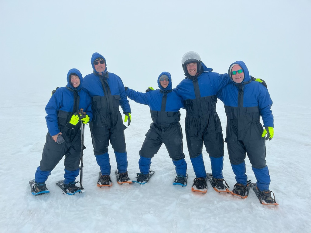
We then got out and snow shoed a bit. But it was zero visibilty up there so we could not go out of sight of snowmobiles. Then headed back to truck.
The only way to appreciate the size of the glacier is to look at a video:
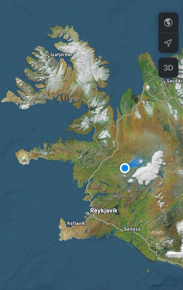
Eastern half of Iceland. Blue dot is me in hotel. The glacier is that massive white thing just east of me
One wild thing happened right before we came back. There were two Icelanders who took us up in that truck. One of them took us on the snowmobile trip. The other one headed up himself in a snowmobile to dig out some snowmobiles that were buried in snow. When we got back to the truck he radioed us saying he was lost. He had forgotten his GPS unit and it was white out. He finally made it back 30 minutes later and told us that he almost drove into a crevasse. He was visably shaken.
![]()
![]()
![]()
![]()
![]()
![]()
OR
Copy the link to @rickkossik Journo below
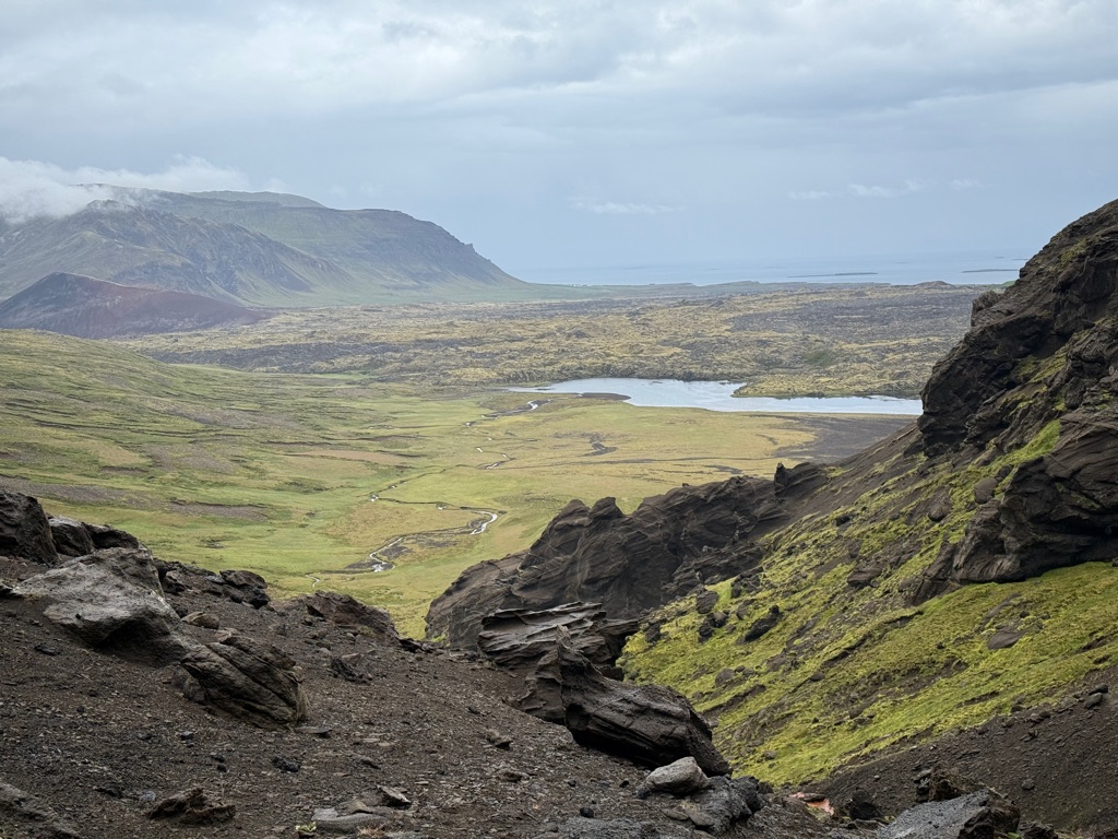
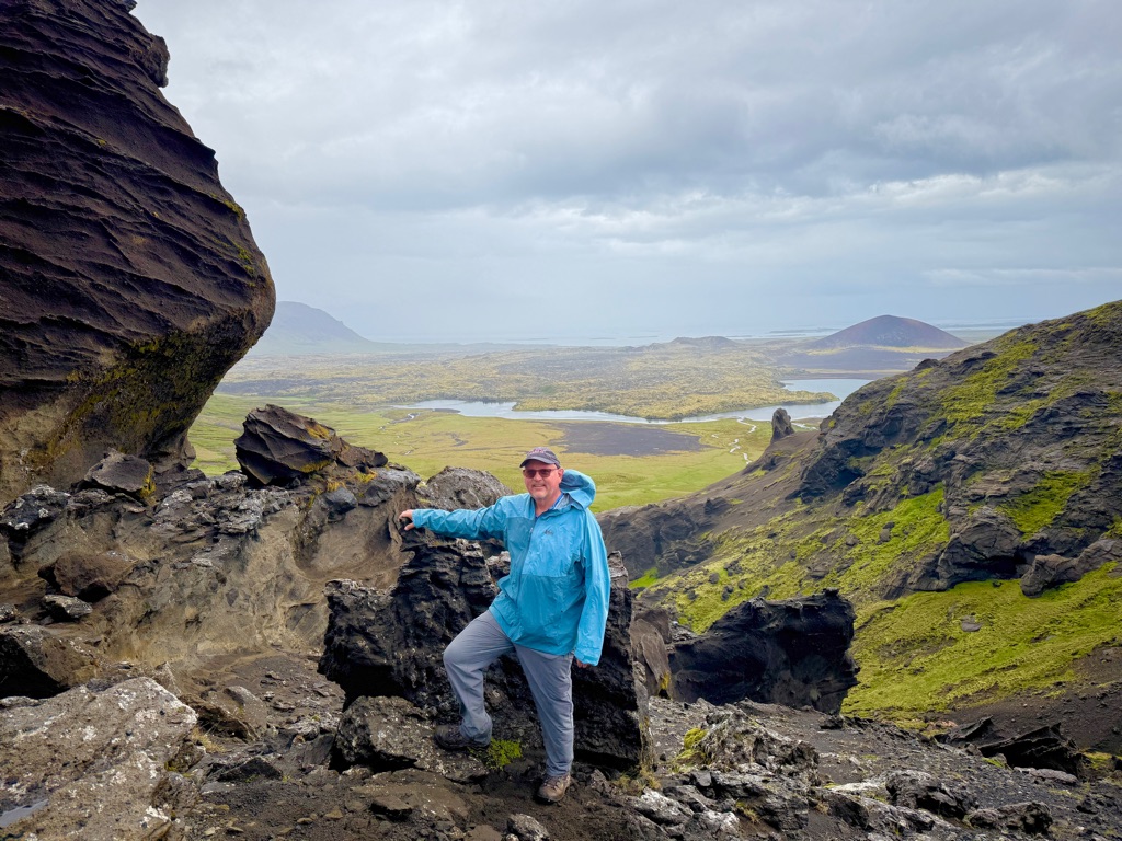
Started at Bifrost. If you remember from Norse mythology (or Marvel movies) it is the gate between earth and Asgard. In reality, it is an area with a couple calderas/craters and associated lava flows. Did a 5 mile loop up to the crater and then around a lake.
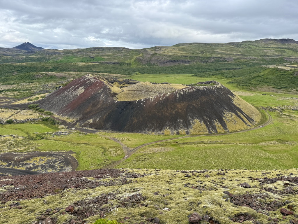
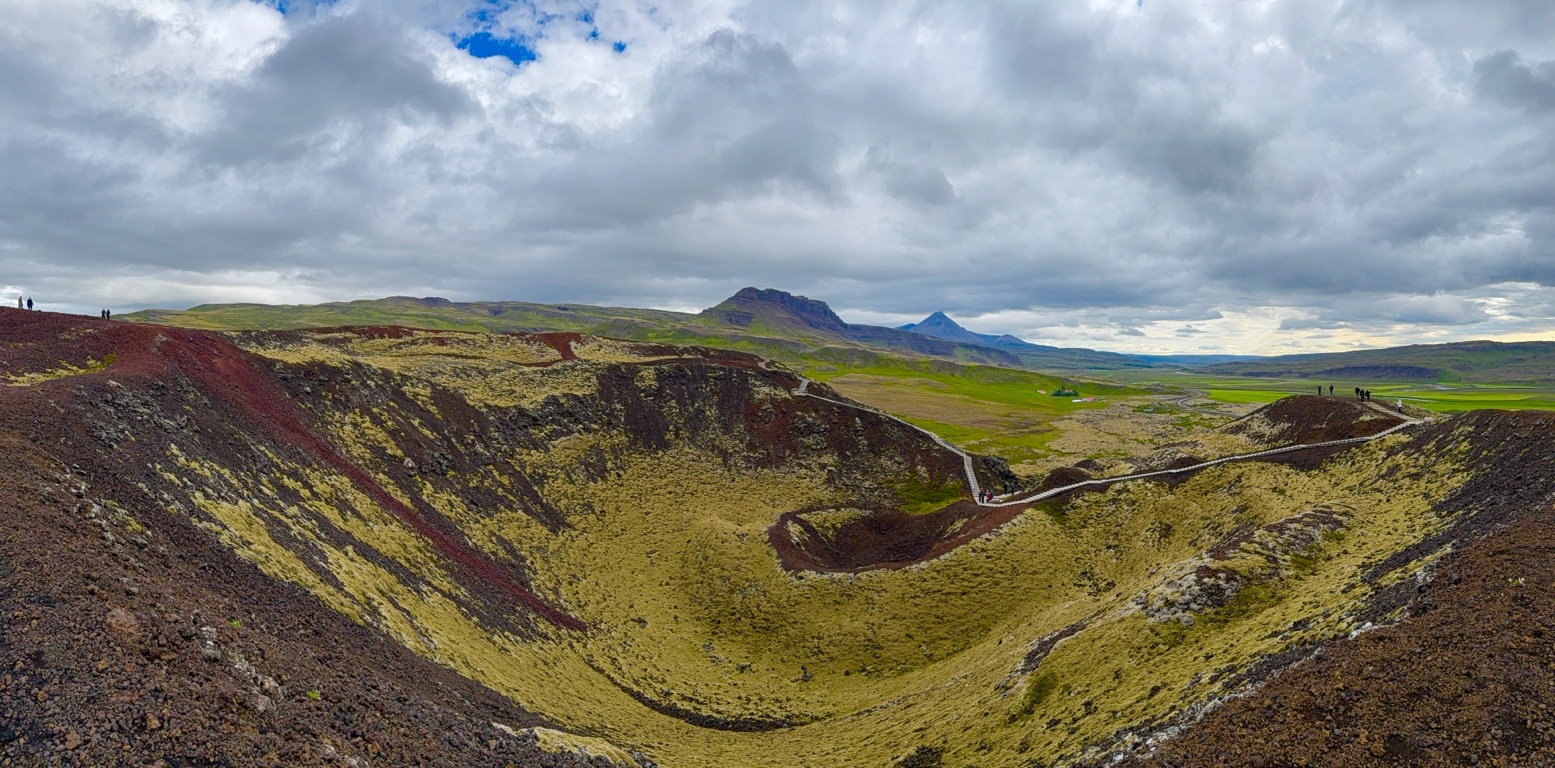
Looking into the crater ftom the rim
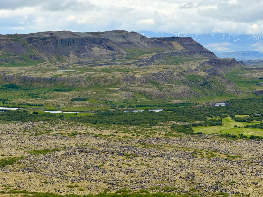
From crater rim. The light color is lava flow (covered with moss). Not recent. About 3000 years old.
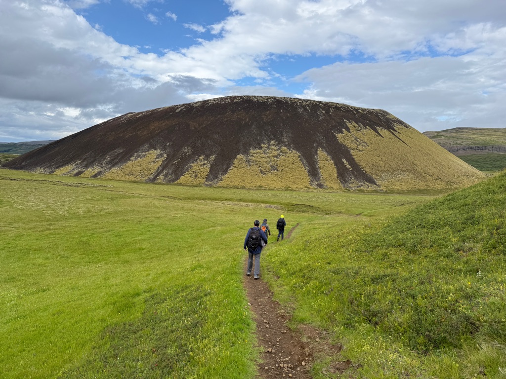
Another small volcano
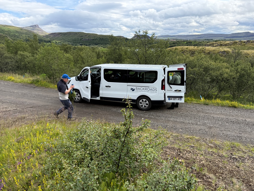
Some hikes are one-way instead of loops. The van is driven by one of the guides to meet us:
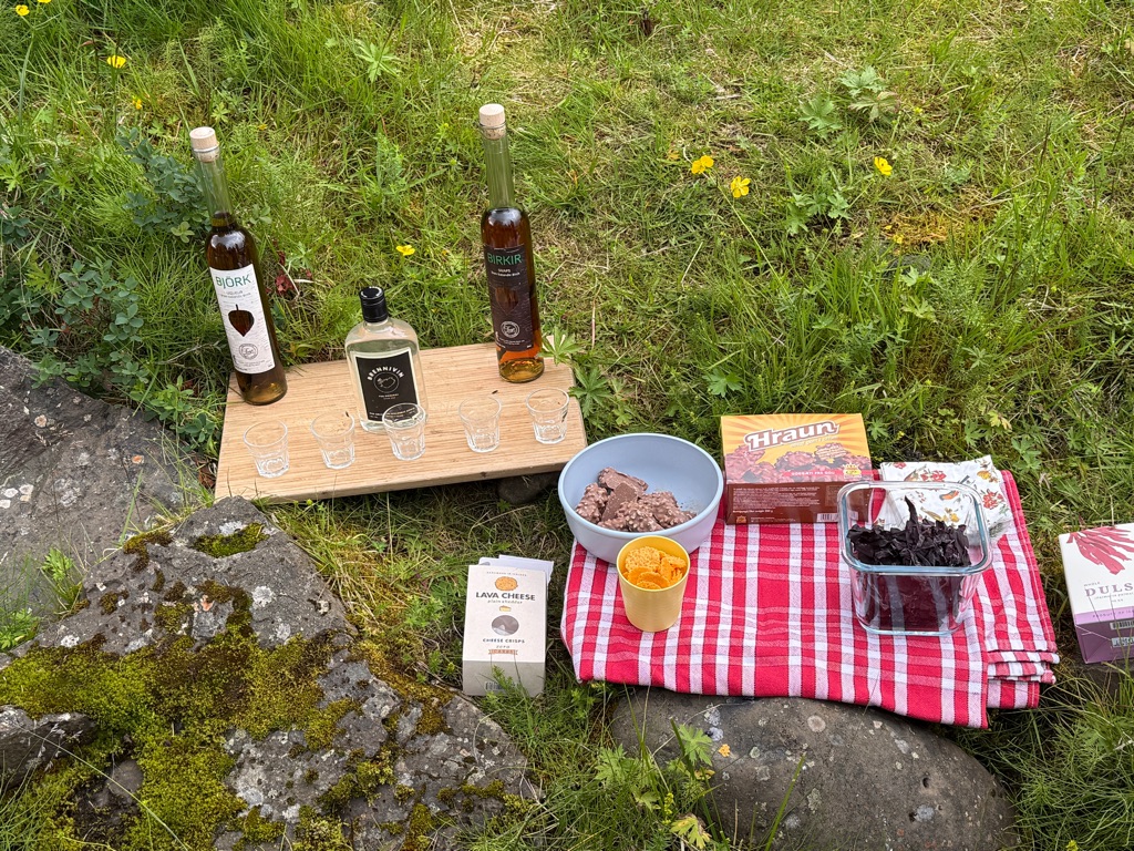
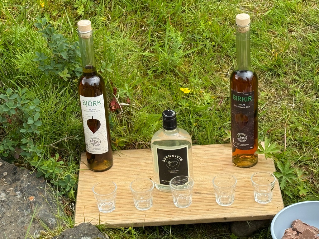
At the end of this hike this is what was waiting for us:
Then headed to a farm for lunch, during which a young local musician played for us:
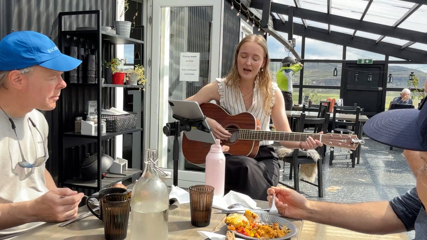
Interestingly, she grew up on a farm right next to the volcano that erupted in 2010 and caused all the airspace over Europe to close. She was 10 years old. She was awoken in the middle of the night and they fled to her grandparents house a little further away. They were lucky. Only about a 6 inches of ash fell on her house and farm and it was not affected by the floods.
![]()
![]()
![]()
![]()
![]()
![]()
OR
Copy the link to @rickkossik Journo below
After lunch, we drove further west onto the Peninsula, where we will be staying tonight.
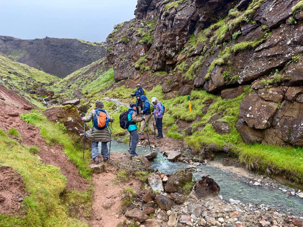
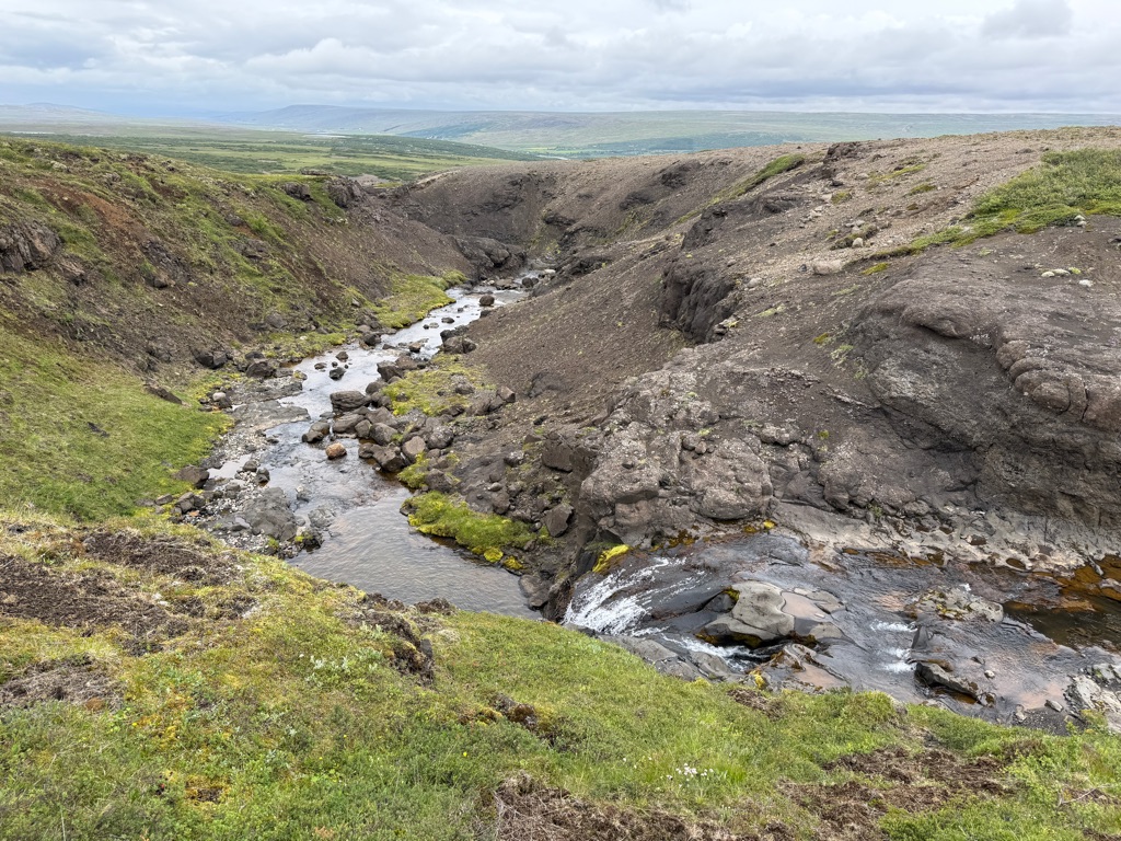
This hike was largely off trail. Although only about 3 miles long, the second half rose about 700 feet up a narrow canyon. It was quite steep.

Stream crossing

The top. We started at that river. In the distance is the sea.
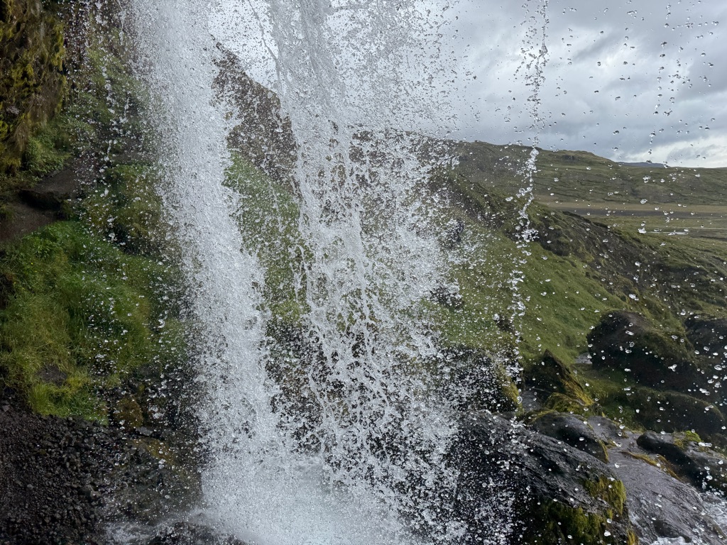
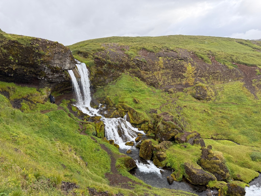
On the way back, the trail went behind this waterfall:
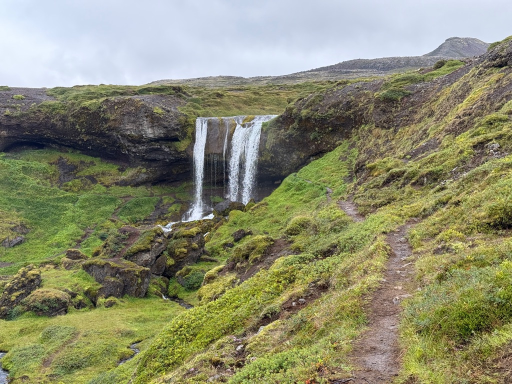

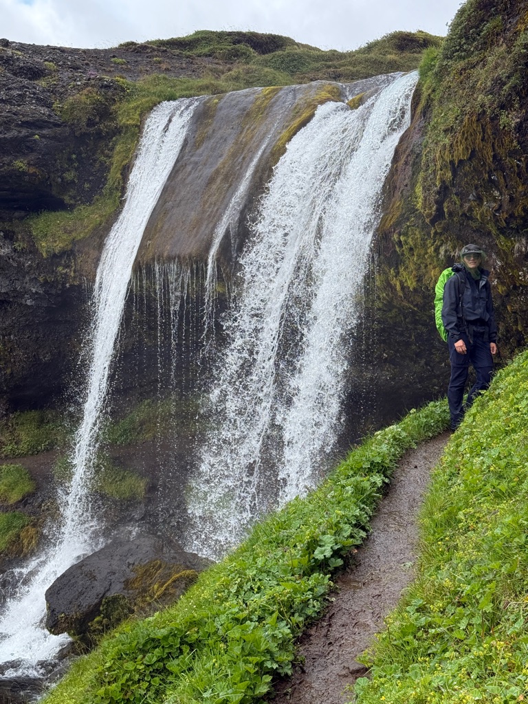
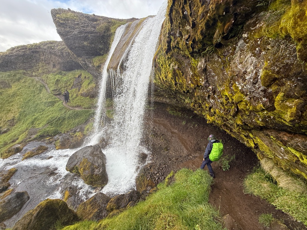
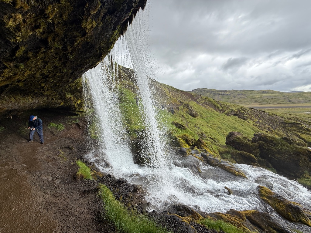
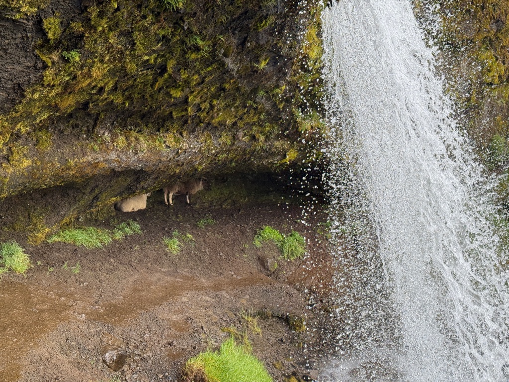
Notice the sheep behind the falls!
On the other side

![]()
![]()
![]()
![]()
![]()
![]()
OR
Copy the link to @rickkossik Journo below
Arrived at hotel on edge of national park fairly late. Unlike the other hotels (which were modern), this was an old farmhouse (which had been expanded). Very isolated and very beautiful.
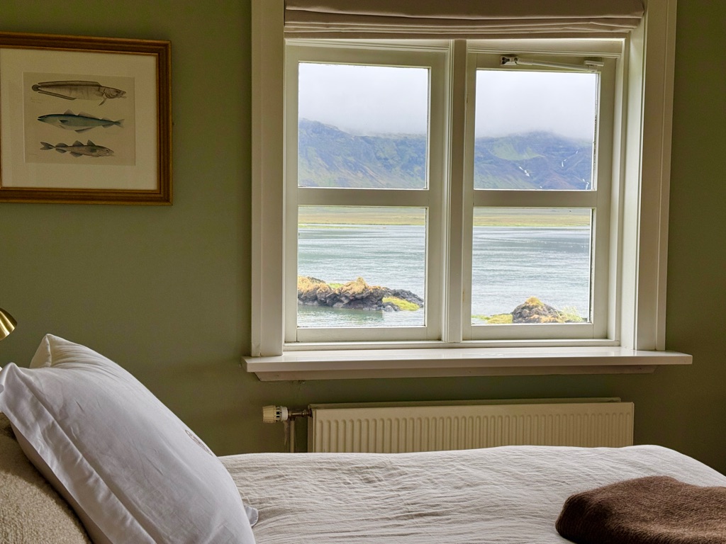
The view out my window
This little bay was used 450 years ago as a meeting/trading place. Met some archeologists diving here looking for old timbers from a shipwreck.
More pictures of hotel (on a sunny day) tomorrow
![]()
![]()
![]()
![]()
![]()
![]()
OR
Copy the link to @rickkossik Journo below
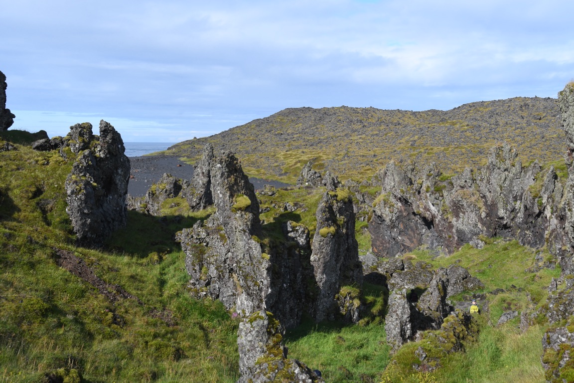
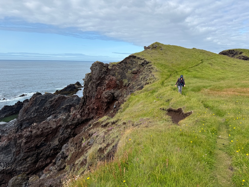
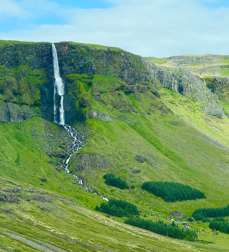
We are on the Snæfellsjökull peninsula (named after the volcano that formed it). The morning was a beautiful 4 mile cliff walk.
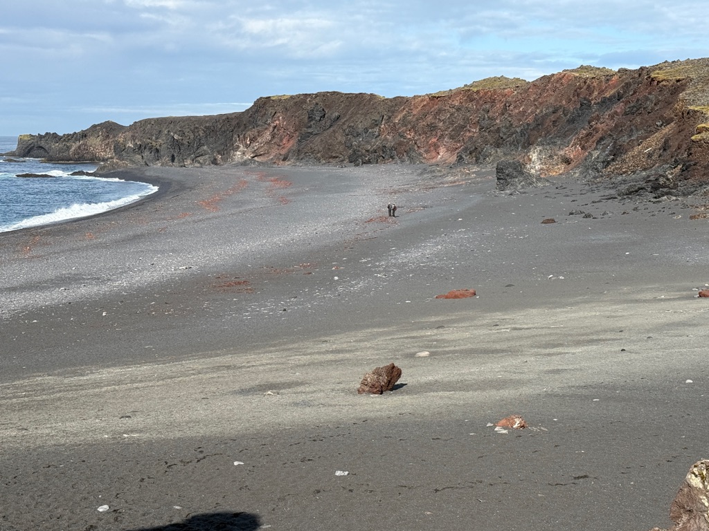
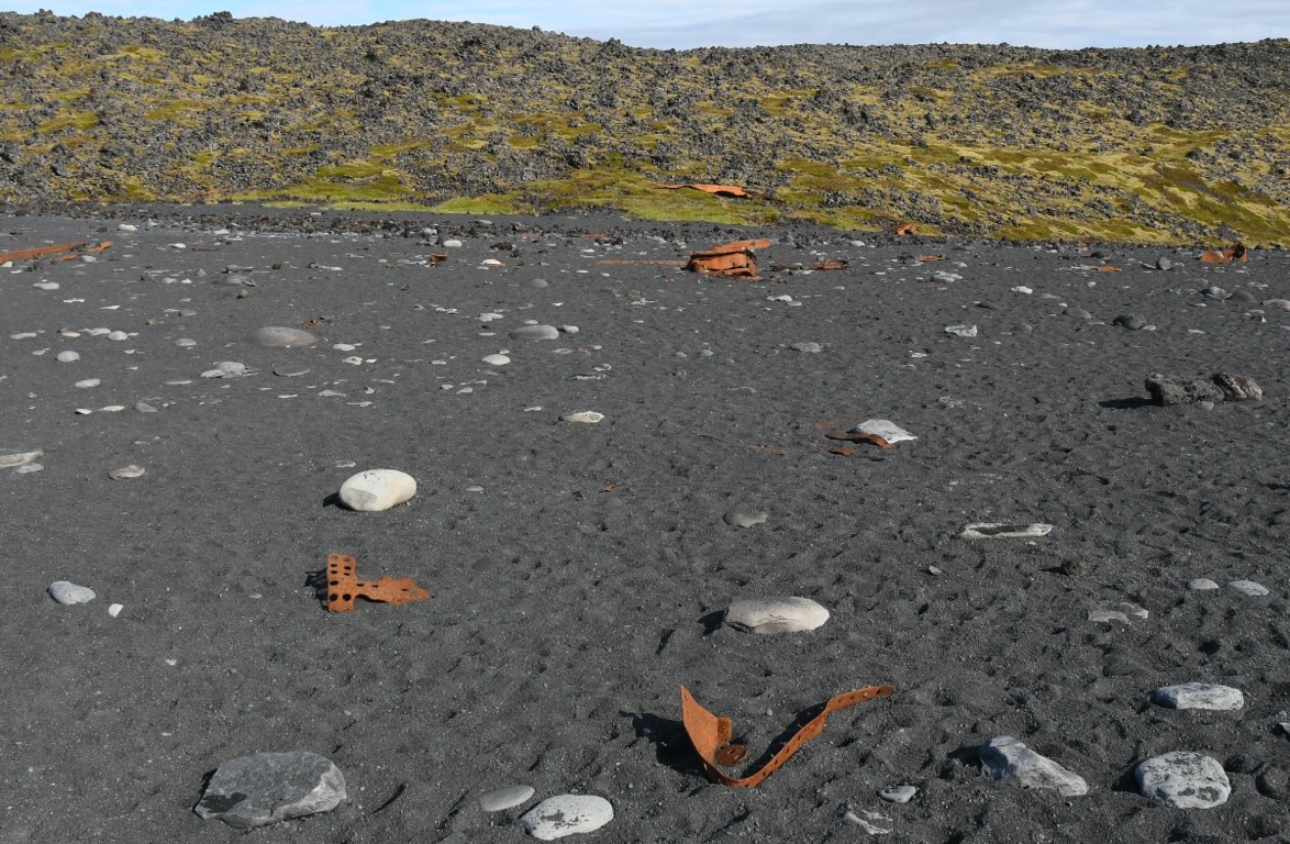
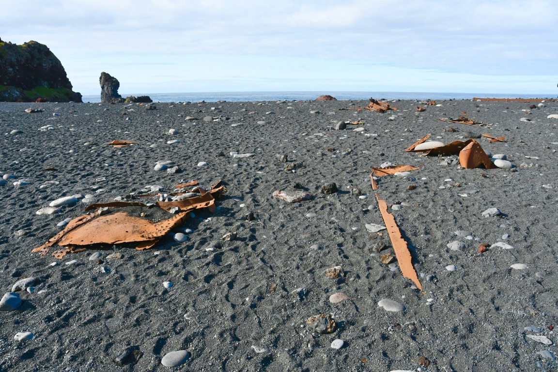
Started at this black sand beach

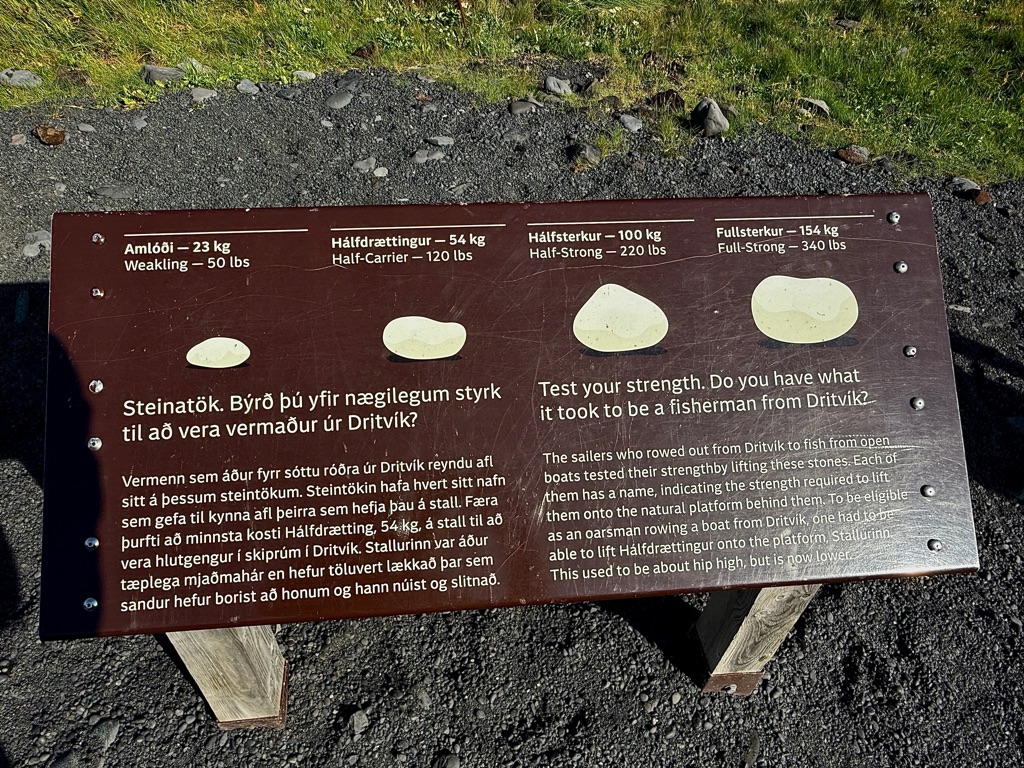
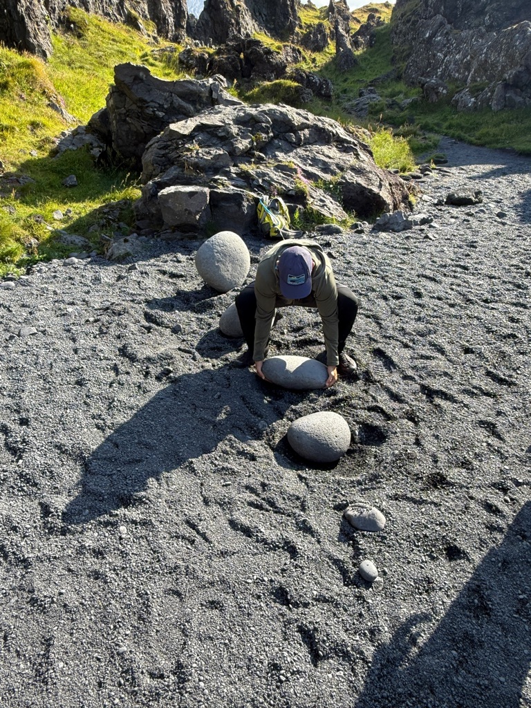
I was able to lift the second one but did not try the third one!
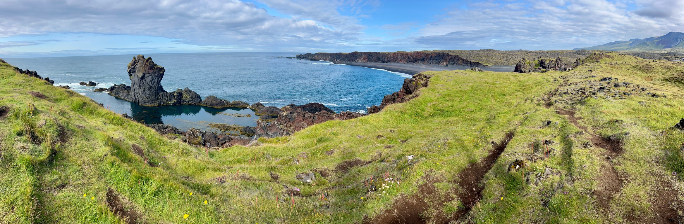
We basically followed a sheep path for about 4 miles
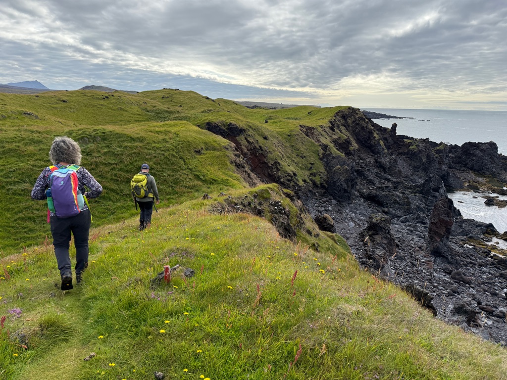
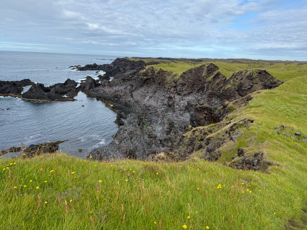
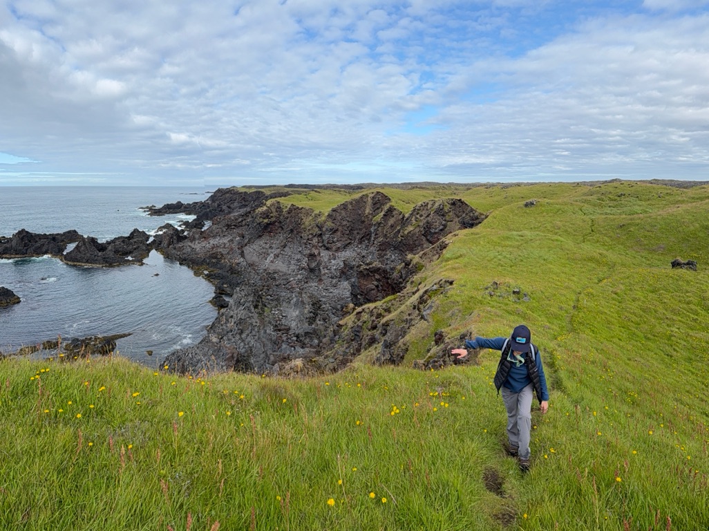
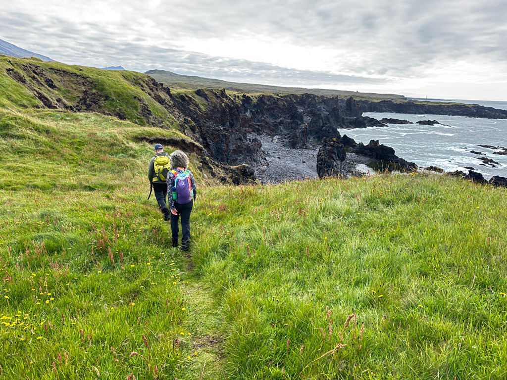
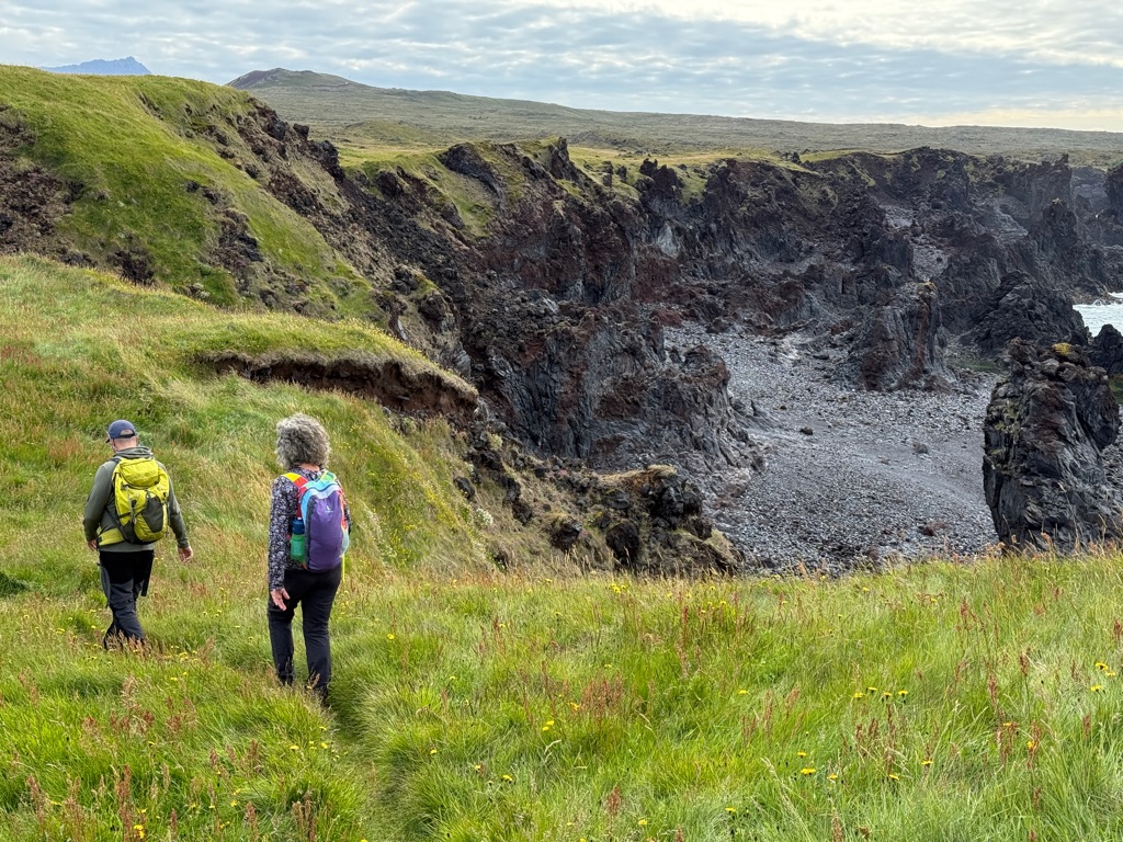
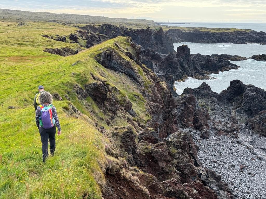
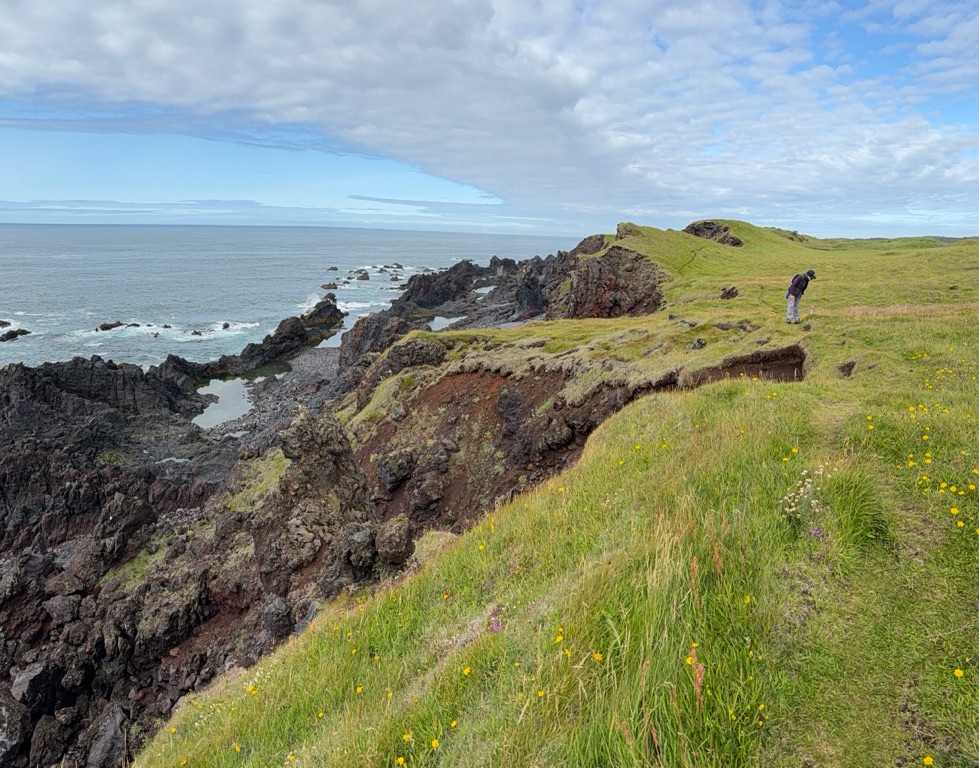
For about a mile we walked through what I referred to as a “buoy graveyard”. Hundreds of buoys (and driftwood) lifted up onto the top of the cliff (this section was “only” about 40 feet above sea level). Winter storms are BIG.
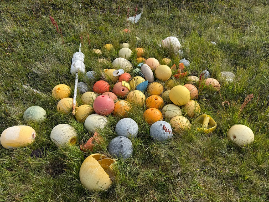
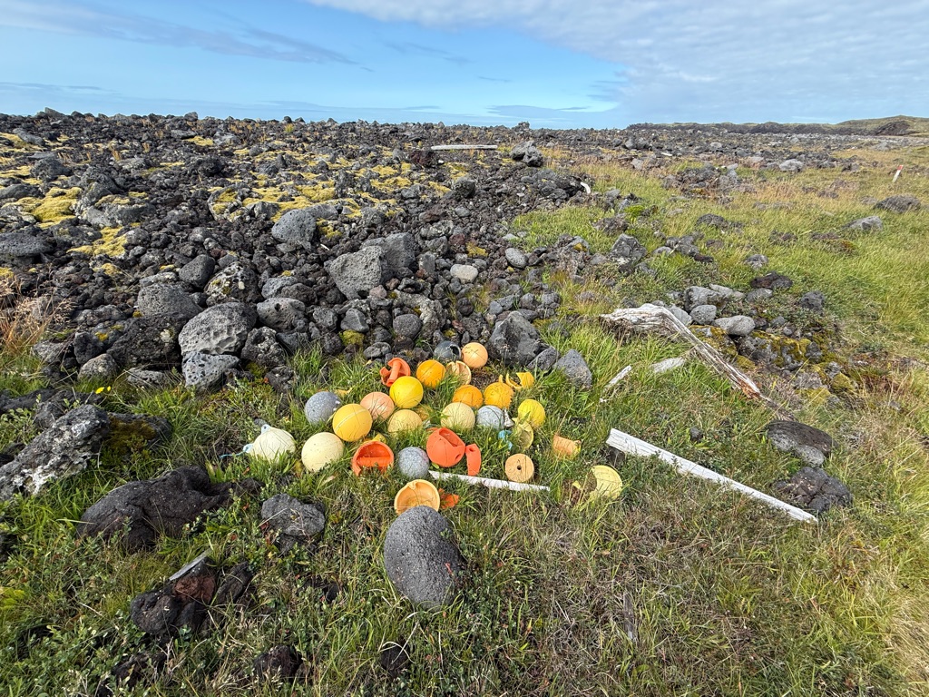
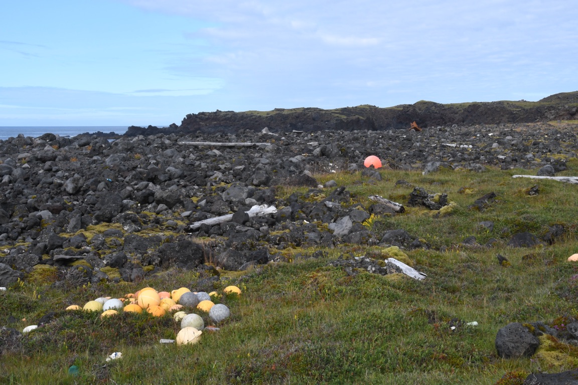
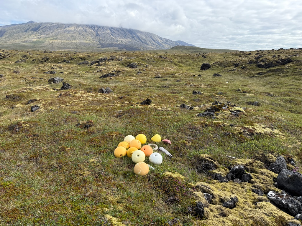
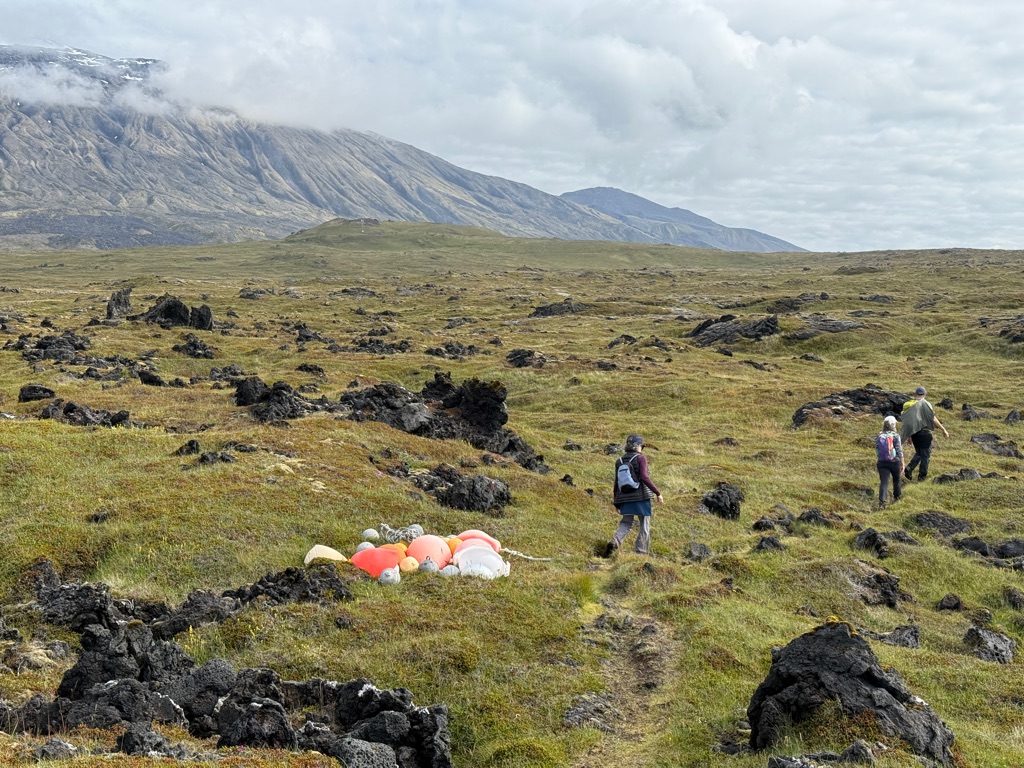
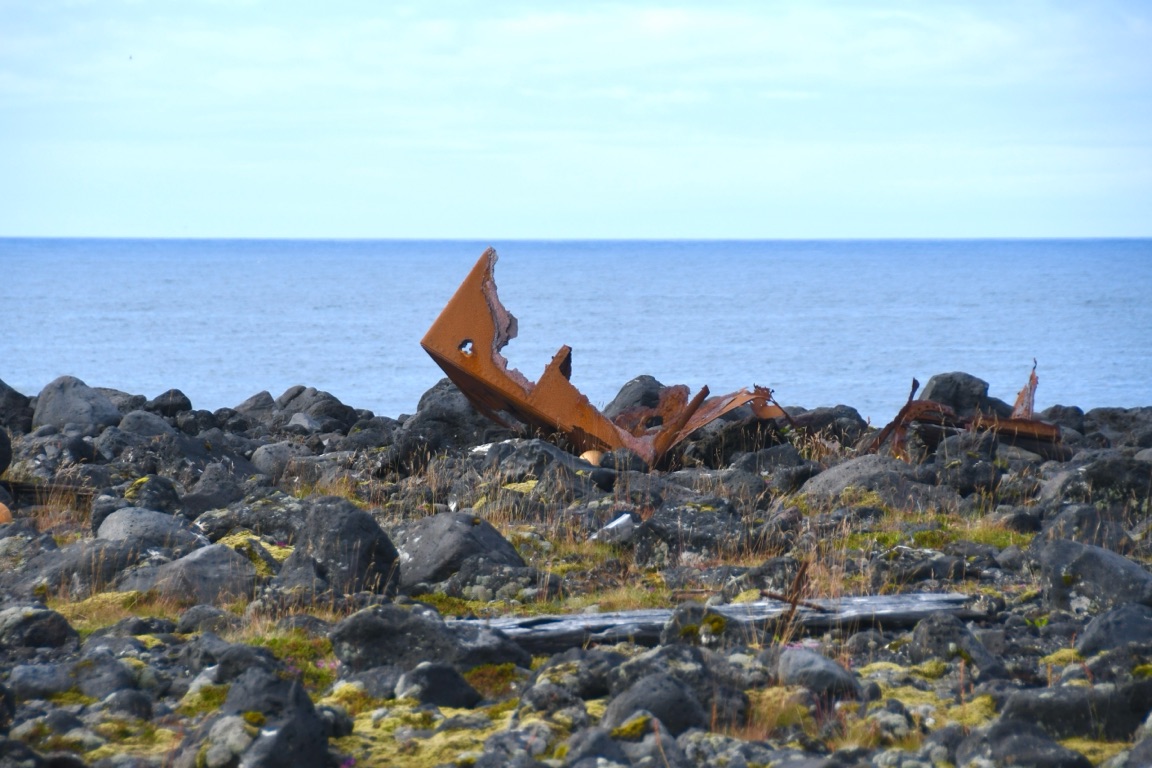
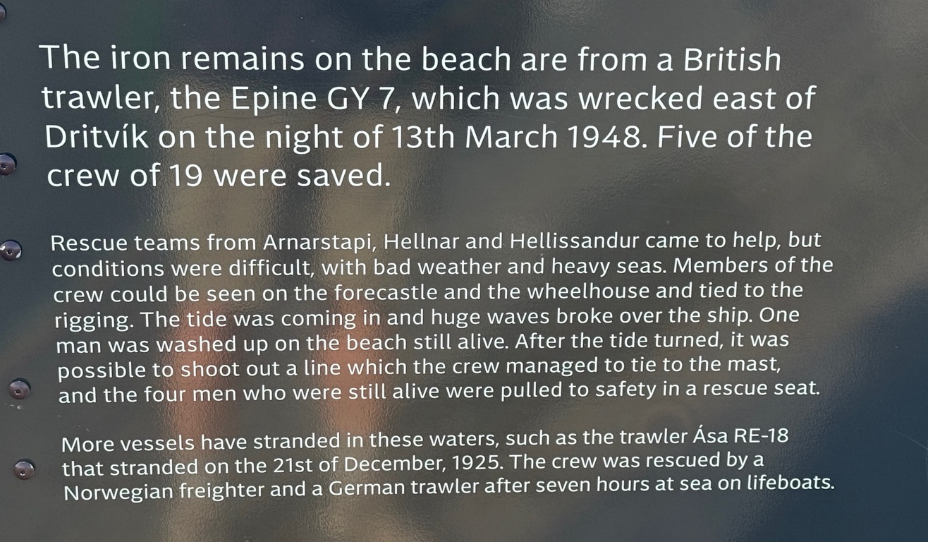
Probably part of the wreck from the black sand beach about a mile away (and on top of a 40 foot cliff)
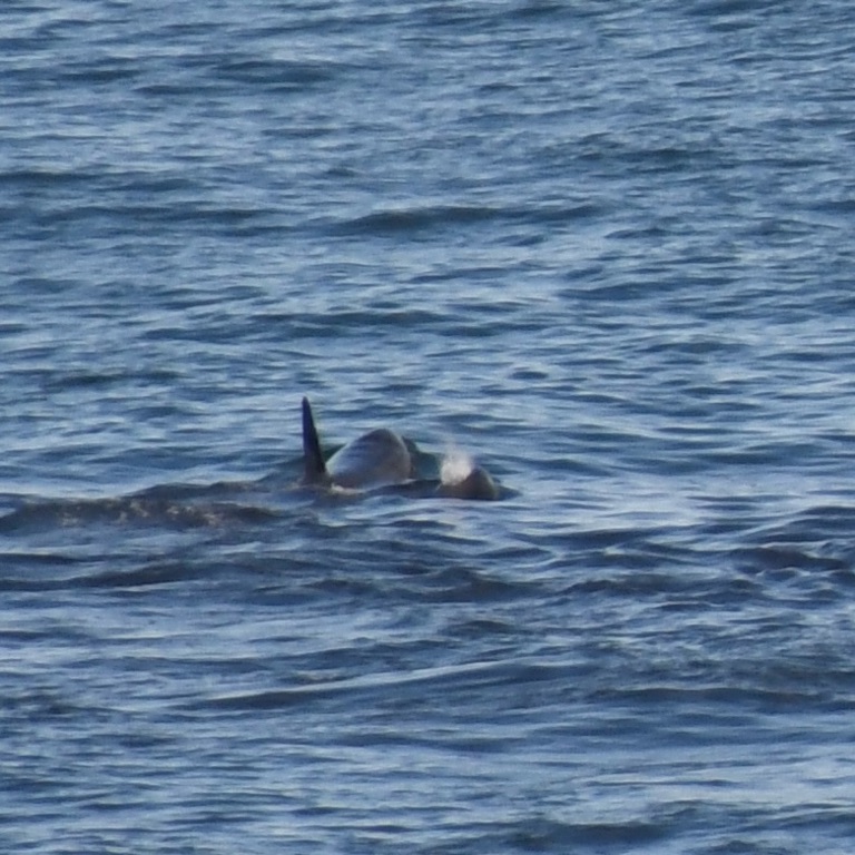
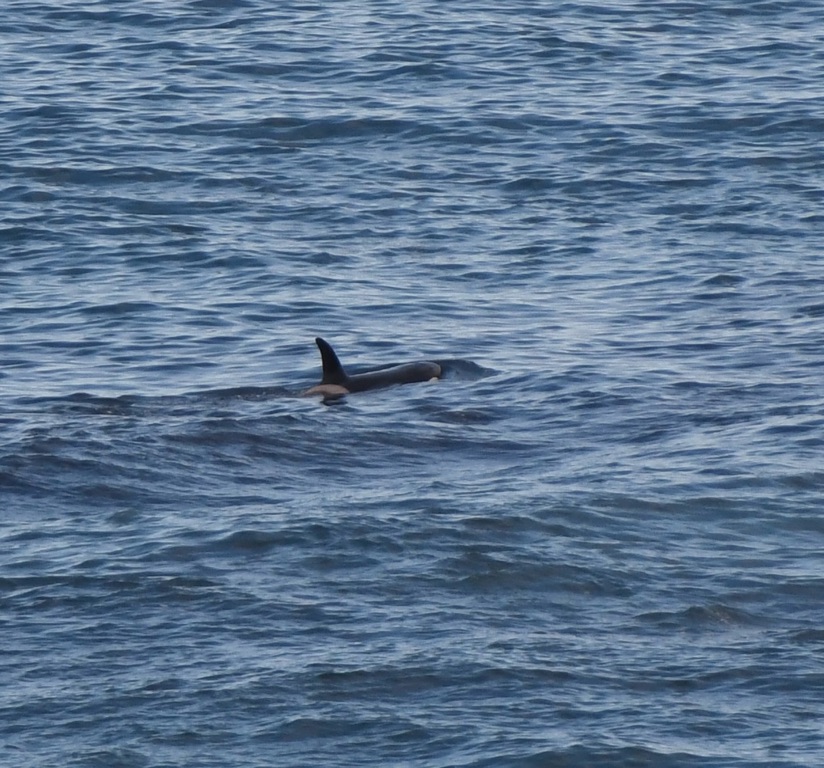
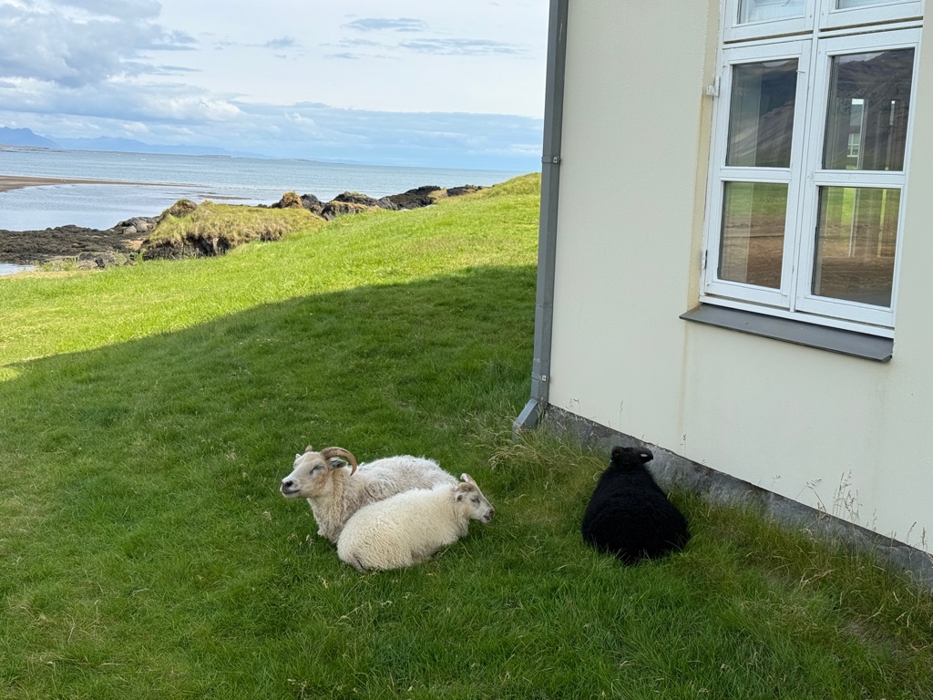
Stumbled upon these guys:
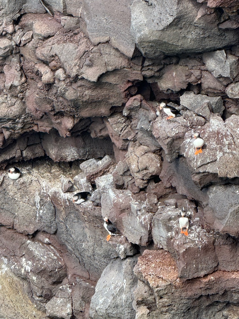
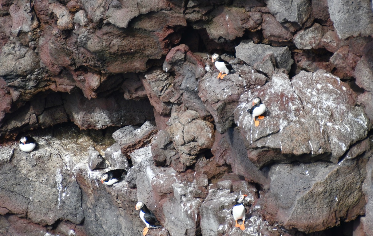
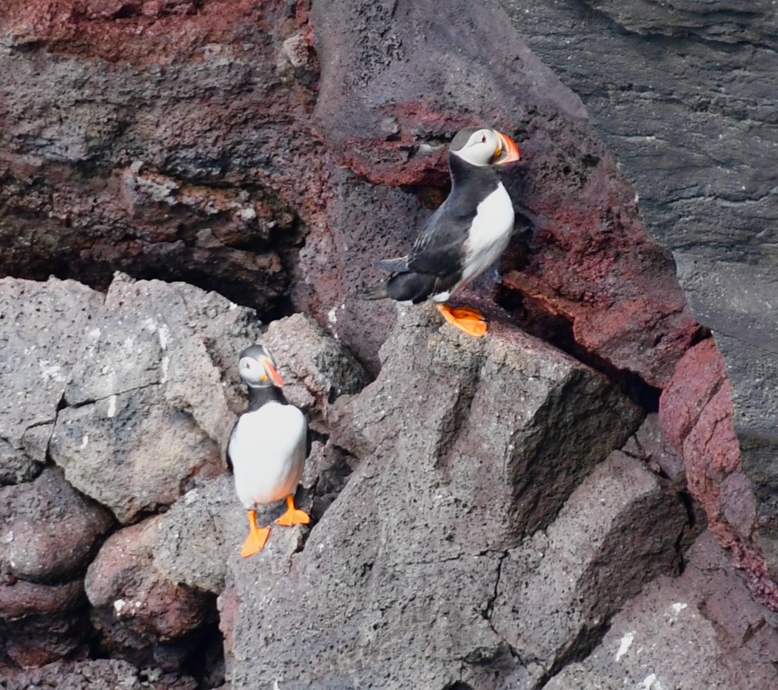

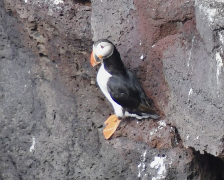
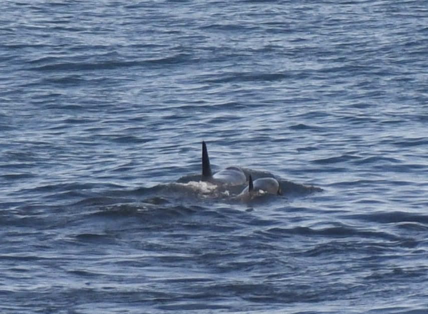
Then we looked up snd saw these guys;
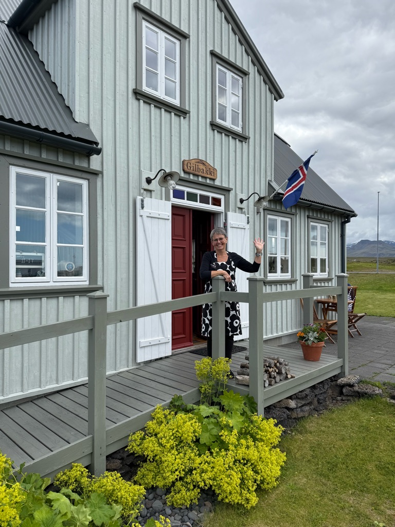
We then drove about 15 minutes to a tiny village and this lovely lady served us fish soup (and cake):
![]()
![]()
![]()
![]()
![]()
![]()
OR
Copy the link to @rickkossik Journo below
The afternoon hike was an easy 2.5 mile walk, but quite beautiful:
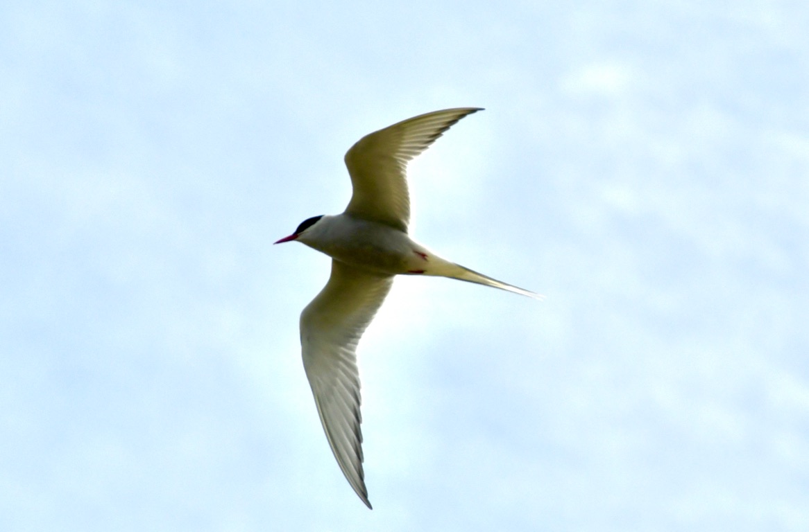
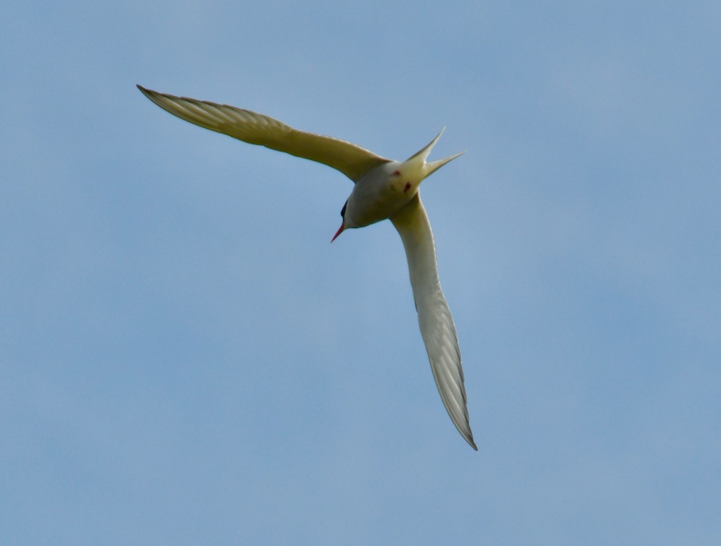
While walking, we were attacked by arctic terns (since they had nests nearby):
![]()
![]()
![]()
![]()
![]()
![]()
OR
Copy the link to @rickkossik Journo below
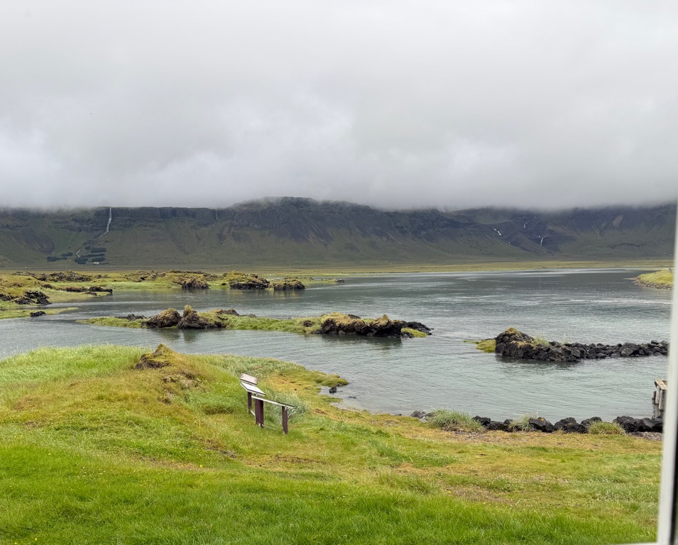
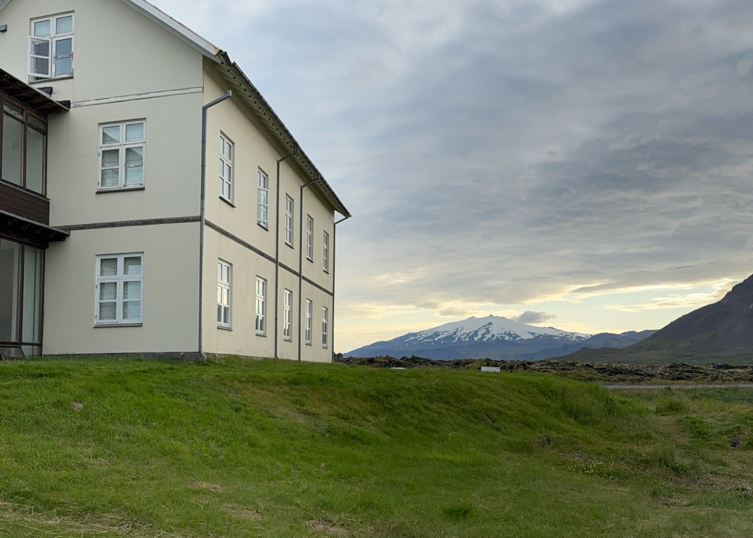
Back at hotel for farewell dinner. Truly one of the most beautiful hotels I have ever stayed at. Completely isolated:
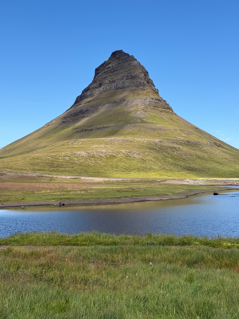
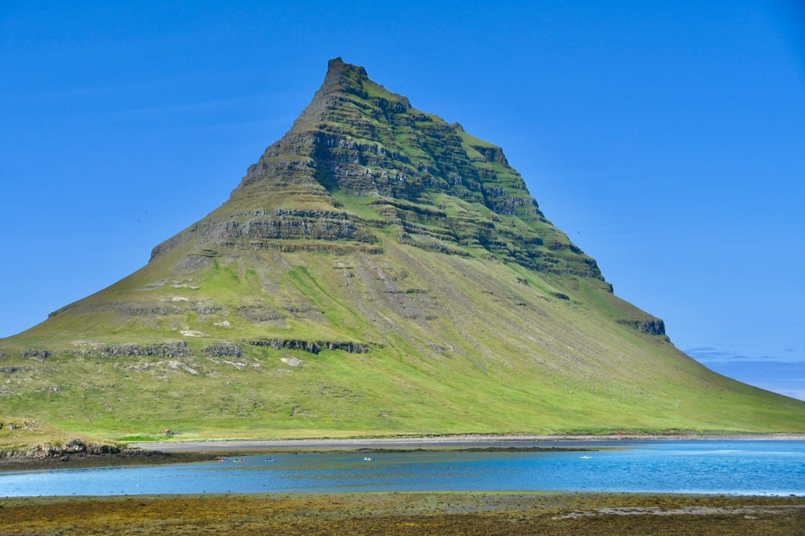
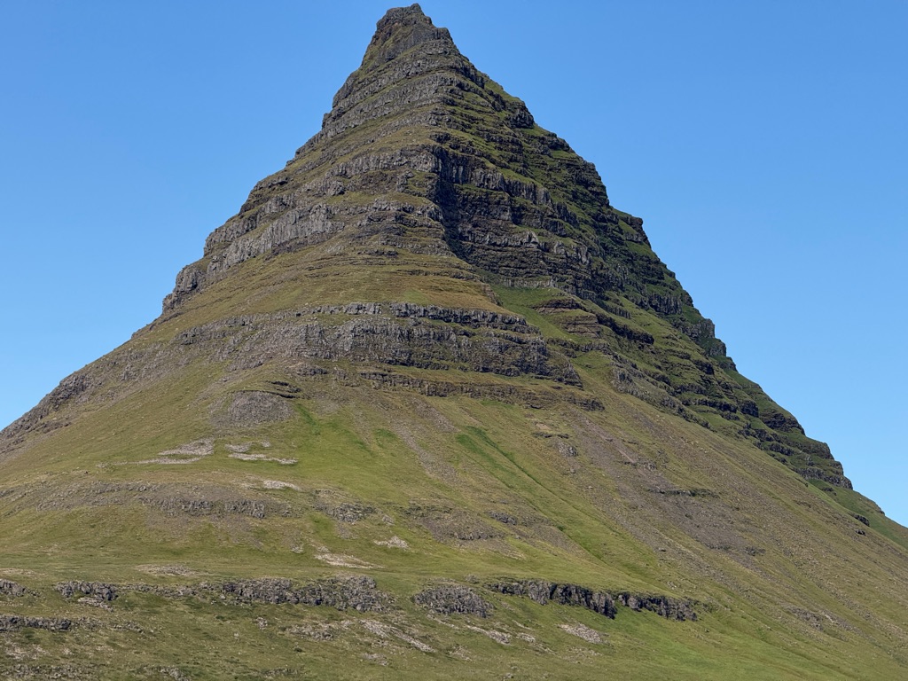
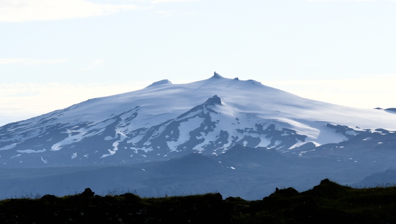
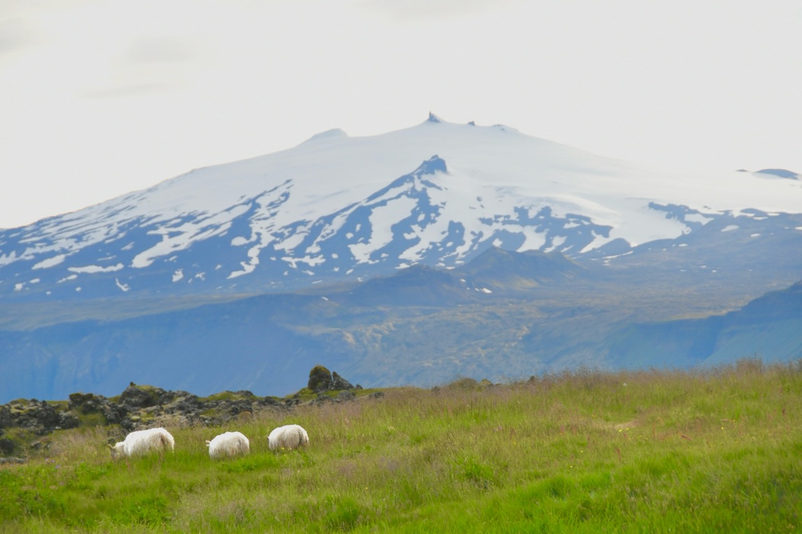
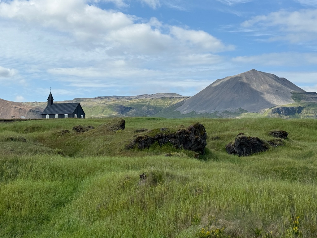
Volcano in the background; by the way, this is the volcano in Jules Verne’s Journey to the Center of the Earth (I did not have time for that excursion 😜)
Some nice views of the volcano from the hotel

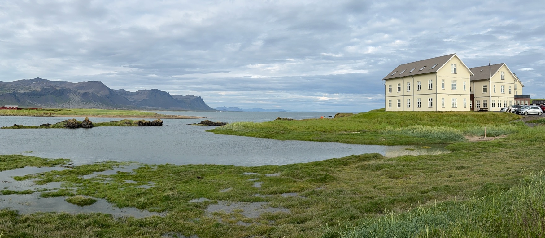
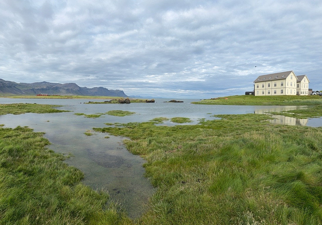
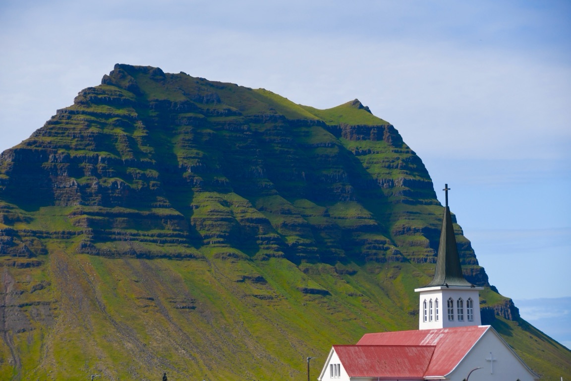
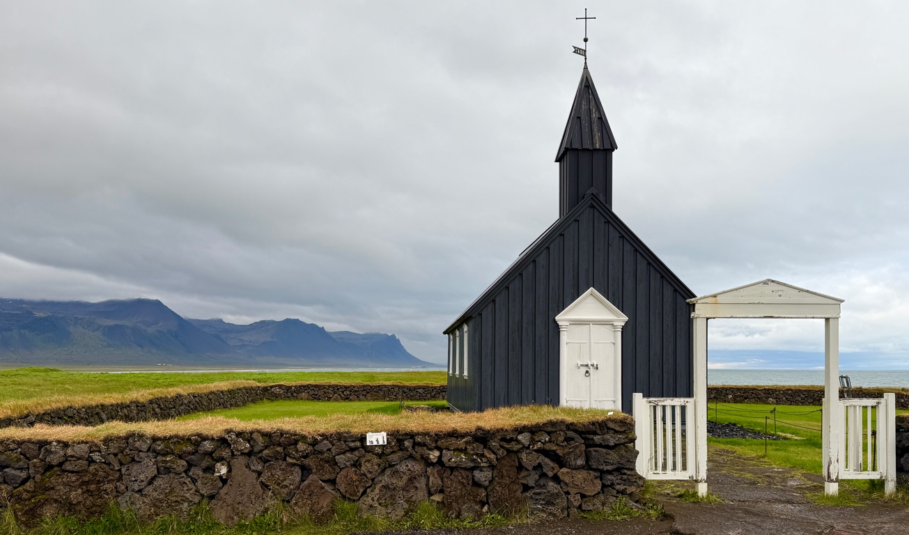
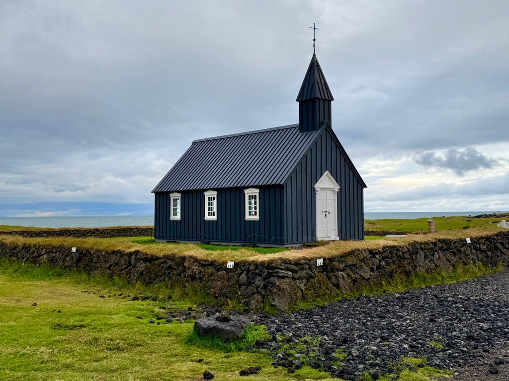
Church next to hotel
Across the road from hotel
That window is my room
Farewell dinner
![]()
![]()
![]()
![]()
![]()
![]()
OR
Copy the link to @rickkossik Journo below
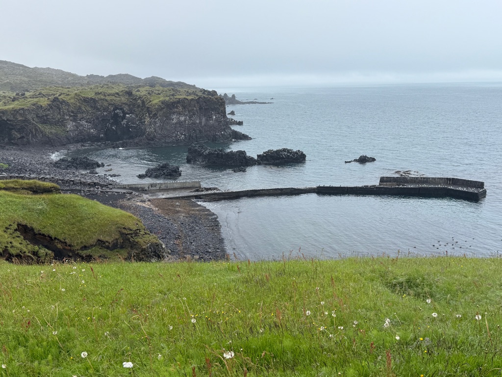
Short coast walk in the rain before we drive back to airport (3 hour drive).
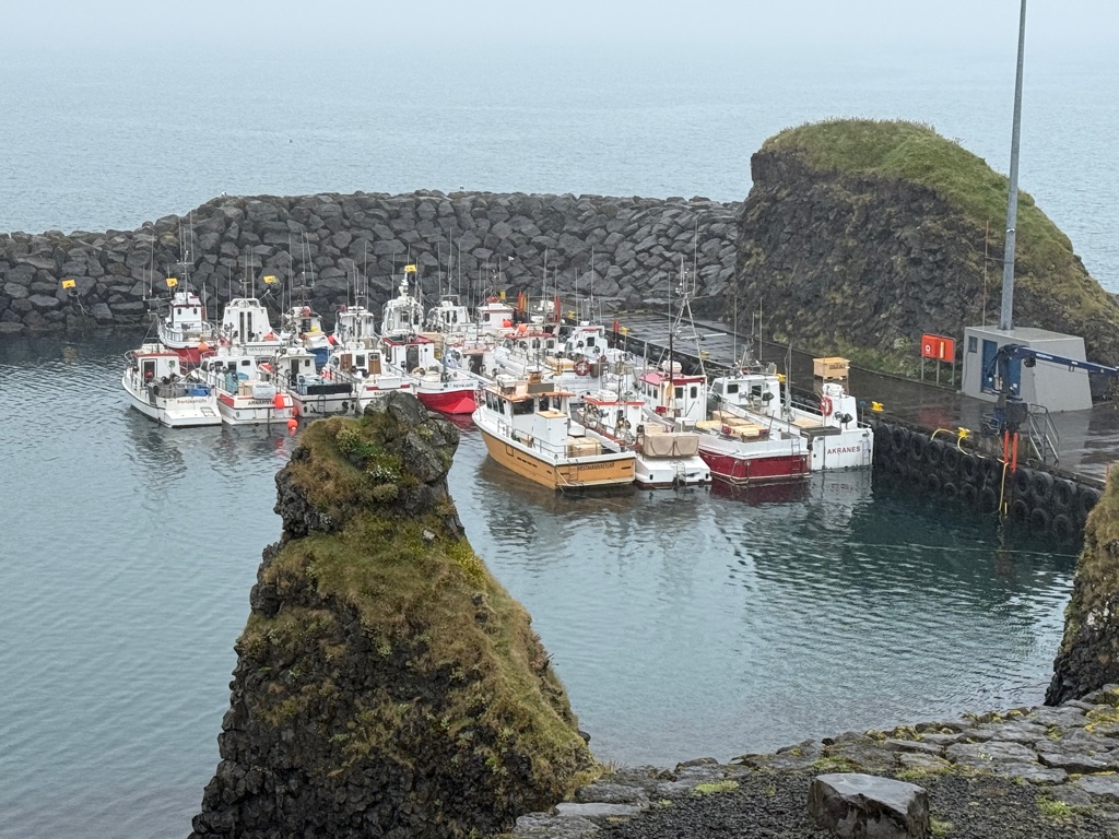
Started in tiny fishing town
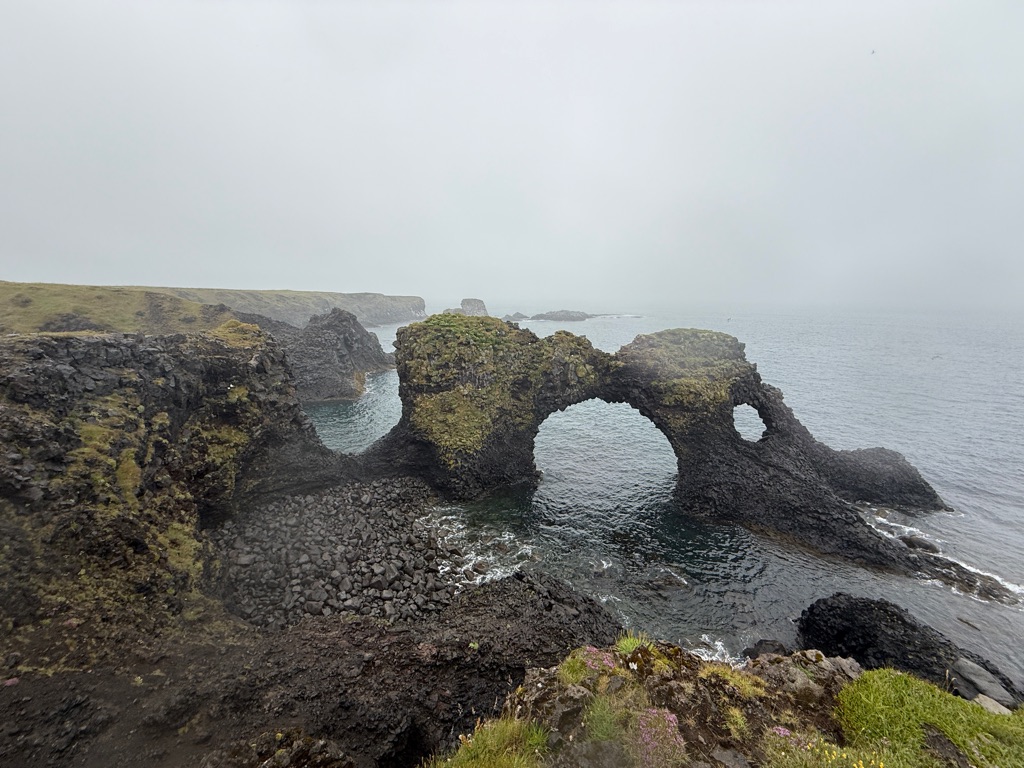
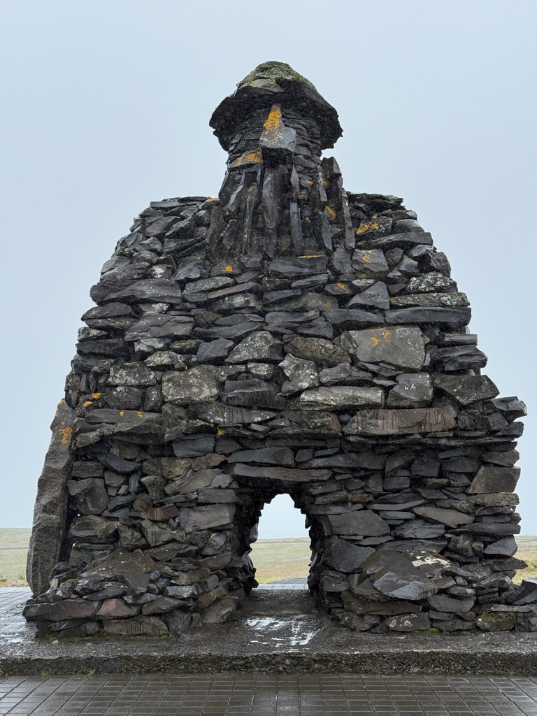
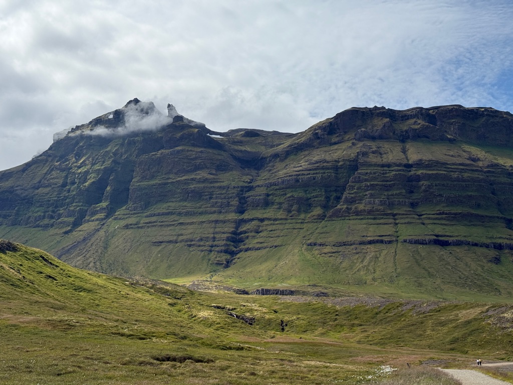
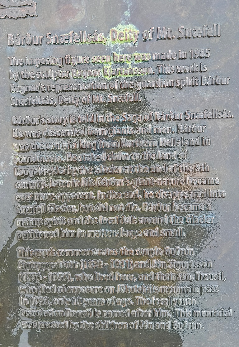
The guardian of the volcano (from one of the sagas); half man/ half giant
Finished here (Hellnar). In Journey to the Center of the Earth this is the place the protagonists landed to explore the volcano. In the 1800s apparently it was the major port along this coastline. Not so much anymore. 😂
![]()
![]()
![]()
![]()
![]()
![]()
OR
Copy the link to @rickkossik Journo below
![]()
![]()
![]()
![]()
![]()
![]()
OR
Copy the link to @rickkossik Journo below